
First and foremost, a special shout out to Yesmy and Roxanna, the two amazing women working the reservations desk at the Amaszonas office in Uyuni. Without their efforts, a lot of what I am about to share would never have been possible. The guardian angels of Uyuni, as I like to refer to them, I will forever be grateful.
El Alto landings
The runway at El Alto is almost 4-Km long! Not for nothing though – at that altitude, aircraft land at twice their sea level velocity and need every foot of tarmac available to them. At 13,225 ft, El Alto is also the highest international airport in the world, and a gateway to La Paz, the world’s highest capital city.
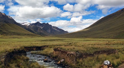
La Paz itself sits in a bowl surrounded by the Cordillera Real, a branch of the Bolivian Andes, flanked on its south by the imposing snow-capped peak of Illimani (at 21,122 ft., the highest mountain in the range) and the equally impressive Illampu, to its north. El Alto lies on a plateau some thousand feet higher than the capital, and the drive down from there to La Paz offers some rather dramatic views.

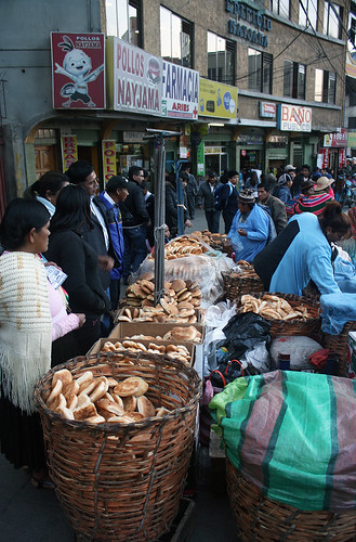
Might of the Mercado
First impressions of La Paz typically range from outright chaotic to sheer clumsy to hopelessly crowded, and make no mistake, it has all of those virtues! But it is, nevertheless, a fascinating city, and a rather under rated destination in general.
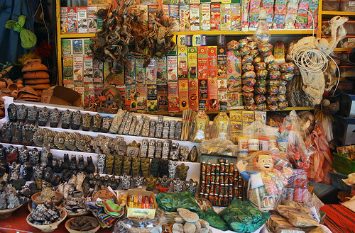
What the city lacks by way of architectural landmarks, parks and museums, it more than makes up for with its countless markets – all vibrant, varied and colourful – and their accompanying sights, sounds and smells. From the somewhat touristy Mercado Hechicería (witches market) to the locals-only Mercado Negro (black market); from the much newer Mercado Lanza to the dozens of pop-up markets that grace every other street corner, La Paz‘s streets are teeming with vendors, offering more than you can possibly imagine, and never in short supply of character or surprises!
Along the Prado
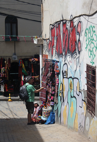
The Prado splits the city into its west and east, giving rise to wealthier enclaves as it gradually makes it’s way down hill. Unlike most hilly cities, in La Paz, income is inversely proportional to altitude! Sopocachi is where most of the city’s high-rises are concentrated, and Zona Sur (further along the Prado) is a favorite amongst its expats. But it is the less affluent parts of town that are the most interesting – Rosario and Belen, to name a few – visually, at the very least!
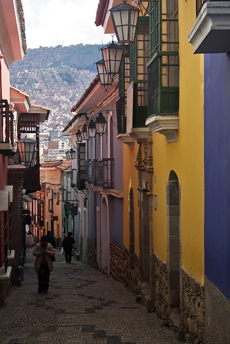
The city has plenty of colonial relics, in various stages of disrepair, but thankfully, a handful of these have been beautifully preserved on a little street just east of the Prado. Calle Jaén is a pedestrian-only cobble stone affair, housing within its colourful colonial-era structures, no less than 4 small museums, all of which can easily be visited within half a day!
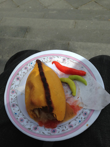
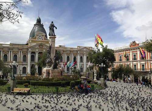
A half-mile or so from Calle Jaén lies Plaza Murillo, home to the seat of the Bolivian Government and the Cathedral of La Paz, the city’s foremost congregation. Considered to be the city’s main square, Plaza Murillo is also the centre of political life in the capital. Grab a Salteña from one of the dozen vendors around, then sit back and watch as the world, and countless pigeons, go by…
The 45-minute tease
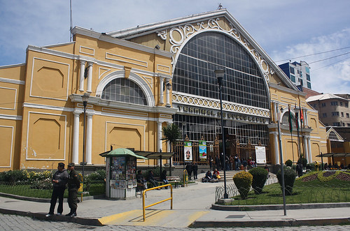
Buses to most destinations leave from the central terminal in La Paz, located, once again, just east of the Prado! The terminal is housed in a former train shed, the impressive structure having been completed in 1905, and designed by none other than Gustav Eiffel! On a good day, you can get a bus to pretty much any destination in the country, and across Bolivia’s borders too. But when it comes to land travel, “good days” are few and far between in the country, as I quickly discovered on day 2 of my trip!
A miners strike had effectively blocked the highway south of La Paz, and as a result, none of the bus companies serving Oruro, and points south, were operating. In Bolivia, strikes can be as short lived as a day and as long as an eternity – it was anyone’s guess how much longer this would carry on for. I had been forewarned, of course, and I learned my lesson the hard way – Bolivia is not a country you visit on a short itinerary!
With much reluctance, I booked myself a seat on an afternoon flight to Uyuni. No doubt, this was an extra cost I had to incur, but flying there also meant I would have to forfeit a rail journey between Oruro and Uyuni, something I had been yearning to do. I was bummed! A little consolation came by way of a choice window seat on Amaszonas flight 302, affording me stunning views of the Altiplano, terrain that I would otherwise have crossed by land…

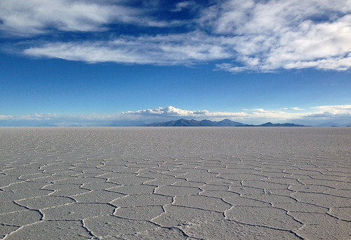
Salute to the Salar
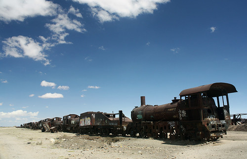
Apart from being the gateway to the world’s largest salt flats, Uyuni‘s biggest claim to fame is the train cemetery that sits just south of town. There, two distinct rows of abandoned steam locomotives, all heavily vandalised and corroded, line the yet active railway towards Avaroa on the Chilean border, contrasting sharply with their desert-like surroundings. Cementerio de Trenes is also the first stop on any tour of the Salar or salt desert. Tours typically range from 1 to 3 days, and if you happen to go on the shorter excursion, like I did, you will end up kicking yourself for not having chosen the longer one!
Still, the single day tours (most leave from opposite the train station around 11 AM, returning by sunset) offer more than just a teasing glimpse of the Salar. It is one thing to see the mighty salt desert in pictures, quite another to be barreling along the blinding white expanse at 50 mph, pausing occasionally to take it all in; a photo op here, a sighting there.
So flat is the Salar that it is jokingly referred to as the smoothest road in Bolivia. Across the 4,000-odd square miles that make up the salt desert, the altitude varies by only one metre! And below it all lie over half of the world’s lithium deposits! Somewhere in the middle, under azure skies, sits Isla Incahuasi, a rocky, hilly outcrop, that is host to the only vegetation on the Salar, giant cacti! The tallest of the these rise up to 9 meters in height, and the oldest date back to a thousand years! The Salar is a study in contrasts; it redefines stark, and gives new meaning to the word surreal.

Getting out of dodge
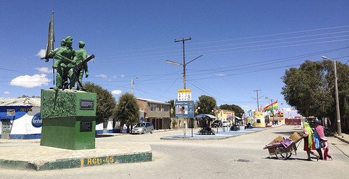
A one-horse town, with little more than a clock tower and church to its credit, there’s only so much one can do in Uyuni. So I was rather grateful to have booked a stay at Hotel Toñito, an excellent choice all around for a bed and breakfast, located at the quieter, southern end of Av. Ferroviaria, the main drag in town. My unplanned, extended sojourn there being made all the more special by the warm hosts, Sussy and Chris.
With onward connections and bookings at stake, and the miner-led blockade still in effect, I scrambled to get out of Uyuni. After having lost a full day there, and tried every possible means, all I had was an overnight bus ticket to Oruro, and a great deal of uncertainty going forward. Resigned to the fact, I sat in the plaza, sipping on some Mate de Coca, and contemplating the worst-case scenario, when I was approached by Yesmy and Roxanna. A seat had opened up on the first flight out the following morning, and not knowing my name or my contact number or the hotel I was staying at, they had set out to look for me!
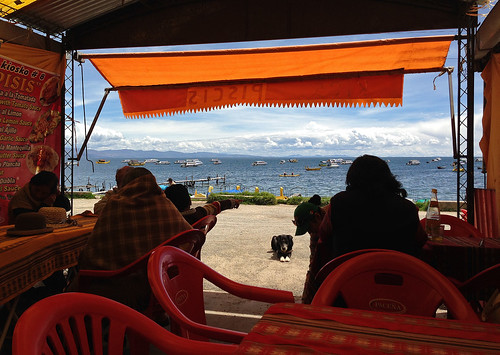
The 0745 am service to La Paz was on the dot. A quick taxi ride from El Alto to the bus station at Cementerio, and a seamless transfer to a colectivo, was followed by a 3-hour journey along the very scenic Ruta Nacional 2. Less than 5 hours after having left the desertscape of Uyuni, I was sitting at kiosko #8 on the Copacabana waterfront, looking out at Lake Titicaca, eagerly awaiting my order of grilled trout!
The cradle of civilization
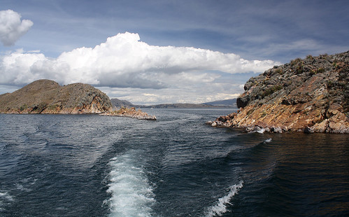
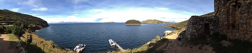
South America’s largest, and the world’s highest navigable body of water, Lake Titicaca straddles the international border between Bolivia and Peru. At an elevation of 12,500 feet, and covering a surface area of over 3,200 square miles, the lake is a sight to behold; its crystal clear, sapphire blue waters fed by no less than 27 rivers and streams!
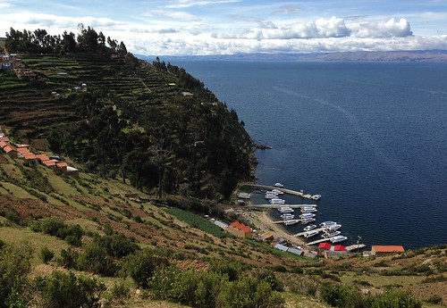
The Incas believed it to be the birthplace of the sun and the moon, and hence all civilization. Isla del Sol (Island of the Sun), on the Bolivian side, has been a point of pilgrimage since Inca times. One of the largest islands on the lake, it continues to be inhabited by indigenous people, who subsist on farming and fishing. Not far east from it lies Isla del Luna (Island of the Moon). Both are easily accessible by ferry from the town of Copacabana, Bolivia’s gateway to the lake.
The 90-minute journey to Isla del Sol – best undertaken on the top deck – offers gorgeous vistas of the lake, its many little islands, and the snow-capped peaks of the Cordillera Real. Once on the island, a climb up the steep Inca steps is well worth the effort; the very top of the hill providing a very different vantage from which to appreciate the magnificent surrounds. The island boasts almost a hundred ancient Inca ruins, and a half-hour walk south along the ridge, brings up one of the more notable ones, Pilko Kaina, from where its possible to return on one of the Copacabana-bound ferries.
The frontera at Kasani
The colourful, compact, and backpacker-filled town of Copacabana is where most visitors end up staying, but from all accounts, it seems like an overnight stay (if not longer) on Isla del Sol is really the way to go. For my part, I didn’t even get a chance to stay the night in Copa, as previously planned. A couple that I befriended on the ferry back from the island happened to have stayed at Las Olas, where I was booked, and didn’t spare any effort in informing me just how awesome the property was! I had little time for regret though – there was a bus to catch, after all, and an international border to cross!
A simple archway marks the separation between Bolvia and Peru at the border town of Kasani, some 8-km west of Copacabana. Passengers must leave the bus on the Bolivian side, get an exit stamp, and then walk across to the Peruvian side to get their passports stamped again, gaining a full hour in the process! The town of Puno, which provides access to the lake from the Peruvian side, is reached at 8:30 PM local time, and after a short halt, buses continue north and overnight into Cusco. But I had a hotel booking in Puno, and a much more civilized way of getting to the former capital of the Inca Empire!
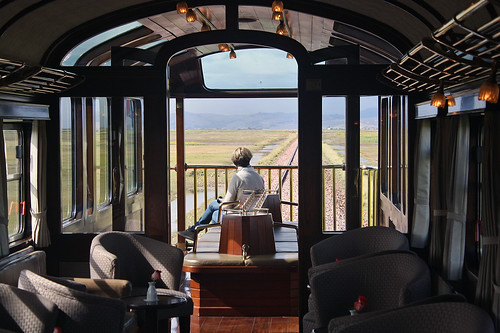
Iron horse through the Andes
It goes nowhere in a hurry – seldom crossing the 45 km/h mark! It calls on no town of repute, and crosses no topographical landmark of note. There are no long tunnels, dizzying switchbacks or gravity-defying viaducts to speak of. Even though it summits at over 14,000 feet, it falls well short of being the highest railway in the world. But despite all of that, a journey on the Andean Explorer is guaranteed to delight!
Starting from Puno at 8 in the morning (the timings are similar in the reverse direction) and charting a course through the mighty Peruvian Andes, the train deposits you some ten hours later, in the beautiful town of Cusco. You arrive there rejuvenated, completely exhilarated, and definitively enriched! Need more proof? It remains, without doubt, the best $161 I’ve spent in my life!

———————————————————————————————–
On Flickr, you can view a full set of my pictures for La Paz, Bolivia, and a journey on the Andean Explorer in Peru.
———————————————————————————————–

WOW…amazing pictures…can imagine how pretty the place must be.My salaam to the two wonderful friends you made! Look forward to your forthcoming trip to Russia. Love Ma
You are well on the way to becoming the most well travelled Indian I know! Time you monetized this blog! The Salar reminded me of the Rann of Kutch, only much more beautiful!