Civic by Sunrise

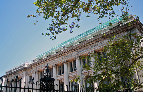
You’ve probably driven through it on your way to Ground Zero; skimmed the surface of it while making your way on to the Brooklyn Bridge walkway, or then rushed past it in your hurry to snag a good deal at J&R. Bounded by Broadway on its west, Park Row and Centre Street on its east, Chinatown to its north and the Financial District to its south, lies a compact, often overlooked, and highly underrated section of Lower Manhattan – Civic Center!

A good place to start your walk around Civic Center is City Hall Park, and probably the best time of day to do so is the crack of dawn…

IMG_9245

Continue reading “Civic by Sunrise”

The Jewel in the Subway Crown

The New York City Subway isn’t quite as old as London’s Tube. In fact, it isn’t even the oldest in the Americas – that distinction goes to Boston. But when it did open, over a century ago, it was a momentous occasion. One that would change the course of the city’s development, and give it the very pulse it’s known for today. The year was 1904. The 27th of October was the chosen date, and the station where it all began – City Hall, in lower Manhattan.

On the last weekend of February, I had the rare privilege to tour City Hall Station – the very birthplace of New York’s Subway – a station that has been lying abandoned since 1945. Here are a few chosen images and accompanying descriptions from my visit.

—————————————-

We gather at the front end of the downtown platforms at Brooklyn Bridge Station. After checking in, we file into the first car of a terminating #6 train, which has just offloaded the last of its fare-paying passengers. Traveling some 600-feet around a sharp curve, we alight minutes later by the grand entrance that leads to the mezzanine level of City Hall Station.

IMG_9229

Continue reading “The Jewel in the Subway Crown”

Before the Village awakes

”This section of Manhattan, owing to its peculiar street system . . . preserves to this day the traditions, habits and quaintness of old New York” – Real Estate Record & Guide of 1915.

Almost a century since the guide was published, little has changed in the West Village. Having spent my first year (in NYC) there, and looking back on 7 years, 5 apartments and 3 boroughs, it continues to be my favourite neighbourhood in the city!

A few weekends ago, a friend and I decided to meet at the crack of dawn and photograph the streets and buildings of this wonderfully quaint hood. For a change, I’m going to let the photographs do the talking, or most of it at least 🙂

Our walk begins in Washington Square Park, considered by many to be the heart of the Greenwich Village. On the park’s south side, the tower of the Judson Memorial Church rises high enough to pick up the first few rays..

IMG_2002

Continue reading “Before the Village awakes”

The Heights of Manhattan

The name Manhattan is a Native American word that translates to ‘island of many hills’. To most visitors though, and to those few residents who’ve never had opportunity to use the GW bridge, the island of Manhattan is perceived as flat! No fault of theirs really – the city’s urban development in the early 19th-century ensured that much of the island’s topographical variations were evened out.

Washington Heights and Inwood, the northernmost neighbourhoods on the island, are remnants of that undulation, and little known ones at that. A stroll or bike ride through them reveals not only what the island would have looked like pre-development, but also many a hidden treasure. Towards the end of summer this year, I set out to find out just that!

11 miles after leaving my house on a warm Sunday morning, I made my first stop at 156th & Broadway. There, occupying a full city block sits Audobon Terrace, a complex of eight early 20th-century Beaux Arts buildings, named after John James Audobon, a French-American ornithologist, on who’s land the structures stand.

IMG_0008

Continue reading “The Heights of Manhattan”