
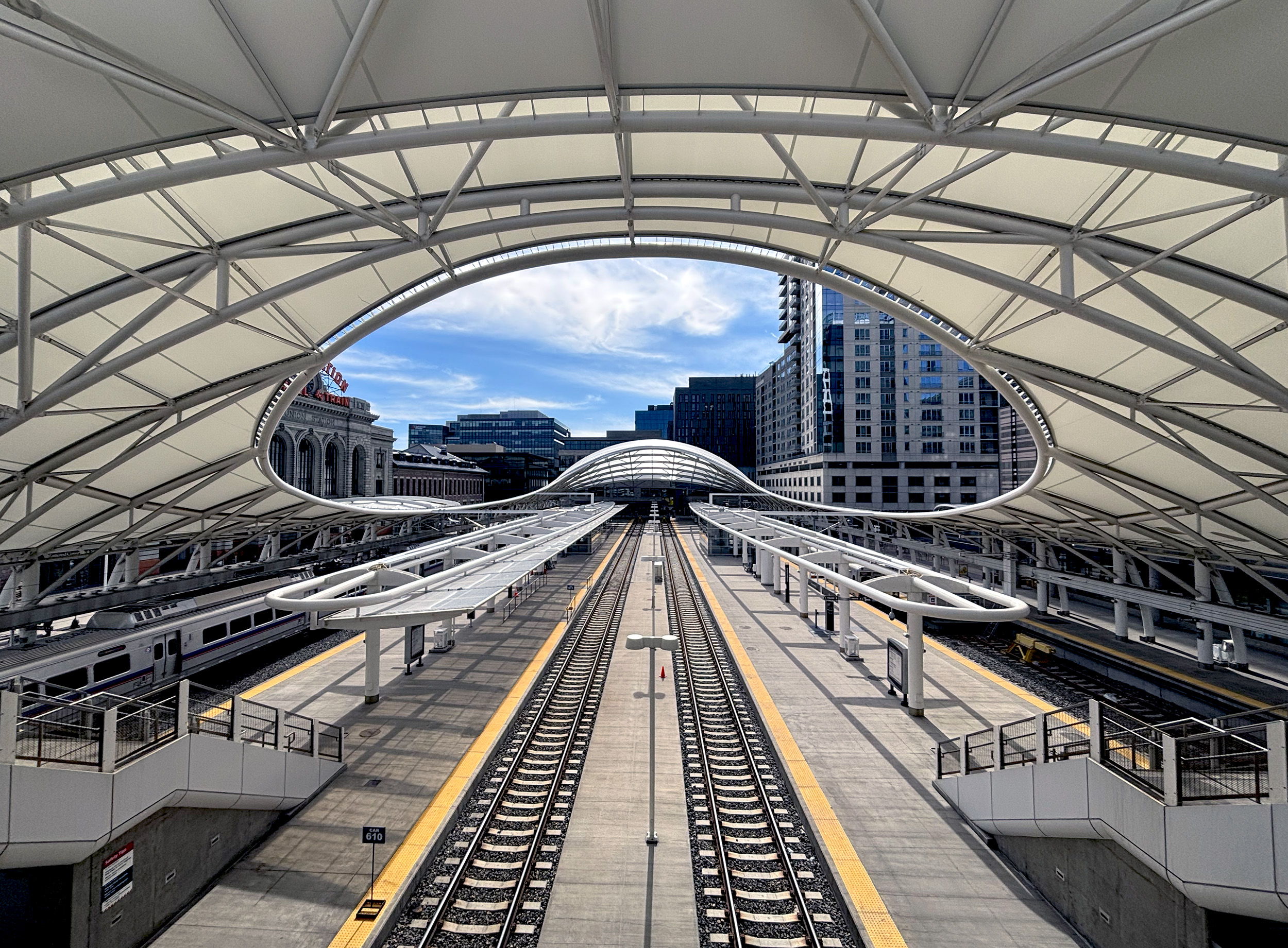
The plan had always been to start in Chicago. Not one but two itineraries were drawn up. None materialized. Time intervened. Then Denver beckoned – I had never been. Others who had journeyed previously between that pair of cities convinced me there was nothing to see but the Prairies. Apologies, Midwest! Welcoming, unfussy and visually exciting, the Mile High City took no time to impress me. Amongst its lengthy list of attractions – Denver Union Station. Perhaps one of the most desirable venues from which to catch a train. A stunning mash up of historic and contemporary. A model for urban renewal and transit-oriented development. And one that’s brought the oomph back to a much-maligned mode of transport in this country. A fitting place then, from which to start our journey.

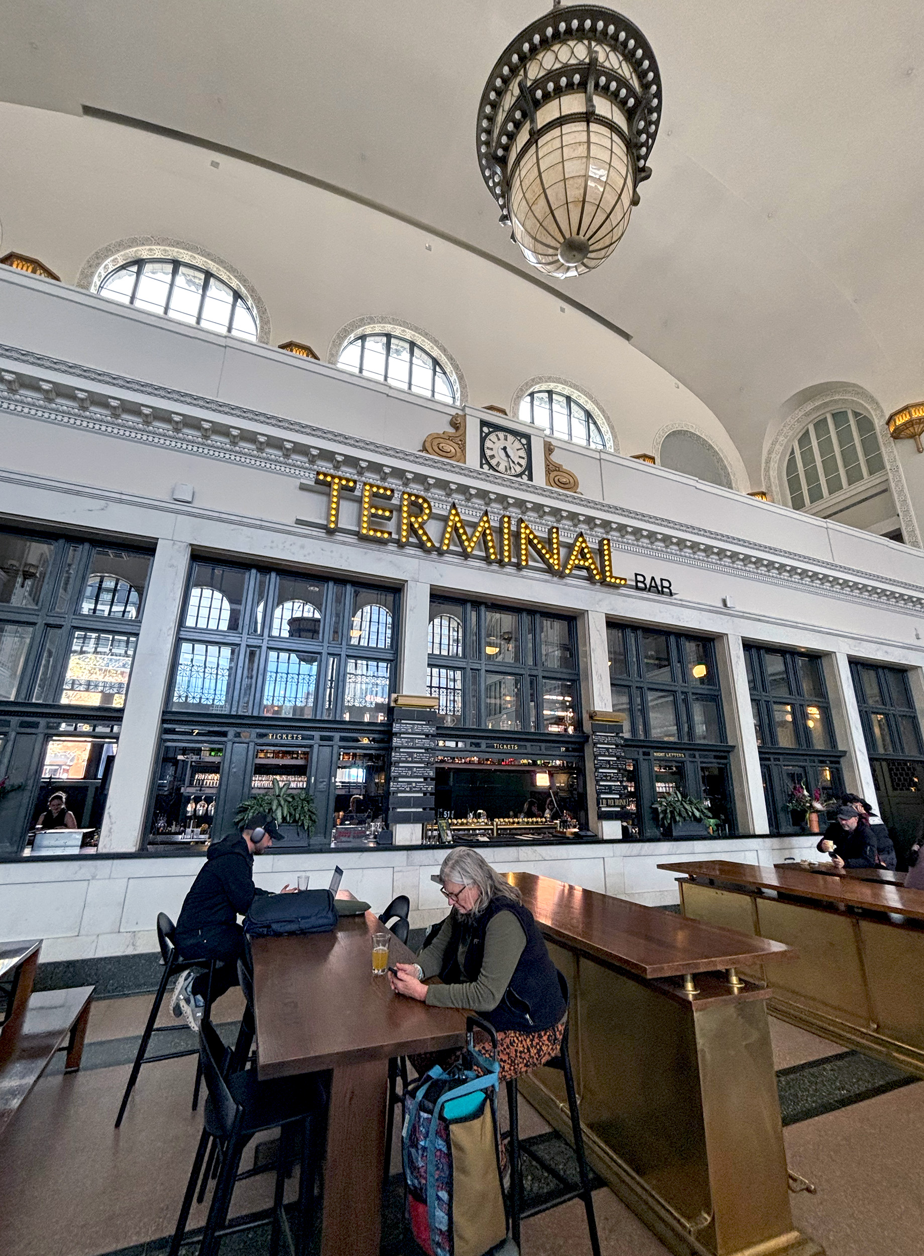
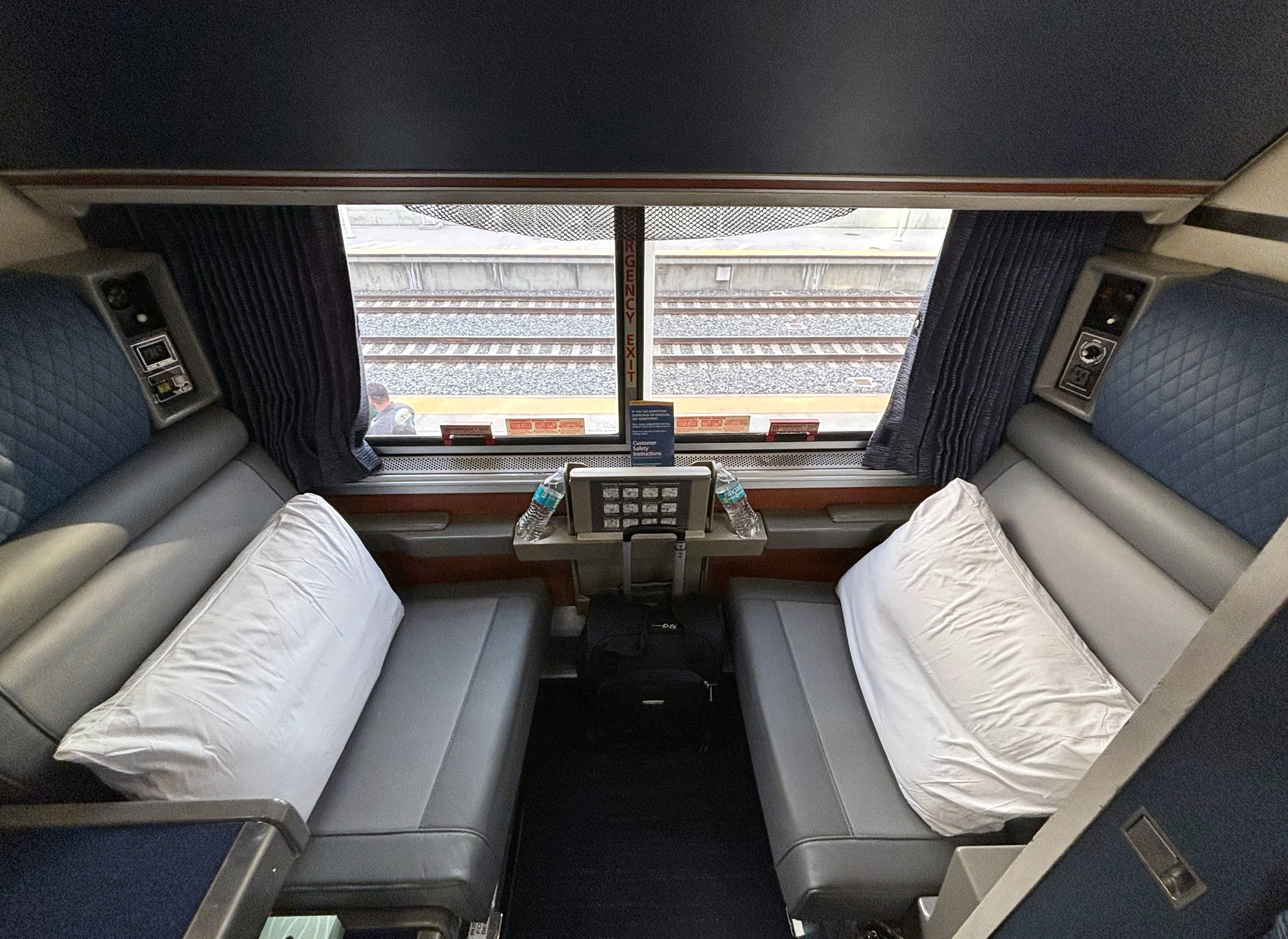
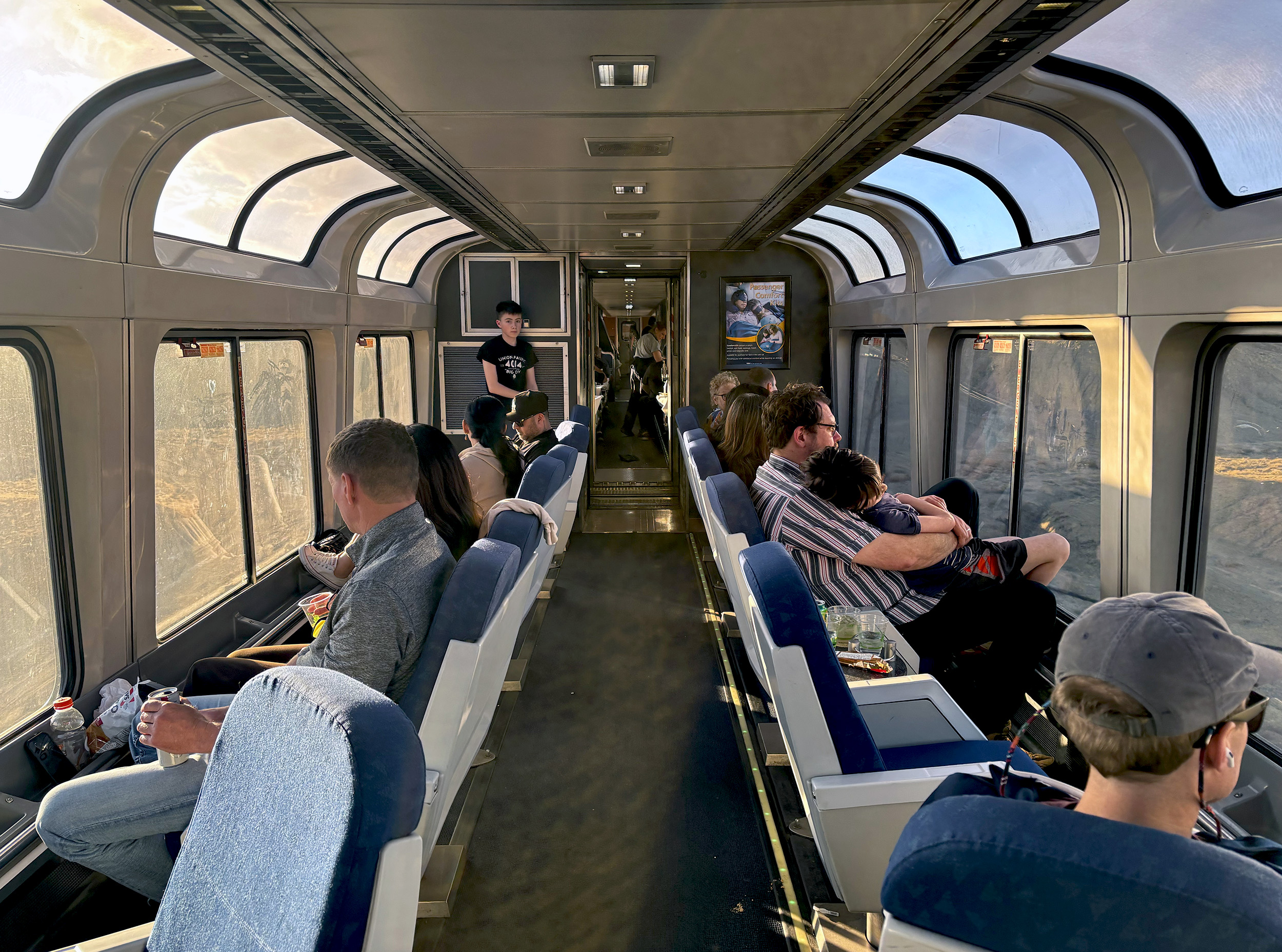
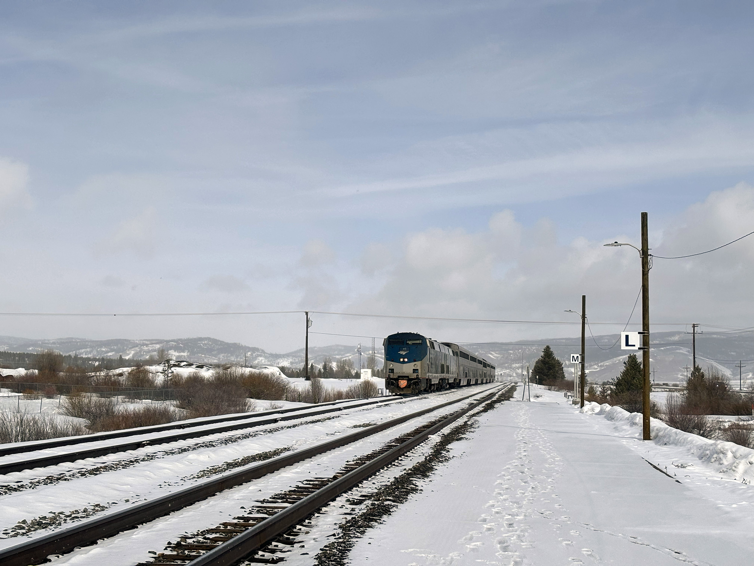
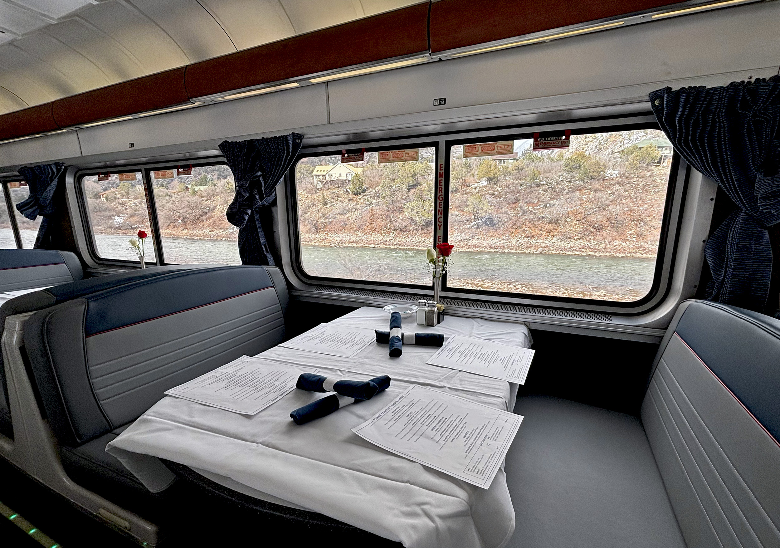
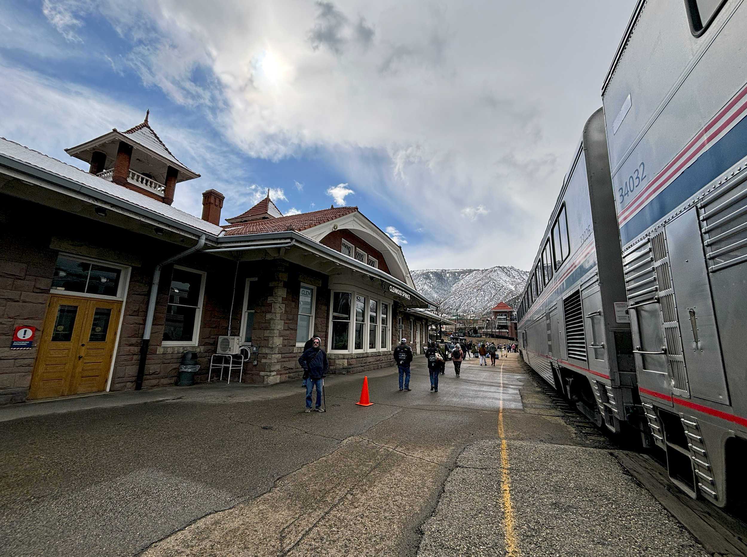
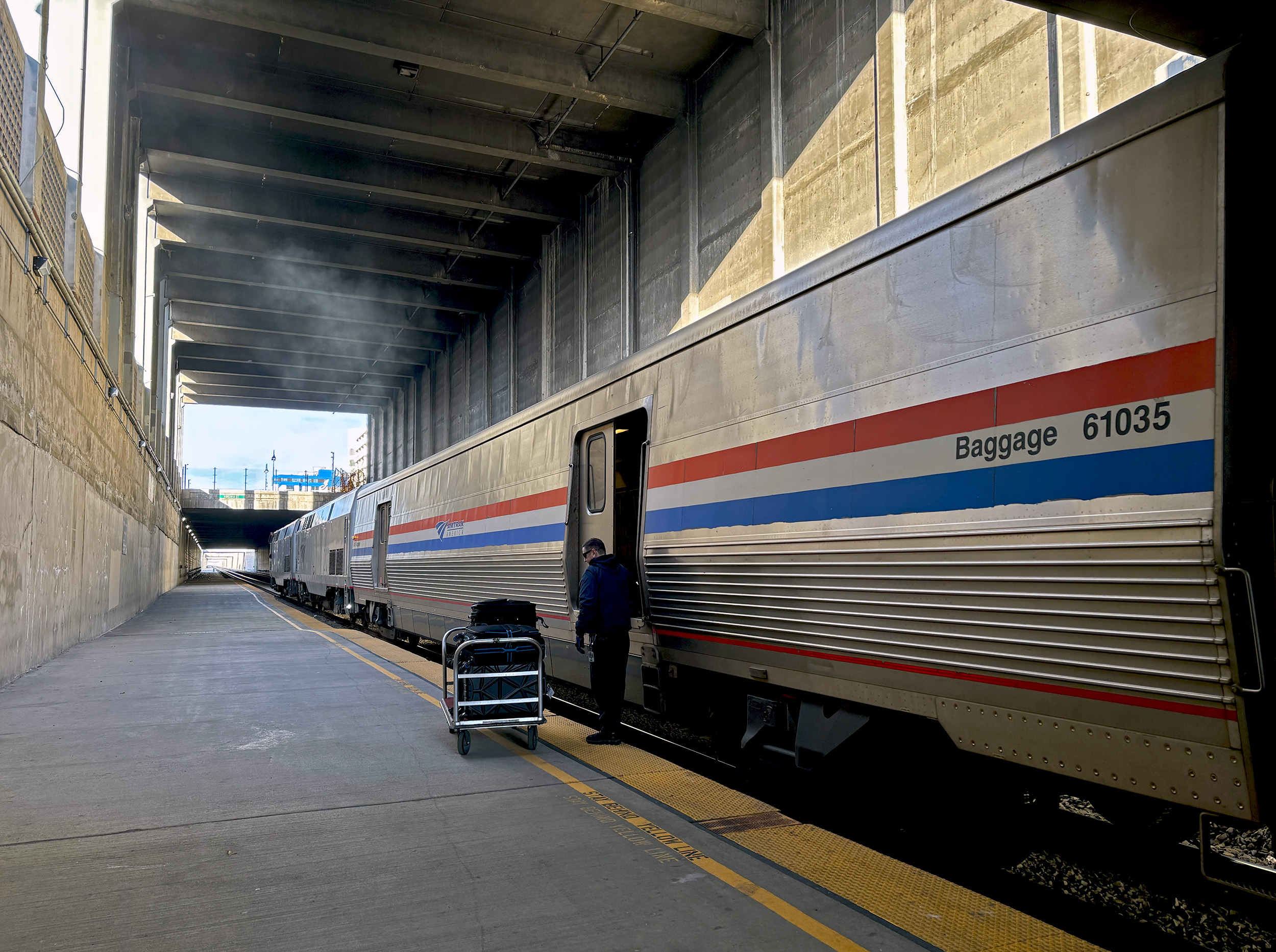
It’s a crisp March morning in Denver as preparations are underway just outside Union Station for a St. Patrick’s Day parade. Inside the station, JB, SS, SB and I are queued up to board Amtrak No.5, the westbound California Zephyr. The train is running to schedule today, having originated in Chicago the previous afternoon, with over a thousand miles – just under half its route – already covered. On past long-distance journeys we’ve all shared roomettes, but having booked in advance this time, we managed to get a decent fare for single occupancy. And just as well. Amtrak’s roomettes, while advertised to accommodate two, are really better suited to just one. We barely linger in them after dropping of our bags, and instead make a beeline for the Sightseer Lounge Car, where the views are guaranteed to be exemplary, but seats are always hard to come by.

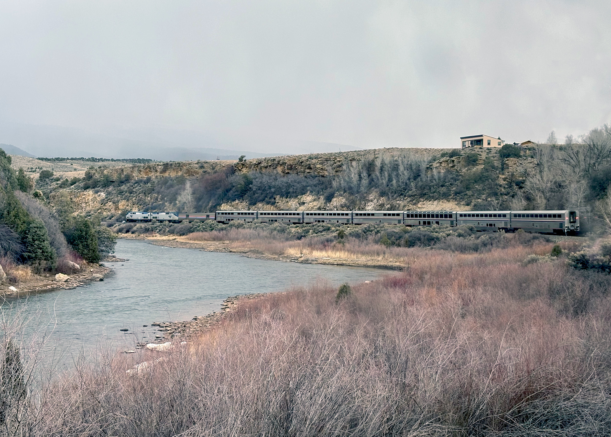
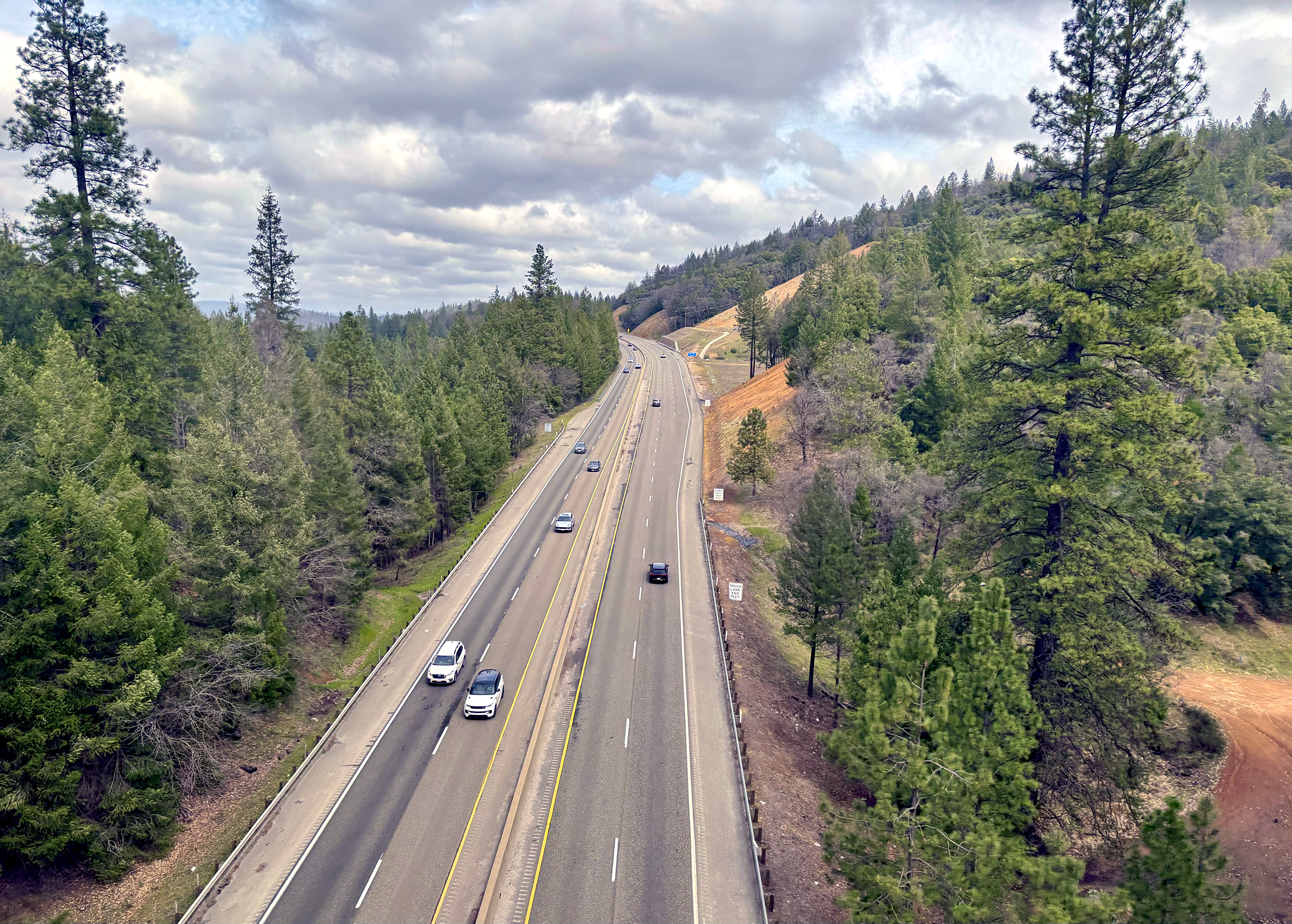
About an hour into the journey, and well past the outskirts of Denver, SB points to a lengthy row of loaded hopper cars in the distance. They are the railroads first line of defense along the notoriously windswept stretch of track known as Big Ten; a long, sweeping curve of 270-degrees, named so as the radius of the track’s curve is ten degrees. The Zephyr gains almost 300-feet in elevation here as it negotiates this feat of engineering, and to everyone’s delight, we get a first peek at the front of our train.
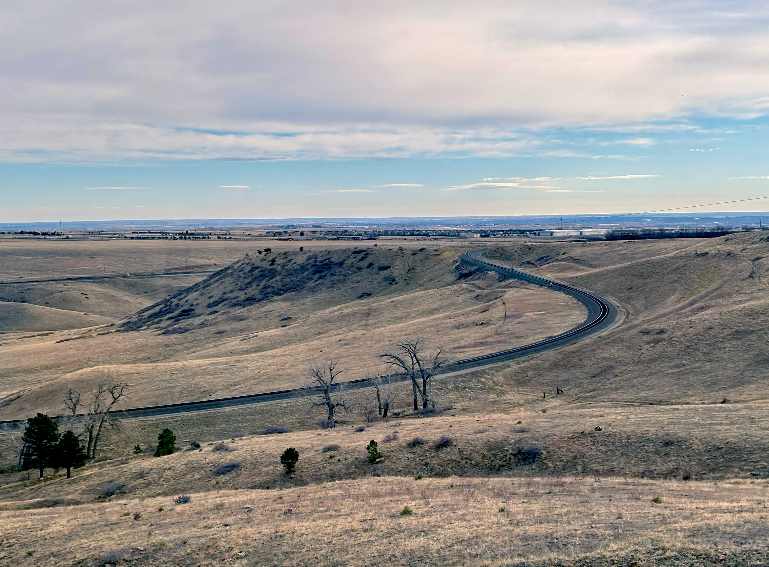
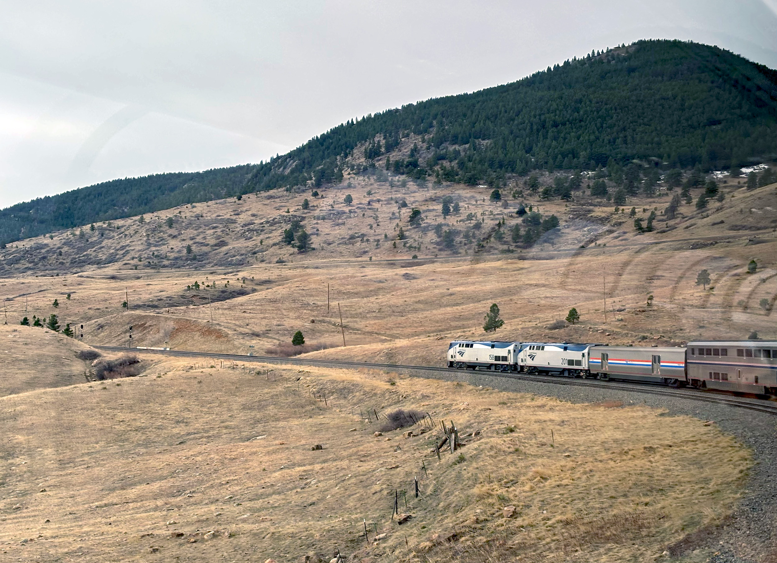
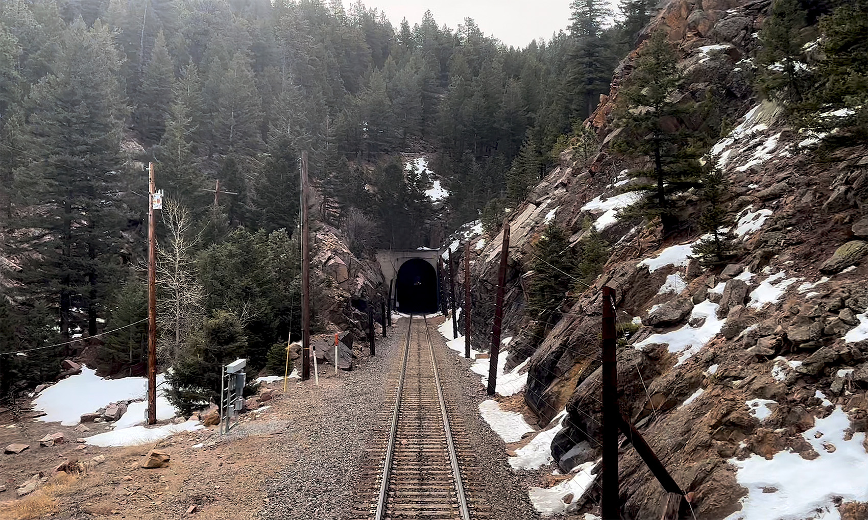
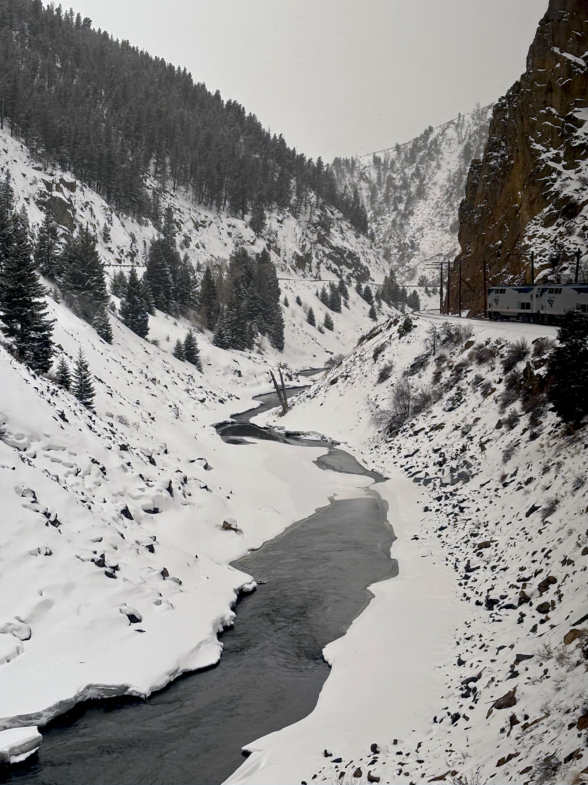
There’s plenty more climbing left to do though, as ahead of us lies the Front Range, a formidable arm of the Southern Rockies. With the Great Plains behind us, and the ascent well underway now, there’s a noticeable increase in forest cover, and occasional patches of snow are visible on the ground too. The Zephyr dives into a tunnel. Then another. And another. Flashes of thick pine forests in between. There are 26 that make up the Tunnel District here, a section that culminates in the legendary Moffat Tunnel, which at 9,239-feet (2,816 m) is the highest railroad tunnel in the United States. Somewhere within that 6.2-mile (10 km) long stretch of darkness, we cross the Continental Divide. After burrowing our way through for nine minutes, we emerge into a blinding winterscape, eventually easing to a halt at the popular ski resort of Winter Park.
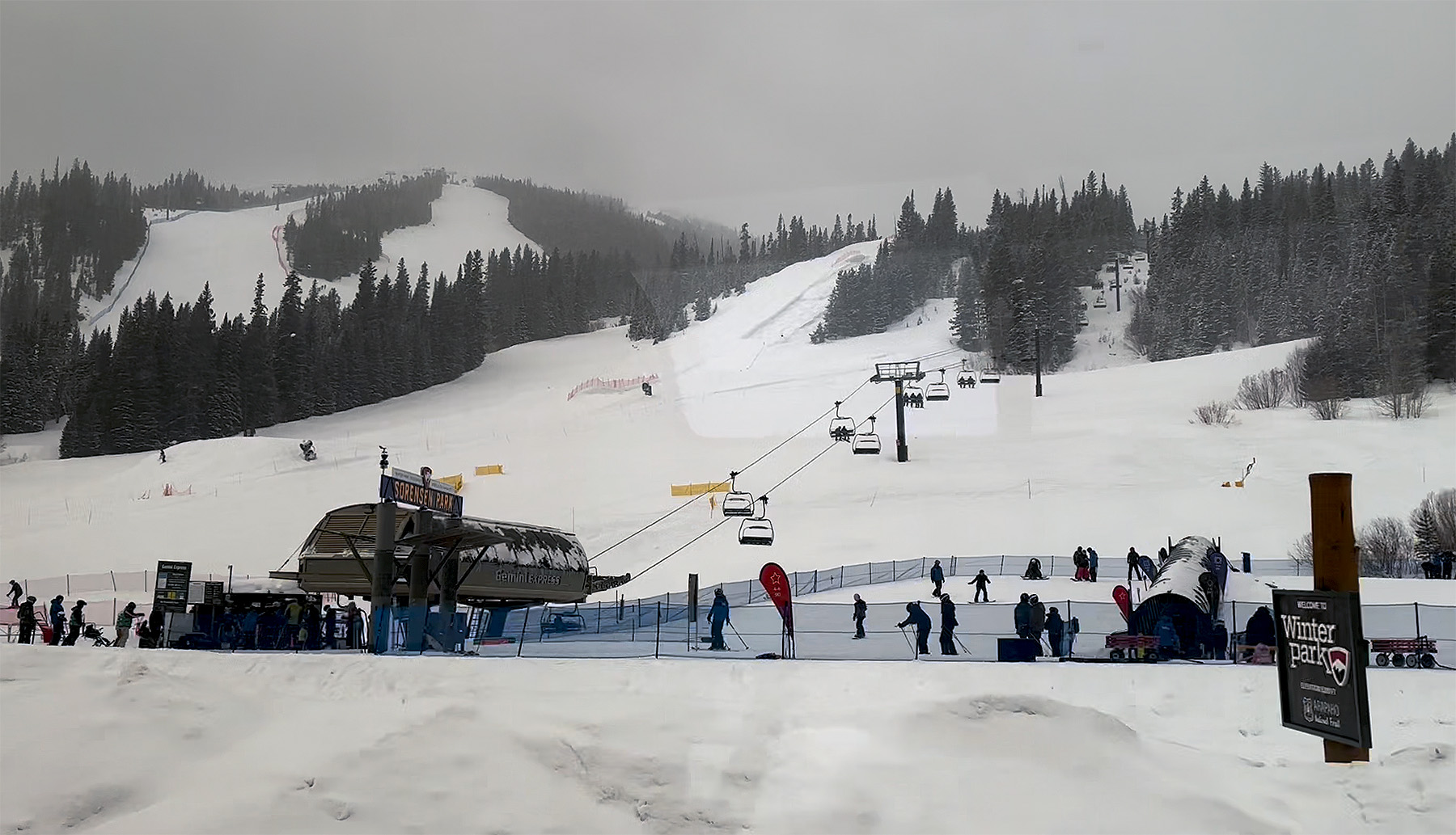
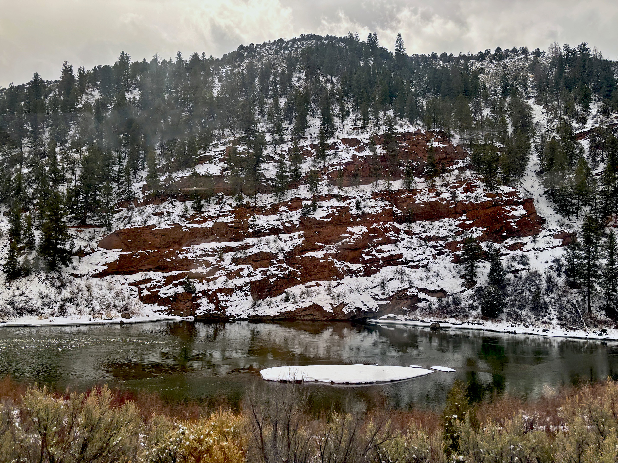
It’s a chilly -7C (19F) as we trek to the front of the train to get a few pictures. Located 8,561-feet (2,609 m) above sea level, Fraser-Winter Park is the highest station served by Amtrak, and a popular one at that, with plenty of skiers and snowboarders alighting. Back in the warm comfort of the Sightseer Lounge Car, we jockey into position for the next point of interest, Fraser Canyon. It is the first of several canyons the Zephyr will go through today, and a relatively narrow one at that. Past Granby, we lose sight of the Fraser River, and are joined instead by the mighty Colorado River, whose headwaters lie less than 30-miles to the north. Its channel is narrow at first but opens up in dramatic fashion not long after, only to narrow again as it carves its way through a canyon. The railway dutifully follows along. In this truly spectacular section along the Colorado River, the views are only ever impeded by the occasional tunnel. A much needed breather, we all agree.
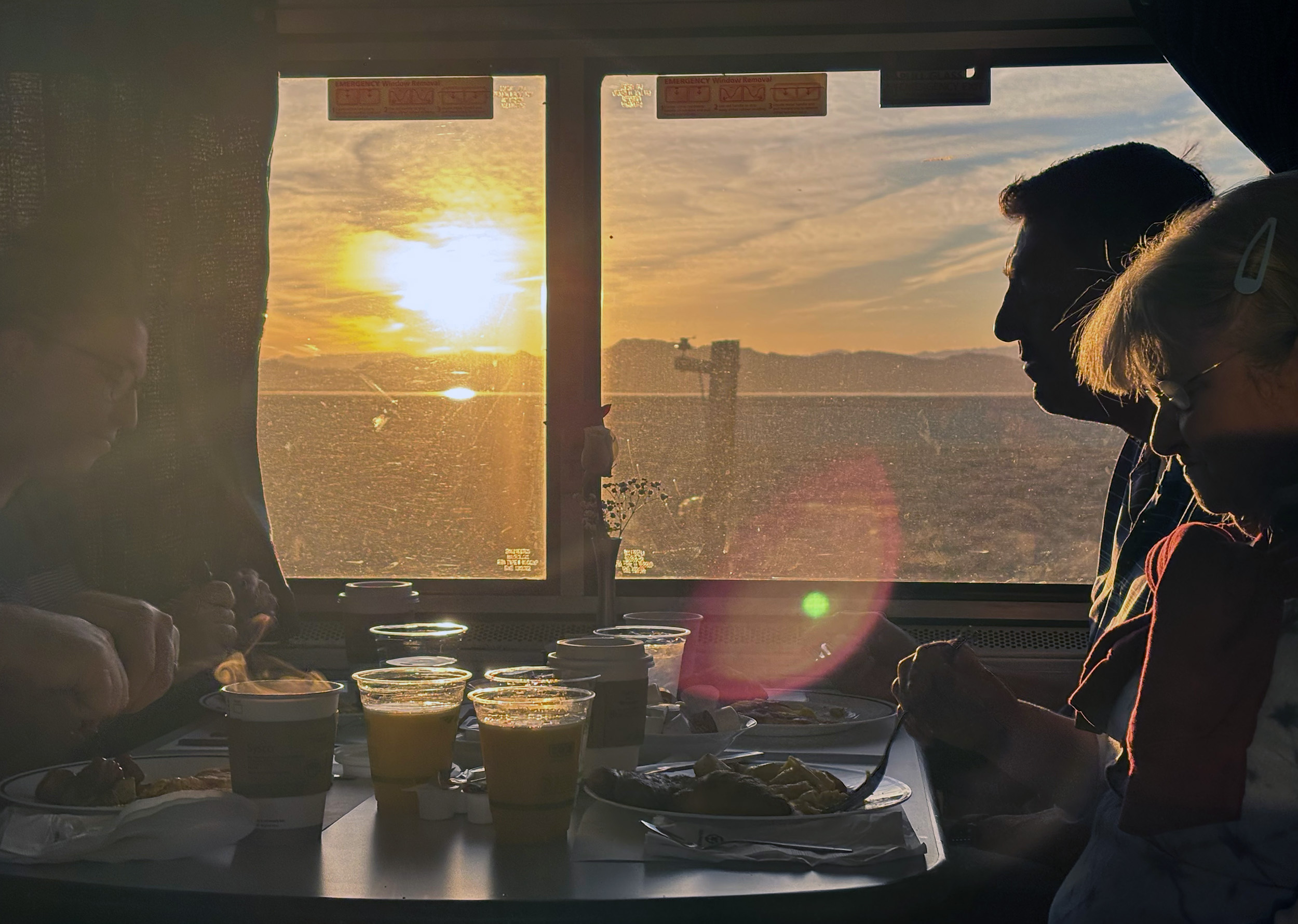
The last seating for lunch is announced, and rather reluctantly we relinquish our seats in the Sightseer Lounge. The Dining Car’s windows are definitely smaller but rest assured, the Colorado River – the fifth-longest in the United States – is not leaving our sights anytime soon. Keeping our phones away at lunch – and by extension, cameras – does have its advantages. Wildlife spotting for one. First, it’s a pack of deer. In-between courses, a bald eagle is spotted. Plenty of geese. More bald eagles. Lunch turns out to be more satisfying than the menu would have you believe. Quite surprisingly though, no alcohol was offered for sale, so while SS and SB head off to secure a vantage for us in the Sightseer Lounge, JB and I detour via the Café Car to pick up some pints. We show up just in time to witness a picture-perfect crossing around a bend in the river, with our opposite number, the Chicago-bound California Zephyr.
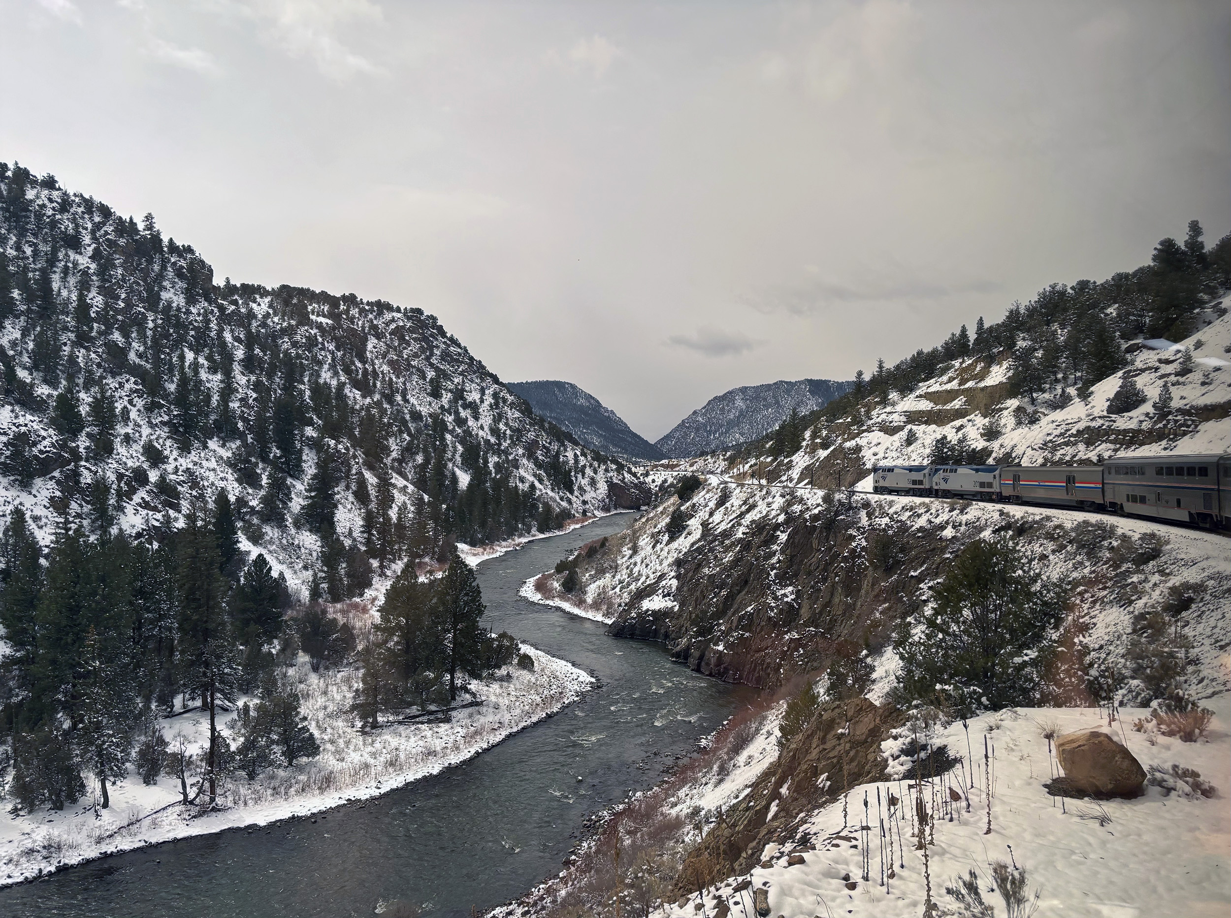
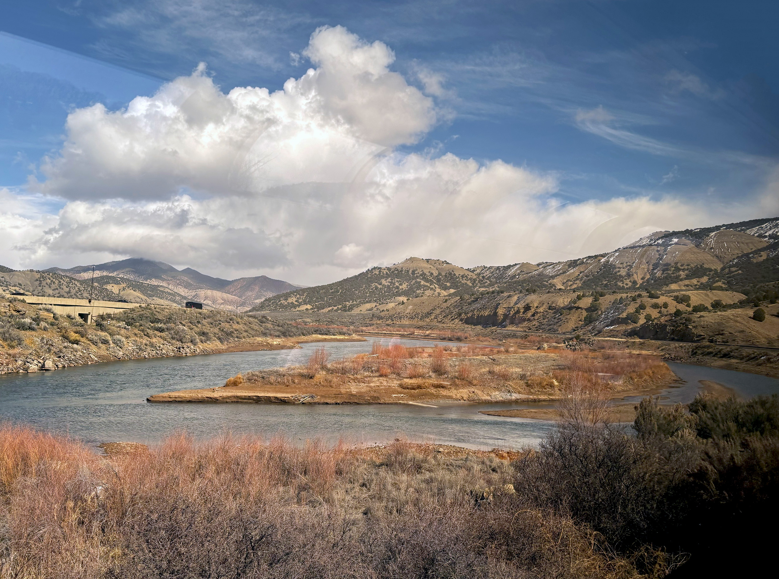
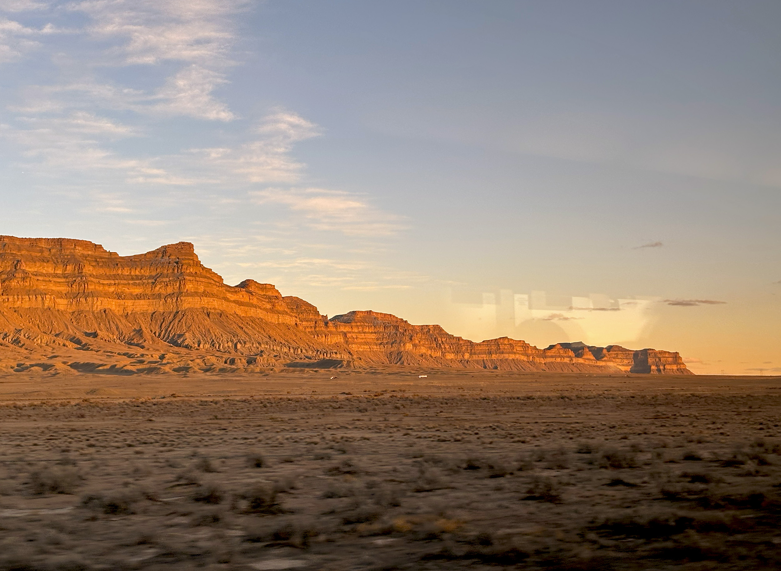
As we inch further west, and toward drier climes, a partially exposed rock face reveals the true colors of the terrain. In Spanish, the word Colorado translates to “colored reddish”, a name stemming from the significant deposits of silt in the area. The weather can change by the hour in these parts, as evidenced by a fresh covering of snow on the mountains to our south, all while the cloud cover is slowly lifting. At Dotsero, we’re joined by Interstate 70 on the north bank of the river, and some very blue skies. For the next eighteen miles, road and rail will occupy either side of the very scenic Glenwood Canyon, till the town of Glenwood Springs is reached. Glenwood is the largest of the canyons that dot the Upper Colorado River, with some of its walls climbing as high as 1300-feet (400 m), and resultantly, the section of road through it is considered one of the most scenic within the US interstate highway system. Its engineering, no less impressive. The most coveted views, of course, remain firmly with passengers on the California Zephyr.

Our entry into the picturesque town of Glenwood Springs is heralded by the iconic Hotel Colorado, an imposing Italianate-style building dating from 1893. The station here – a handsome brick and red sandstone building – was built less than a decade later by the Denver and Rio Grande Western Railroad, and serves not just the Zephyr today, but as an overnight stop for the Rocky Mountaineer luxury train as well. Renowned for its hot springs, the town is also a winter sports destination, if the period sign for “baggage and skis check stand” at the station is any indication.
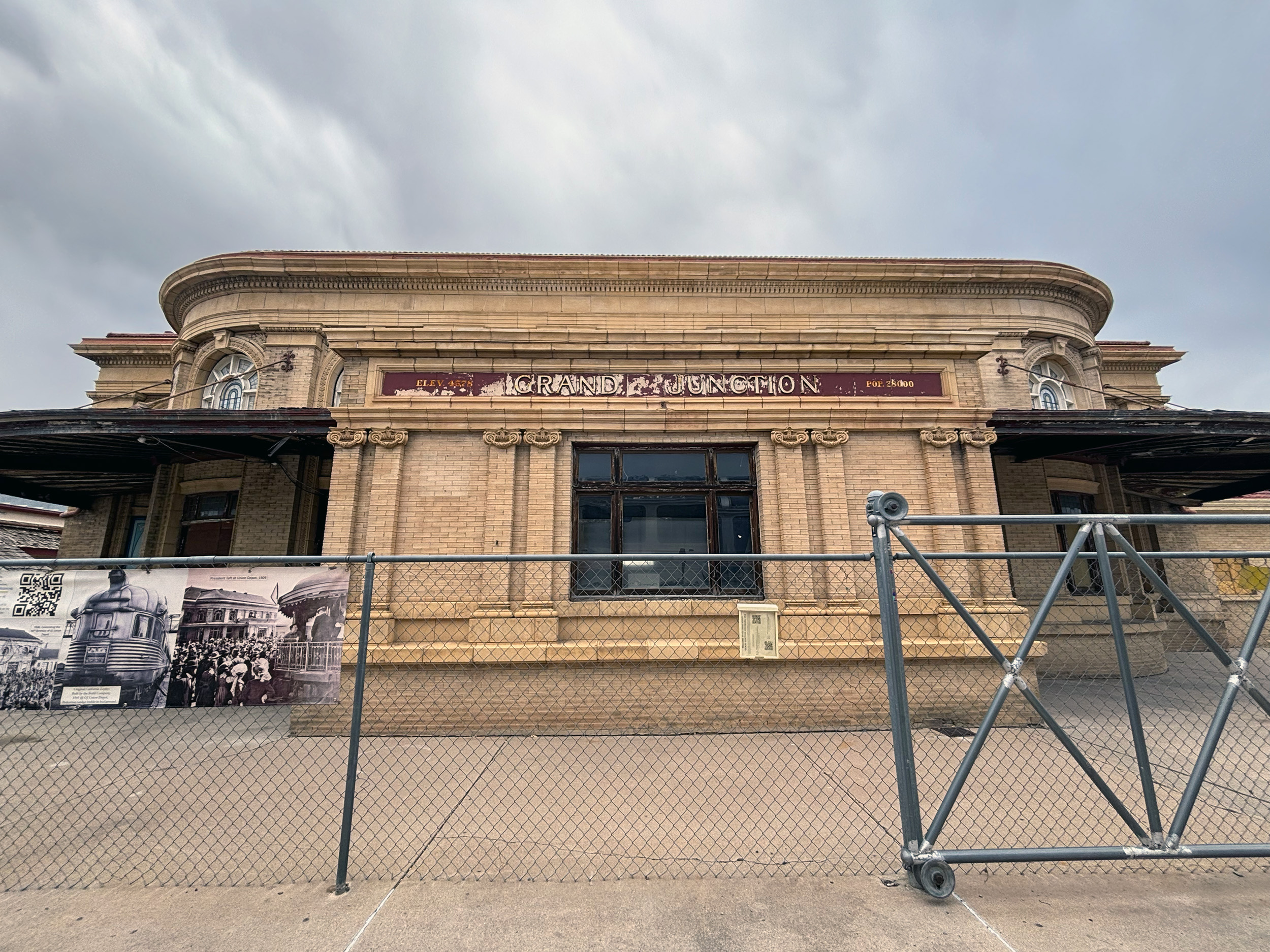
Not long after our departure from Glenwood Springs, the weather takes a turn for the worse. Blowing rain at first, followed by snow. In the midst of those whiteout conditions, JB spots a pair of elk wading along the banks of the Colorado. Then, a brief spell of sunshine – all while it’s still snowing – brilliantly lighting up the topography. By the time we pull into Grand Junction, it’s overcast again but completely dry. The third and last “smoke stop” for the day, there is nothing grand about Grand Junction sadly, what with its elegant old depot building barricaded, and out of use for over three decades at this point. As we scrutinize the plaque alongside the historic building, Donna, the coach car attendant makes the “all aboard” call, and we obediently head back to our viewing stations.
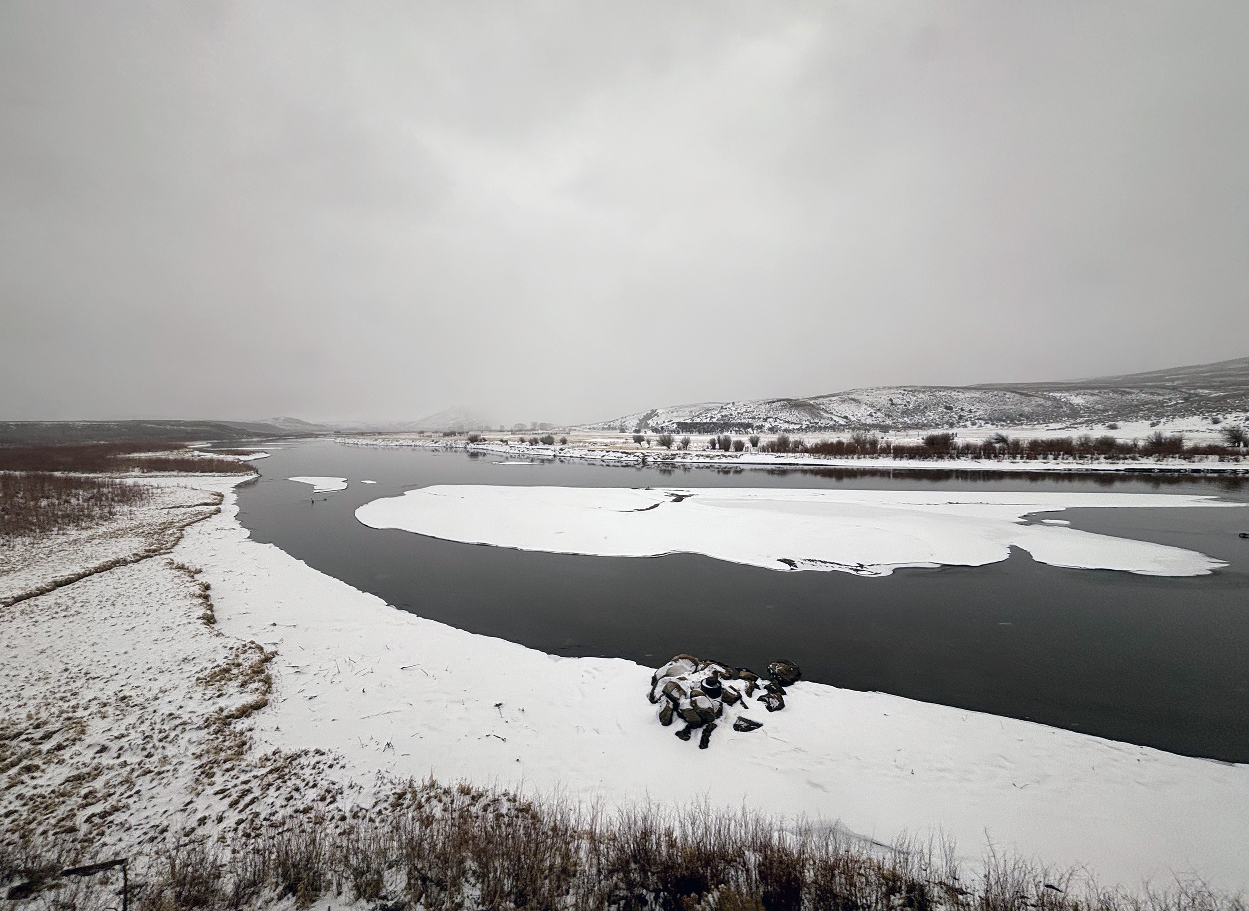
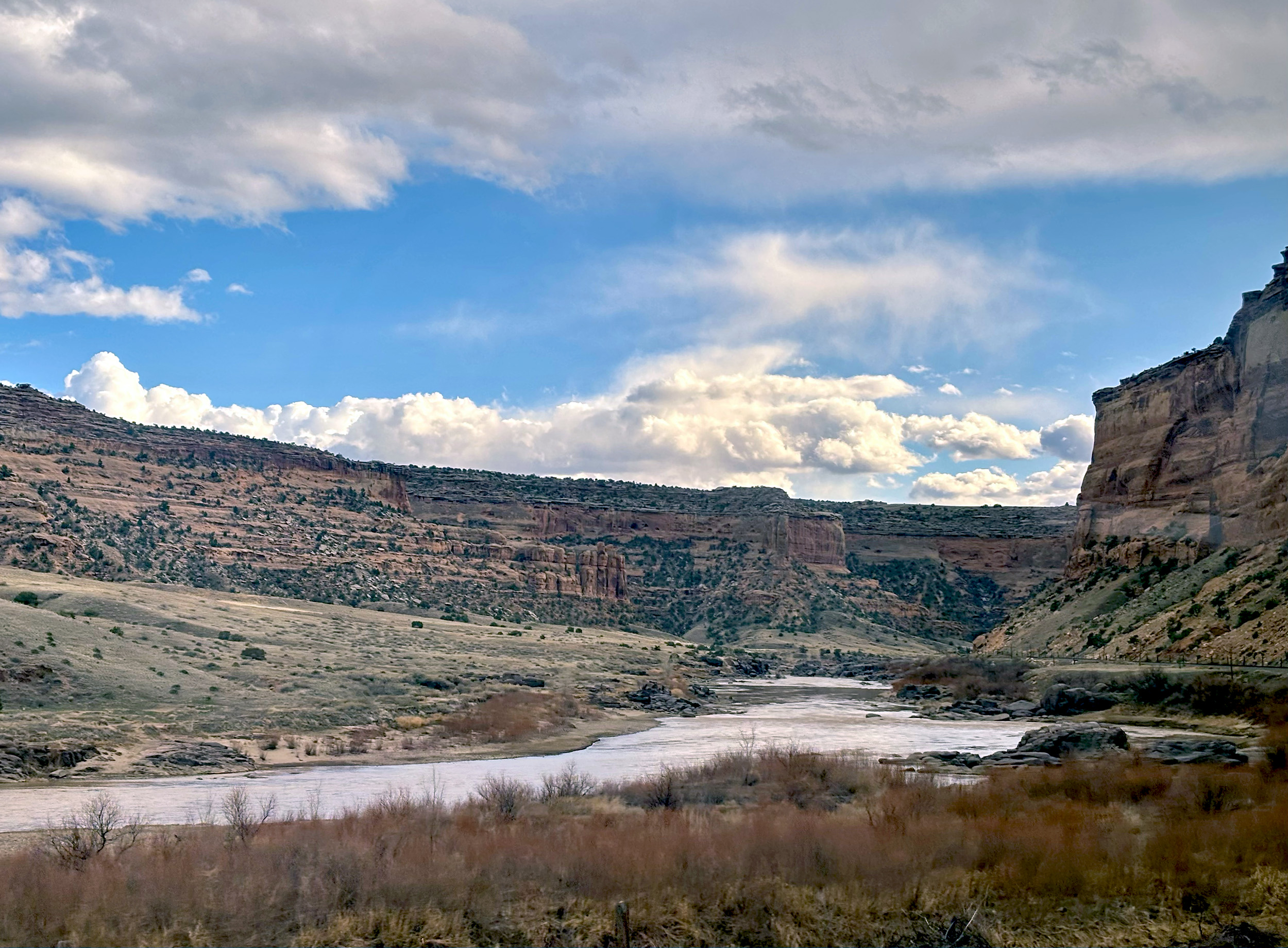
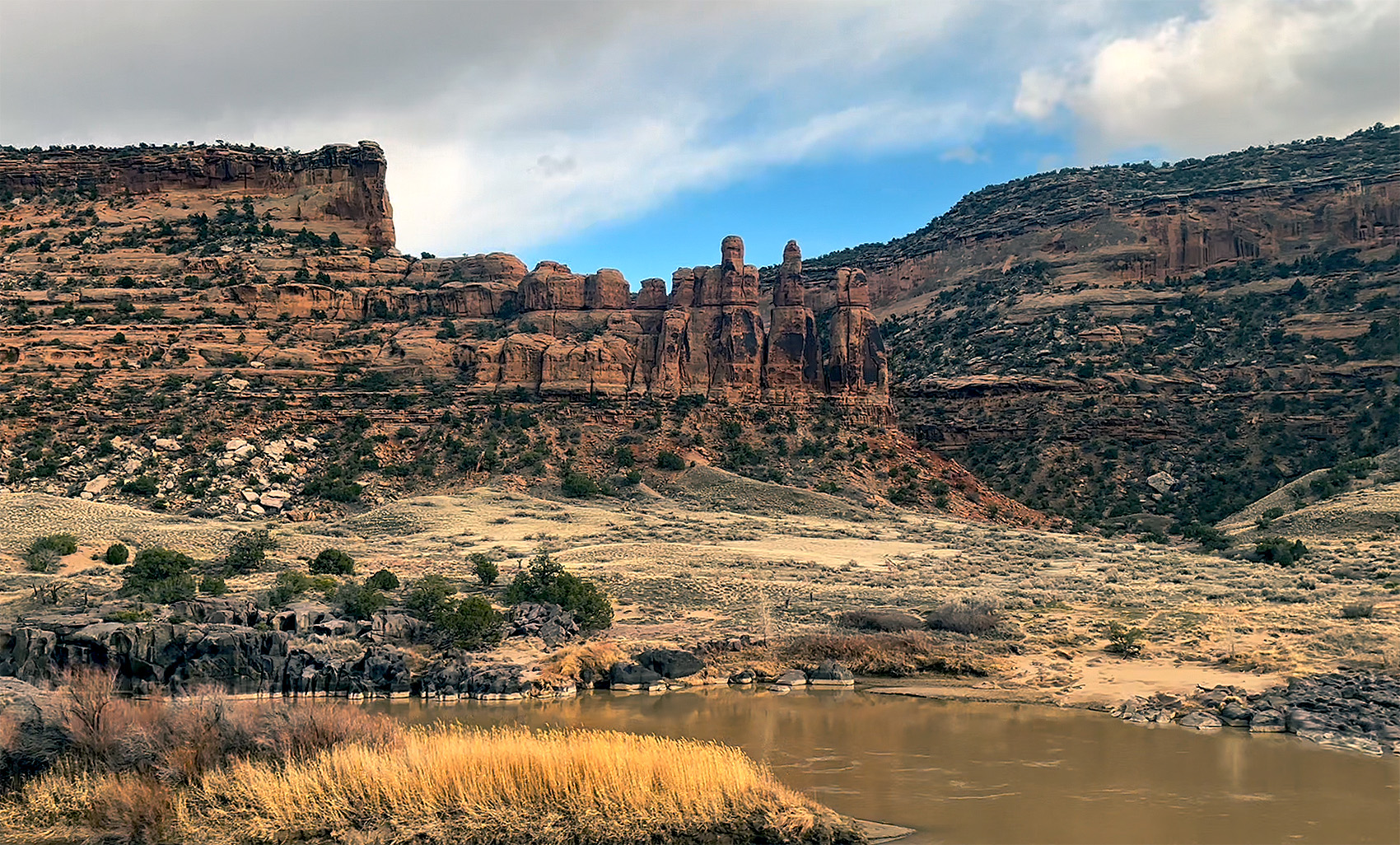
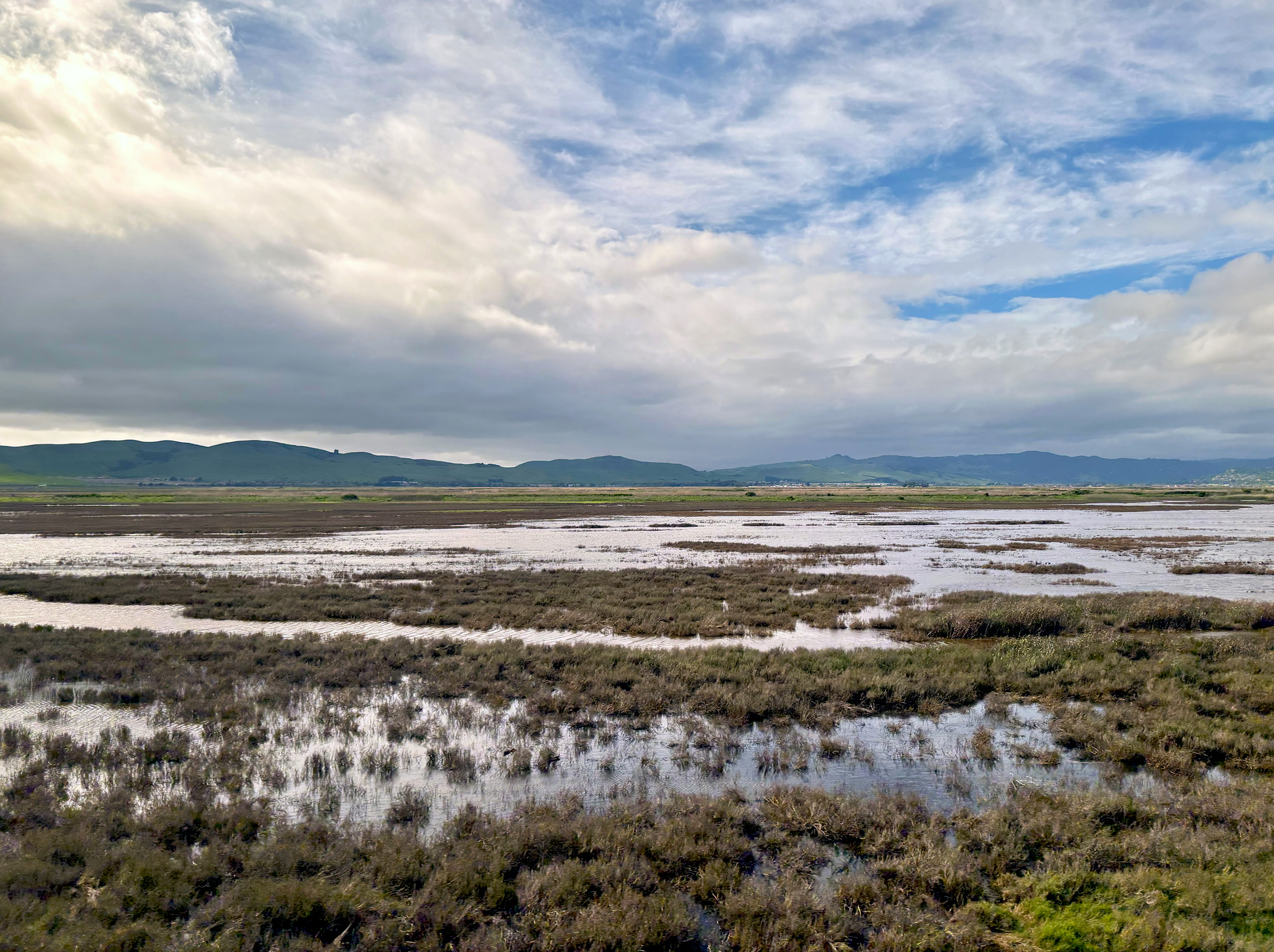
West of Grand Junction, the Zephyr crosses state lines into Utah, tracing the river’s path through breathtaking Ruby Canyon. All of 25-miles (40 km) in length, Ruby Canyon gets its name from the ruby-red sandstone cliffs that flank it. Popular with rafters, the only other access through here is – you guessed it – by train! If the staggering rock formations here look uncannily familiar, it’s because we are only a handful of miles north of Utah’s popular Arches National Park. Ruby Canyon is also the last we’ll see of the mighty Colorado River, as it charts a definitive course southwest. As the landscape opens up, the snow-capped mountains that make up the La Sal Range, a part of the Southern Rockies, now come into view. It’s the very range that frames many a photo taken at the iconic park.
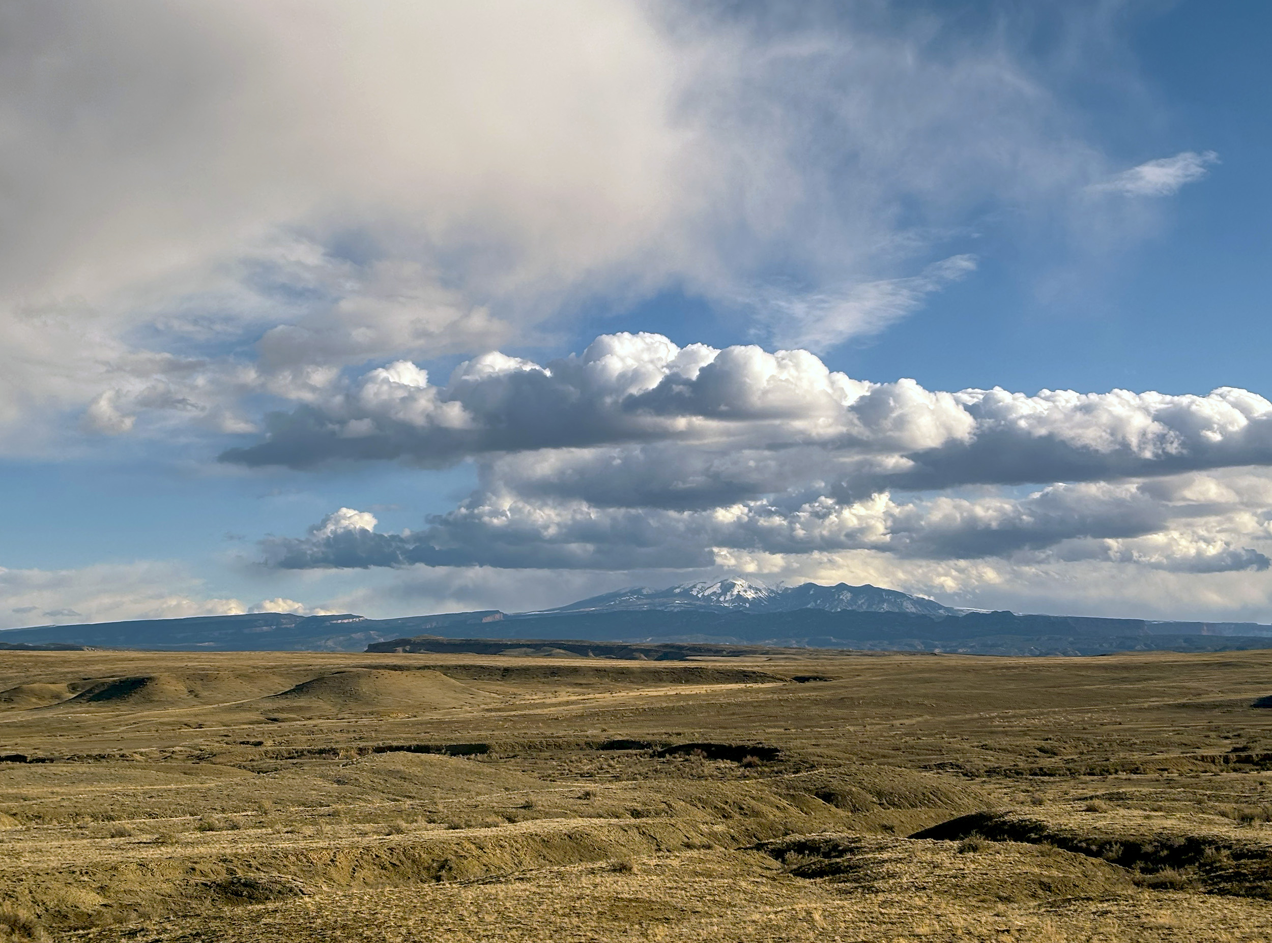
As the late evening light works its magic on Utah’s High Desert, the last seating for dinner is announced. Also known as the Colorado Plateau, the High Desert offers an incredible array of land forms and geological features, and perhaps a top contender amongst them is a series of mountains collectively referred to as Book Cliffs. The buttes here are capped by sandstone bluffs that resemble a shelf of books, earning them their name. The debate tonight is whether this might be the most scenic journey in all of North America. We still have the better part of a day left to decide that, but what we’ve seen so far only points in one direction. Tucking into our entrées as the day winds to an end, we raise a toast to the Zephyr. The State of Utah, meanwhile, continues to serve up a spectacle.
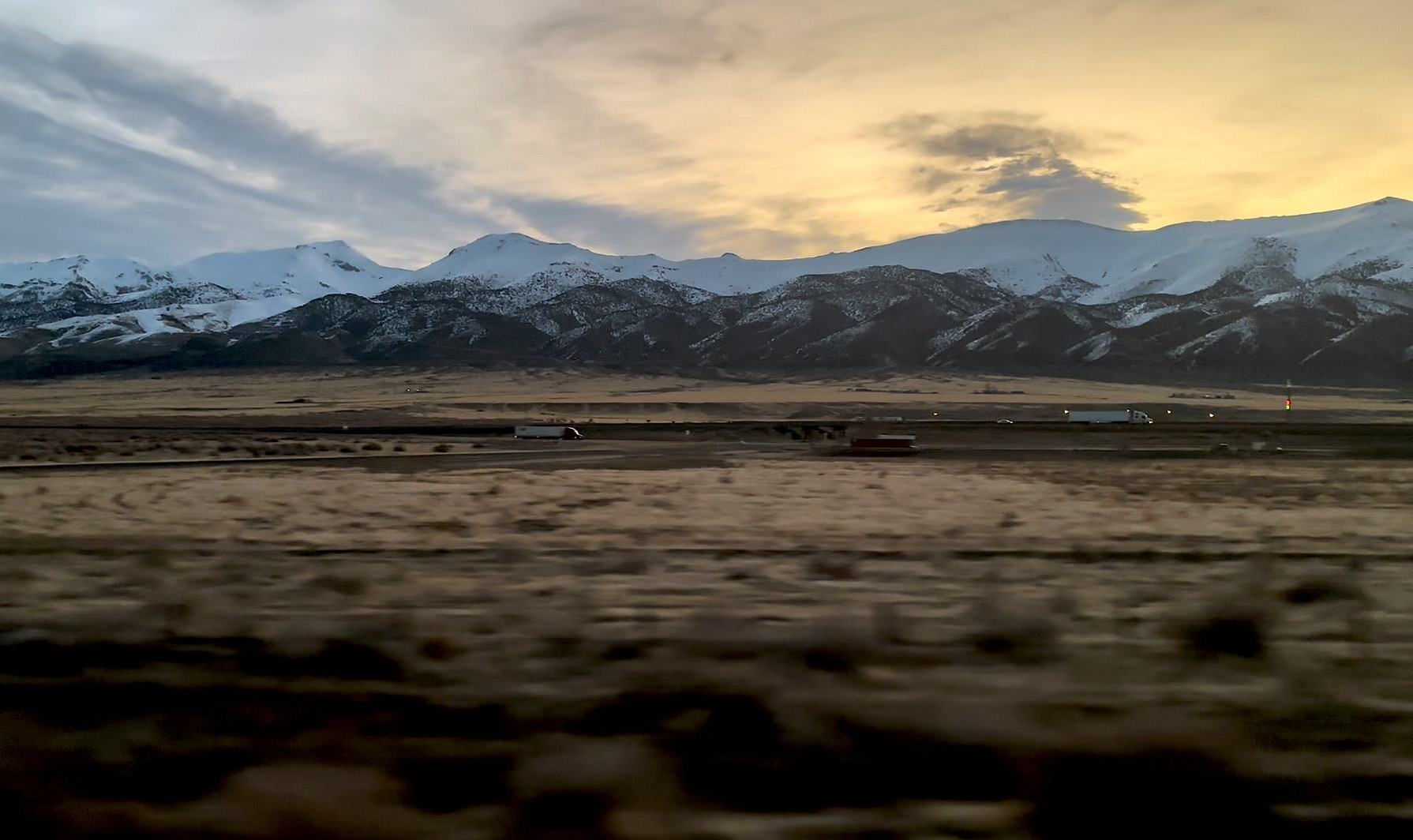
First light reveals a busy Interstate 80, with road and rail charting a course through the Humboldt River Valley. It’s 0530 in the morning, and we’re just east of Winnemucca, in the State of Nevada, having gained an hour overnight. The bed and the ride quality, I have to say, better than I remember it being the last time I did an overnighter on Amtrak. It’s also worth mentioning here that had we been running a few hours late this morning, we would probably be waking up to the Boneville Salt Flats of Western Utah. Oh well, you can’t have it all! Speaking of which, we’re one of the first to show up for breakfast – which is first come, first served – but for some inexplicable reason we are assigned seats (not to our liking, of course) by the Dining Car Manager. We overcome our disappointment somewhat, as freshly brewed coffee and hot scrambled eggs arrive at our table, and to our northwest, the first rays of sunlight paint the Santa Rosa Range of mountains a soothing orange.

Named after a Native American war chief, the little known hamlet of Winnemucca is noteworthy for two reasons. The first of these dates to the turn of the 20th-century when Butch Cassidy’s gang robbed a bank here. More recently, and perhaps more relevant to this journey, the route of the present-day California Zephyr east of here is almost identical to that of its predecessor. Predecessors, I should say. Before 1971 – prior to the founding of Amtrak, that is – a host of competing railroads operated no less than three trains between Chicago and San Francisco; the California Zephyr, the City of San Francisco, and the San Francisco Chief. The current Amtrak version, it can be said, is an amalgamation of those three routes. Covering a distance of 2,438-miles (3,924 km) end to end, it is also Amtrak’s longest daily service.
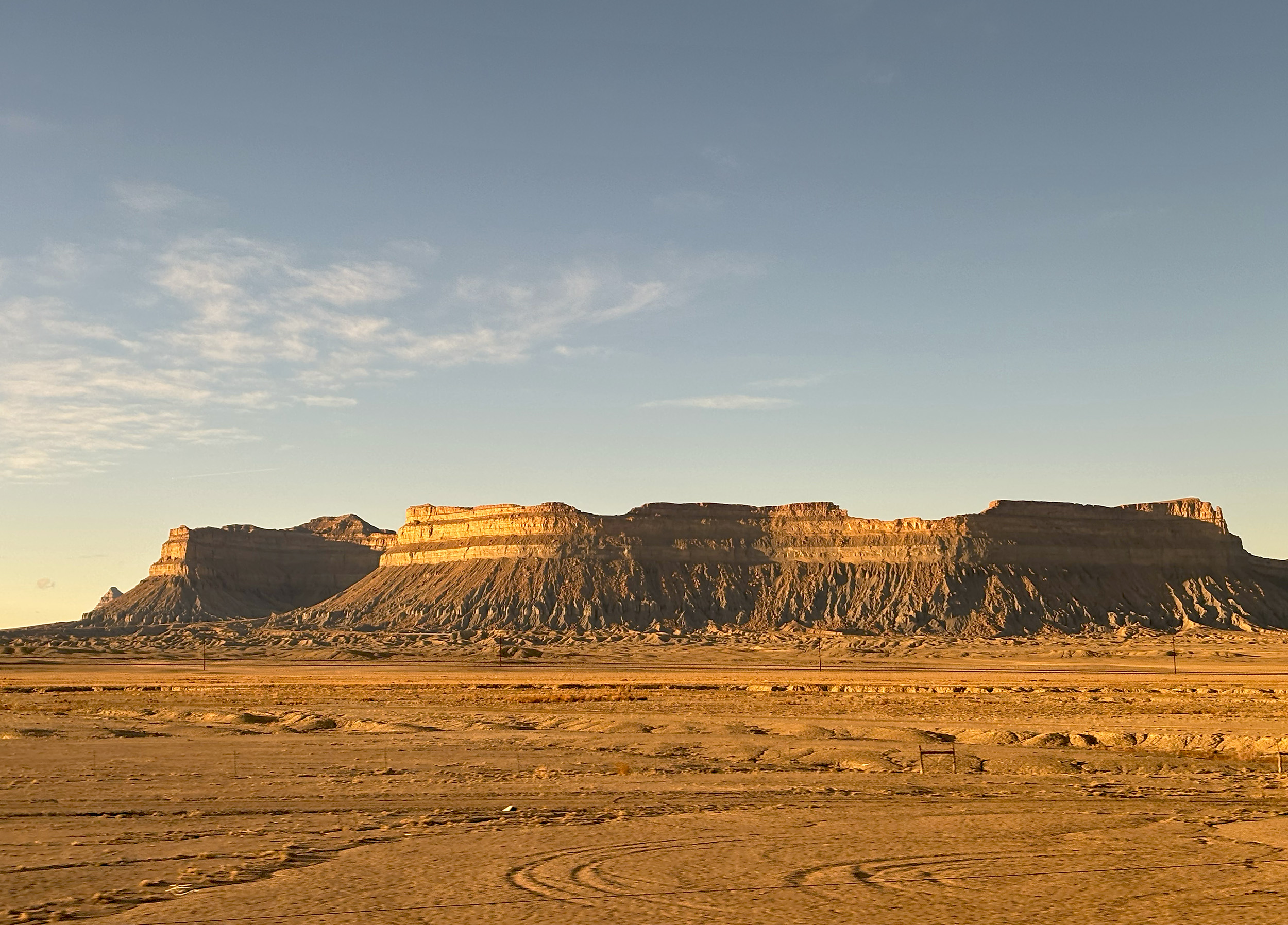
Past the town of Winnemucca, the route of the California Zephyr heads southwest, passing along a dry lakebed known as Humboldt Sink. The area here is also referred to as Forty Mile Desert, a name carried over from the days of the California Gold Rush. Fed by a freshwater source but with no outlet, the sink has been dry for over four decades, giving it the look of a salt flat. So while we might have missed out on the flats at Bonneville, Humboldt Sink fills in just fine.

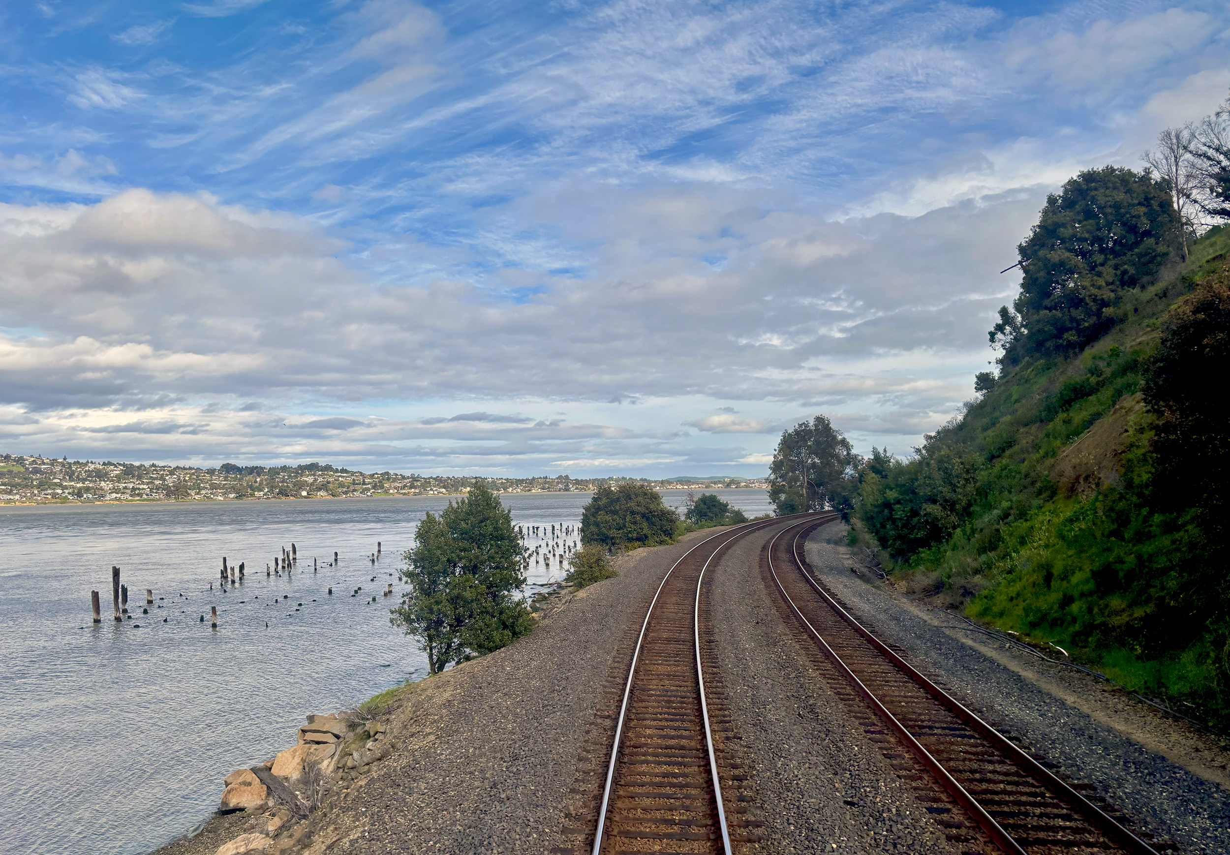
Reno, the third largest city in Nevada, is reached ahead of schedule. There’s plenty of time here to stretch our legs, but the present-day station is an utter disappointment. Built into a trench, it’s emblematic of the kind of poor urban planning that besets many an American city. But we have more pleasant things to look forward to, thankfully. We’ve secured prime seats in the Sightseer Lounge once more, and as we pick up speed west of Reno, the Truckee River comes into view. Flowing between California and Nevada, the river is the only outlet for nearby Lake Tahoe, and the Zephyr’s route, paralleling Interstate 80 here, now makes its way through the Truckee River Valley. In the 30-odd miles between Reno and the town of Truckee, we cross into California, gain 1600-feet (488 m) in elevation, and are back in the midst of a winter wonderland.
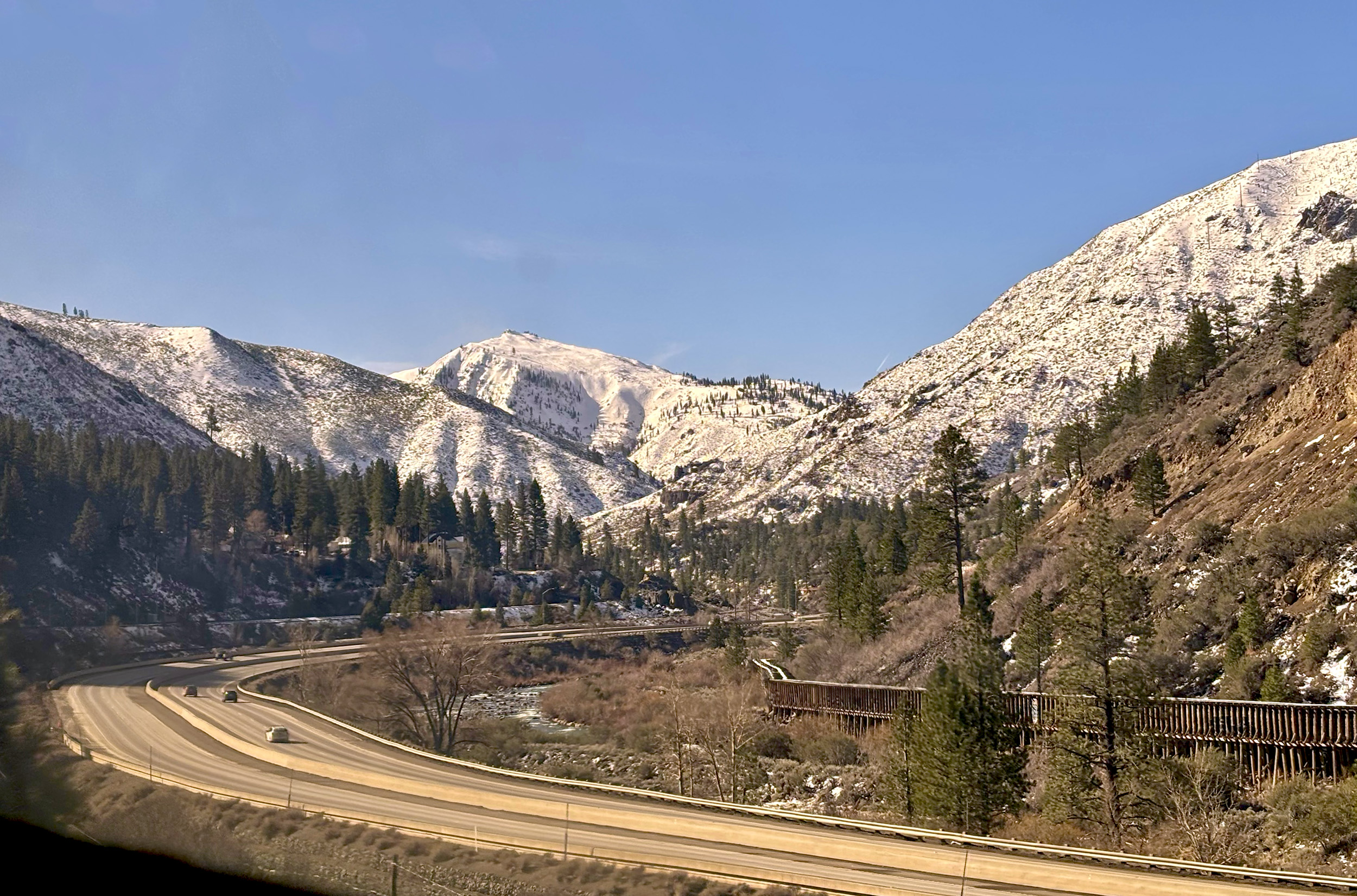
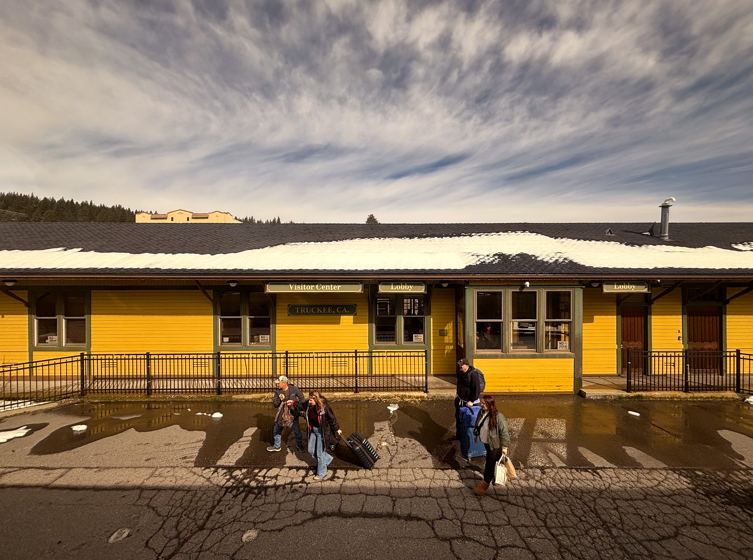
Dating from 1891 and built by the Central Pacific Railroad, the bright little depot at Truckee couldn’t be more different than the one we were just at in Reno. Getting to Truckee was one thing though, but to reach the Pacific from there, the railroad certainly had its work cut out. The earliest settlers from the east were only able to get across the Sierra Nevada in 1844, using what became known as the Donner Pass. The Central Pacific Railroad surmounted that obstacle a little over two decades later, after three continuous years of blasting and drilling the mountain, by hundreds of Chinese workers. A hand-built stone retaining wall – all of 75-feet tall – was one of their many accomplishments, and is now referred to as the Chinese Wall, to commemorate their effort.
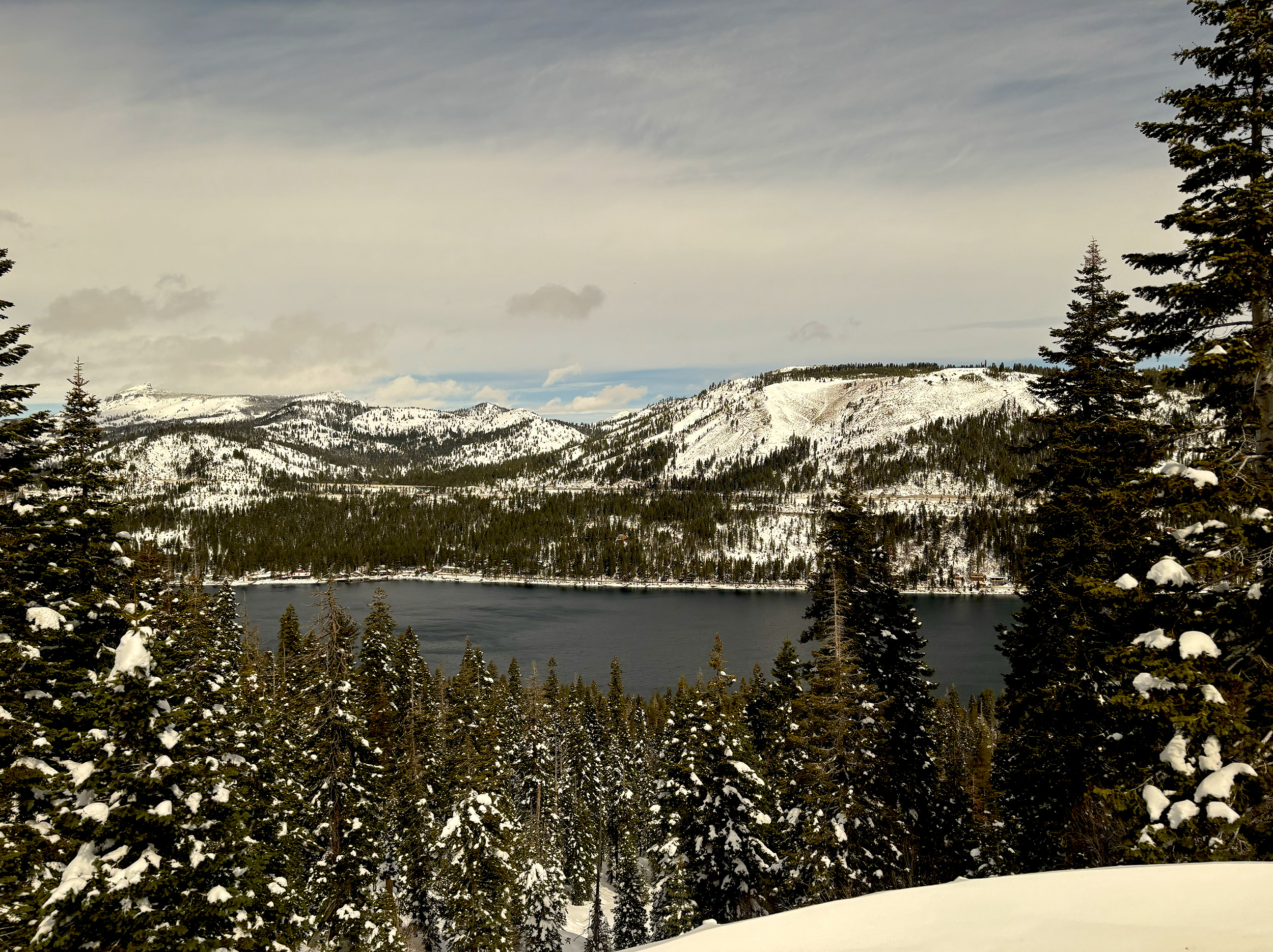
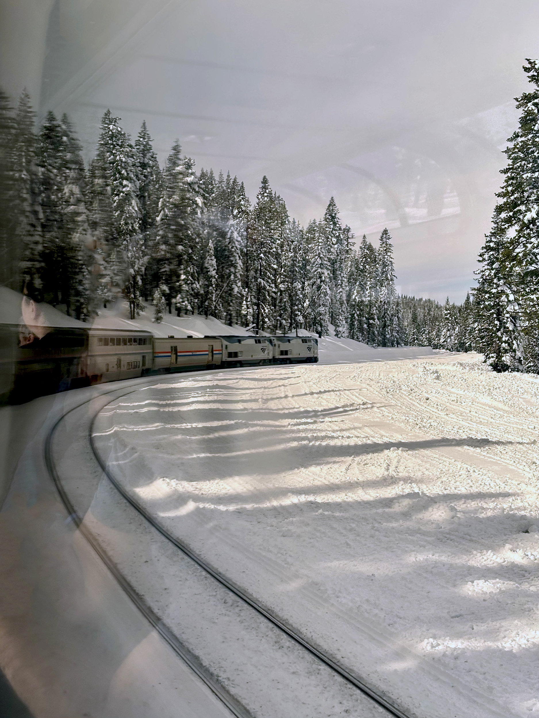
The pass lies nine miles west of Truckee, and in that short distance, the Zephyr climbs a staggering 1,200-feet (360 m). Just shy of the summit (7,056 ft), and in-between several long tunnels, we get a glimpse of magnificent Donner Lake. There are 15 tunnels on the section that makes up Donner Pass, and the Zephyr makes one final push as it approaches Tunnel 41, within which lies the summit. Having cleared that milestone, we’re treated to sweeping views of the majestic Sierra Nevada, in all its wintertime glory. In Spanish, Sierra Nevada roughly translates to “snowy mountains”, and Donner Pass, with an average annual snowfall of over 400-inches, couldn’t exemplify that any better.

Having descended quite a bit, and well clear of the snow line by now, we get a glimpse of Interstate 80 once more, crossing over it by means of the historic Long Ravine Trestle. It’s the very bridge the four of us had photographed the Big Boy on, during our pursuit of it in July last year. It’s lunch time now so we’re back in the Dining Car, and in a turn of fortunes, we get to pick where we’d like to sit! It’s our final meal on the Zephyr, so we ask for an extra helping of their butter cake, an off-menu item that SB is well versed with. Colfax, our next stop, lies in the foothills of the Sierra Nevada and is the first real habitat of note since leaving Truckee. We pull in early to Sacramento, the Capital of California, and the last of the smoke stops on the Zephyr’s westbound run. For me, it’s familiar territory from here on, having done the route west of Sacramento, on the Coast Starlight a few years ago. Only this time, California’s Central Valley – looking absolutely lush – is barely recognizable, and further west, at our station stop of Martinez, spring has certainly sprung! Did we just go through three distinct seasons?

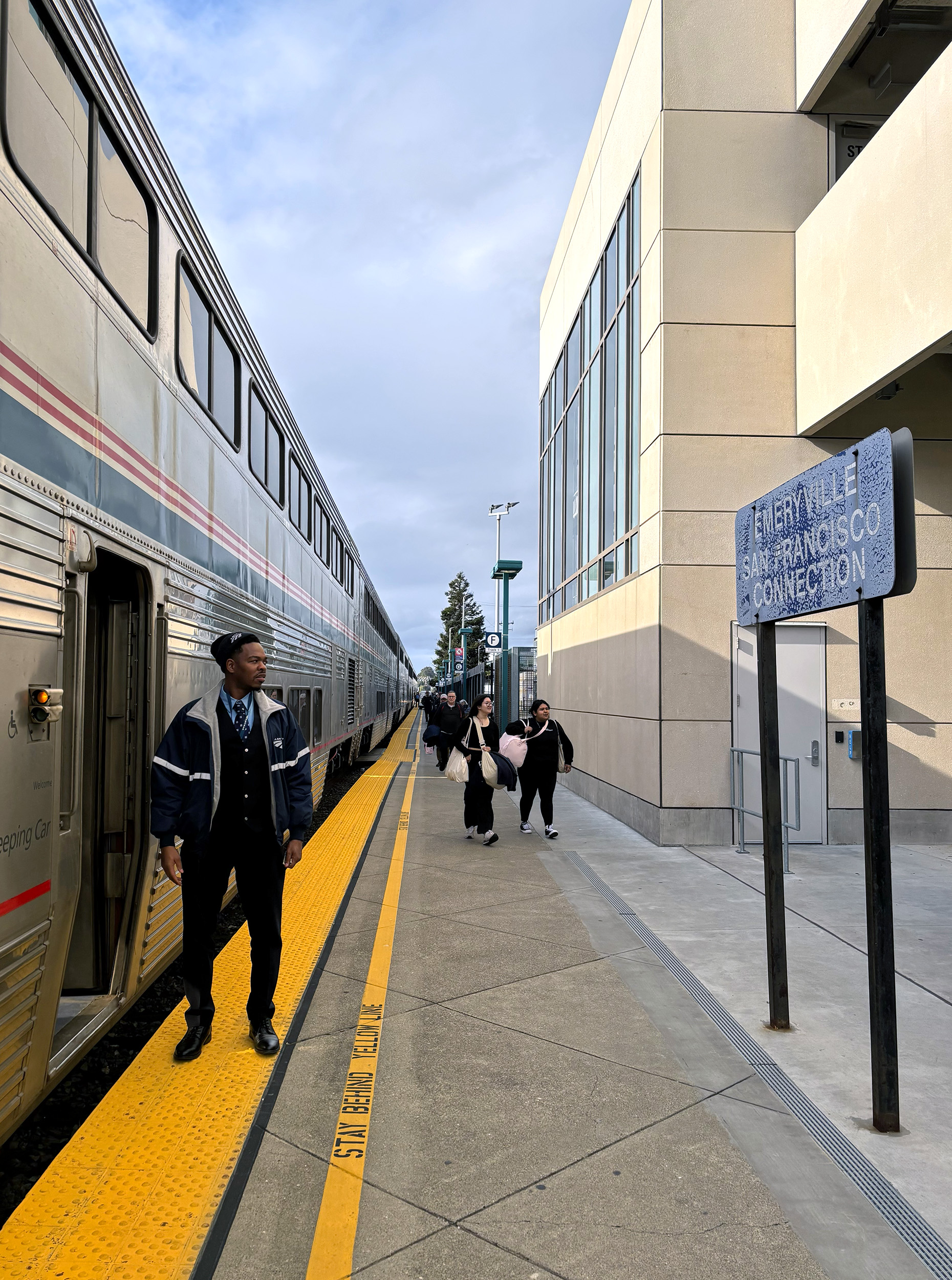
Past Martinez, the route of the Zephyr hugs San Pablo Bay all the way to Richmond, making for a truly scenic last stretch of the journey. Arrival at Emeryville is a full six-minutes early, mighty impressive given the sheer distance our train has covered, and Amtrak’s rather dismal reputation at timekeeping. Emeryville Station, while perfectly utilitarian, is as far a cry from Denver’s Union Station as one can possibly imagine. It’s the underwhelming end to an otherwise spectacular journey. A train ride with few parallels in North America, the four of us finally agree. The jewel in Amtrak’s crown.
A full set of photos from Denver, and our journey on the California Zephyr, can be seen on my Flickr.
