
Welcome to my first blog ever! Hopefully there will be more 🙂 Thought I’d start one after all since I end up sending out mails with photo attachments and accompanying captions. Sometimes this does get painful – not only for me but also for those viewing it am sure. So here’s where I hope to give everyone a chance – to decide for themselves whether or not they’d like to go through the monotony all over again..
Meet Ashwin – 29, single(?), banker based in nyc. Ashwin’s sister Shivani and I were in college together and that’s how I know him. I leave home a little later than planned (what’s new?) and hope that Ashwin gets to Fungwah before me and more importantly with enough time to secure seats on the 7 pm departure for Boston. He doesn’t disappoint. ‘Good going Ashwin’ I think to myself as I see him waving frantically at me from his perch inside the bus. The bus leaves 15 minutes earlier for some reason and apart from an F1 like turn somewhere in Brooklyn its a fairly uneventful ride (by Fungwah standards) to Boston south station which is reached only a little later than scheduled (again by Fungwah standards) at 10 past 11 at night.
Meet Bhavjit er sorry make that Dr.Bhavjit Ghumman (PHd), polymer engineer based somewhere in Mass. Makes for good matrimonial column stuff no doubt! Although he’s supposed to pick us up from south stn, he awakes only at around the time of our arrival so comes up with an ingenious plan to pick us up from north station instead. No big deal we think – that’s only another 30 minutes and 2 train rides away from us – exhausted as we might be!! At midnight we pull out of Boston for what’s going to be a 3 and a half hour drive to Gorham, New Hampshire (NH). Uneventful yet again except for NH cops pulling us over at the respectable hour of 0215 am for doing 75 quite blissfully on a 55 mph zone. Bhavjit gets away shaken but not stirred (read no ticket!) We crash for 4 hours at this overpriced Mt.Madison Motel in Gorham town..
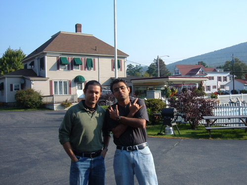
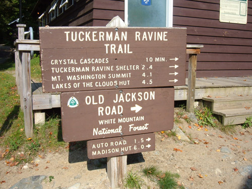
And last but not the least meet my uncle (henceforth Chacha) double PhD and more importantly (for what we were about to attempt) 2 time Boston Marathon runner. Quick bite at Dunkin Donuts later and we’re at Pinkham Notch which at 1600 ft is the base for our ascent up to Mt.Washington which stands tall at 6300 ft making it the highest in the US Northeast.

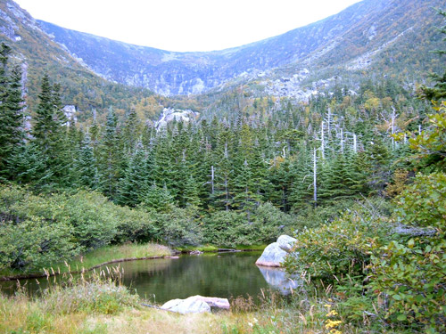
That’s the summit you can see on top and at this point it looks like a fine day so the experienced climbers that we are (yeah right!) we decide on taking the toughest of the trails going up – the Tuckerman Ravine Trail which is 4.2 miles long and will take us up 4700 ft.
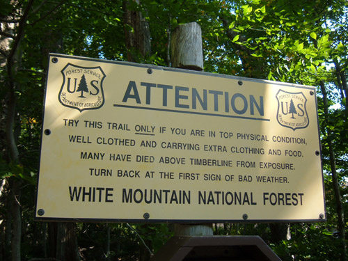
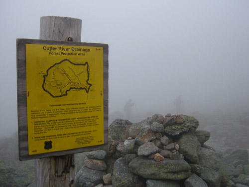
And needless to say signs such as this don’t seem to deter us at all.. Of course the statistics only appear at the very end – 136 deaths on the presidential range so far – the most recent of them occurring on August the 4th this year!
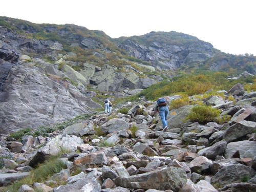
And so the hike begins..Chacha takes the lead with Bhavjit keeping company and Ashwin shuttles between them and me. Needless to say, I bring up the tail. The configuration from my point of view normally looks something like this..
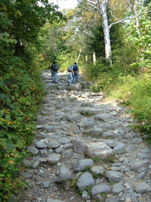
As you can see the trail still seems very manageable – an incline for sure but relatively flat and paved for what we were about to encounter ahead. Soon enough we run into our friend the Moose..
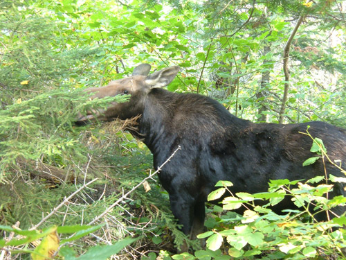
After having our fill of photographing it, we climb some more only to come to rest halt no.2
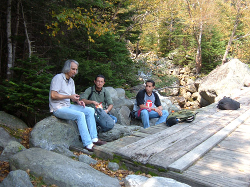
A little over 90 minutes into our climb we reach the half way point. Dark clouds begin to appear above us and seem to envelop the summit in no time. AMC volunteers advise us to consider turning back if the weather gets any worse. We decide to prod on regardless and pose with a defiant smile for a group photo. Our physical condition tells a different story though – mine for sure.
As we trudge on, the changing landscape warms our heart. In a matter of time We will be above the tree line. AMC has some camper’s huts very close to this point. Highly recommended on our next trip here – if we ever make it again i.e.
The terrain has changed quite dramatically by now and the trail or the lack of it thereof is now made up of rocks and boulders. The incline has increased and so has the distance between the front runners and me.

The temperatures have fallen quite a bit to and its now time to add on more layers. The average temperature difference between the base and the summit is as much as 20C or 40F. It gets worse as the winds kick in higher up and that coupled with the sweat from the first half of the climb is a sure shot recipe for hypothermia. A little rain would only add to our woes at this stage! That said, its always very gratifying to look back from time to time and gloat over the distance covered. Those little roofs you see in the distance are the half way point we’ve left far far behind!

As we leave behind the half way point we come up to the stage where the tree line starts receding and its all rock and boulder territory from here on. Don’t miss the waterfalls on the hill side.

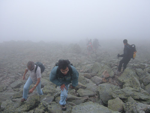
The climb gets really tough at this stage and this image should give you all a fair idea of just how tough it gets in the second half of our trail. Bhavjit and Chacha leading, Ashwin catching up and me – as usual – coming in last! Notice the yellowish markings on one of those rocks – that’s about the only sign you have that you’re on the right trail.
And soon enough we take another break. I think what made this climb work for us is that although we took our share of breaks we kept these to no more than about 5 minutes each – else we would have just lost all momentum.
It was times like these that we wished we had paid heed to our friendly AMC volunteer’s weather warnings.. Its all over we thought!

The last reaches of flora on our ascent provided great variety and a riot of colour.

With about a kilometre left to do, the wind had really picked up at this stage and we were soon going to be walking amongst the clouds – an exciting thought at first but painful when your doing a trek as tough as this one.
We wondered what it would be like on the descent since just by looking around it appeared we were lacking in the right kind of equipment or accessories – most notably a walking stick for want of a more appropriate term.
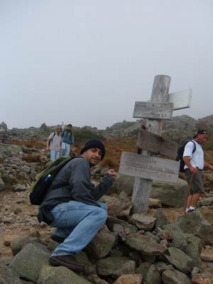
At 1:15 pm, 3 hrs and 35 mins after our start at Pinkham Notch, we were finally there – on the summit of Mt.Washington.
We were almost immediately greeted by a barrage of Harley cruisers on their way down the auto road.

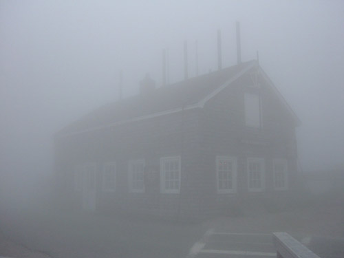
The fog was thick as you can well make out and the summit is known to remain under fog for 304 days of the year. On a clear day one can actually look out to 3 states of the US Northeast, the province of Quebec in Canada and the Atlantic Ocean! The mountain is known for rapidly changing weather conditions and at this very building was recorded the highest wind speed in the world – 231 mph. We got away relatively cheap with only 25-35 mph winds on that day!
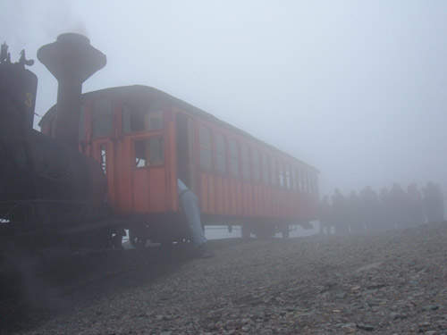
Of course wherever I go, the railway can never be to far behind! Apart from being reached by an auto road and several hiking trails, the summit of Mt.Washington is also reached by the world’s first (or so they claim) cog railway which dates back to 1866. Much to my delight it is still steam operated and we could hear the whistle on the other side of the mountain as we made our ascent up. The tickets are almost as steep as the incline itself and at 42 bucks a pop for a one way ride (ok so its 57 for a return!) I had to give that a miss this once. For all you railway buffs reading this and for anyone else interested, have a look at www.thecog.com for more pics and info. Trust me, it is steep – the incline i.e. 🙂
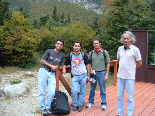
That’s us on successful completion of our mission in the warm confines of the visitor centre on top – much food and drink later but looking shattered never the less!

Yup, no trekking down for us – not because we couldn’t (yeah right!) but because it started raining quite heavily and the ranger advised us not to make the descent as the rocks would be slick and unsafe. So we piled into another rip off in the form of a 26 buck shuttle van ticket for a 25 minute ride down to the base.

That’s how much weather conditions and foliage can change within 15 minutes of our descent from the summit.

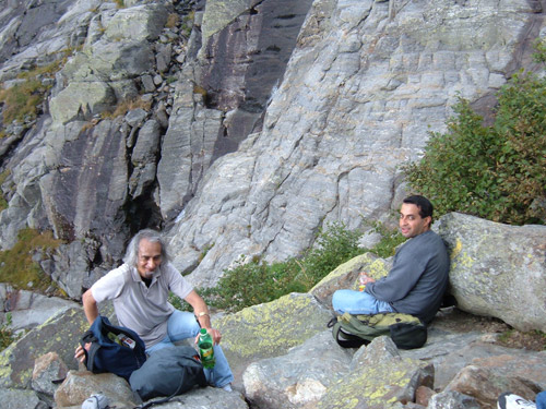
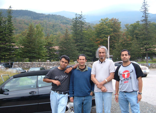
Back at Pinkham Notch and we readied for our long drive back but not without a last group photograph! If you compare pic no.2 with this one you will notice that the summit is now clouded over as against the clear views we had earlier.
We were all set to take the Kankamangus Scenic Highway back but a thunderstorm appeared out of nowhere! Scary clouds those!

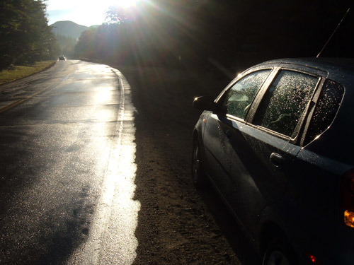
It was gone almost as fast as it came and the sun shone brightly on us for one last time that day. I don’t know how much justice this photo does to the moment but think golden hour, water evaporating from the road, early fall foliage, rainbow on the horizon and an ‘almost looking photoshoped’ blue sky!!
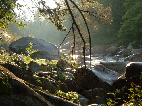
And at this very point we ventured down to see an equally beautiful evening sun cast its magic on the Swift river.
So you’ve figured out the mountain and the moose by now. The Mocassin Man? Well, my Chacha went up the mountain wearing old moccasins! Bhavjit adds: “He wanted to go up barefoot, but we insisted..”
Happy climbing! 🙂

I follow your posts for quite a long time and must tell that your posts are always valuable to readers.