
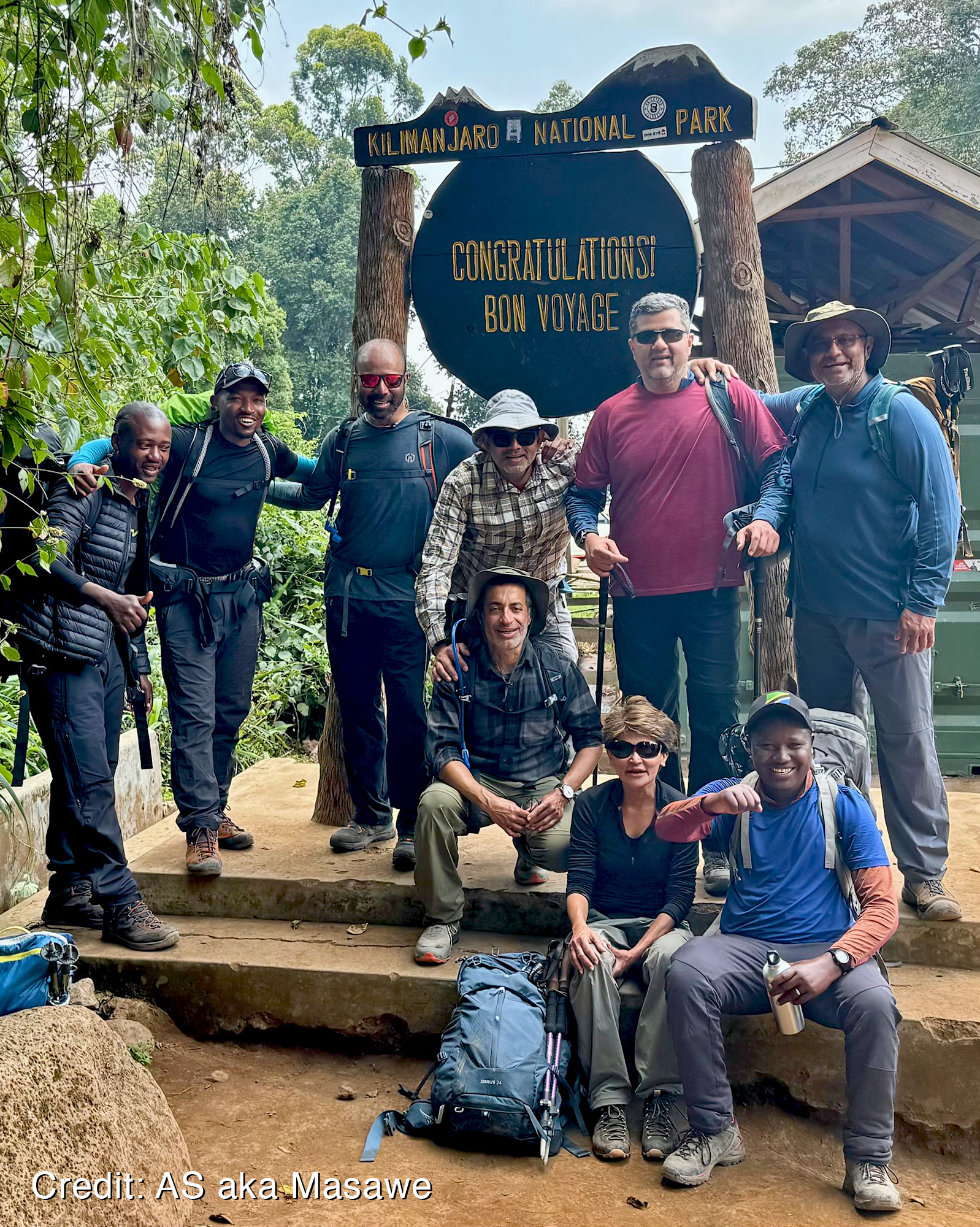
In the first half of October ’24, six of us friends took a giant leap of faith by attempting to summit Mount Kilimanjaro. What follows is a day by day account of our trek, which for many of us was the climb of a lifetime.
Asante Sana to guides Michael, Vincent, and Pascal. To the cooks, servers and the innumerable porters, who’s names we never even got to know. Without every single one of you, we could never have done it.
In memory of my Sister. A tribute to my maternal Grandfather.
Day 1: Machame Gate to Machame Camp
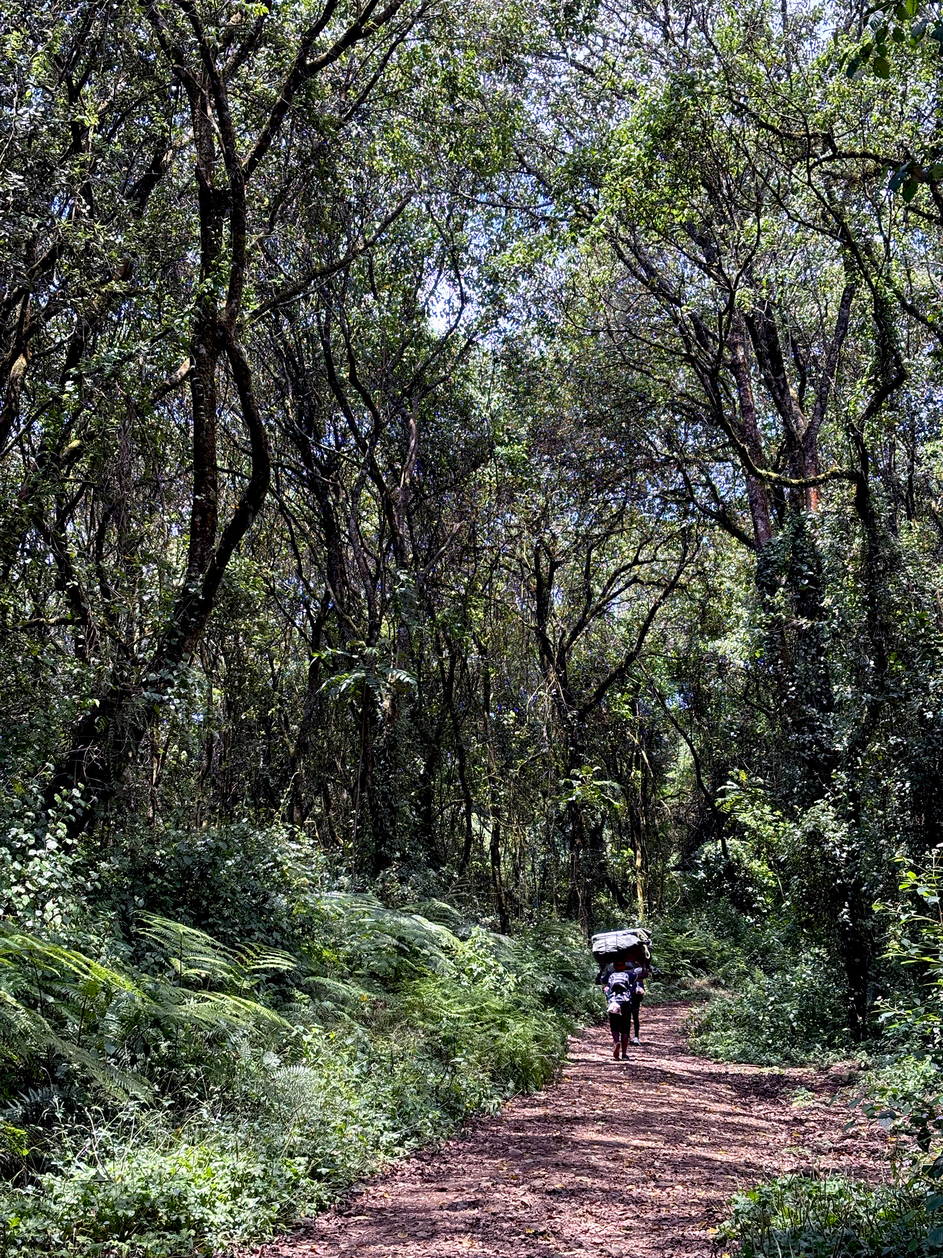
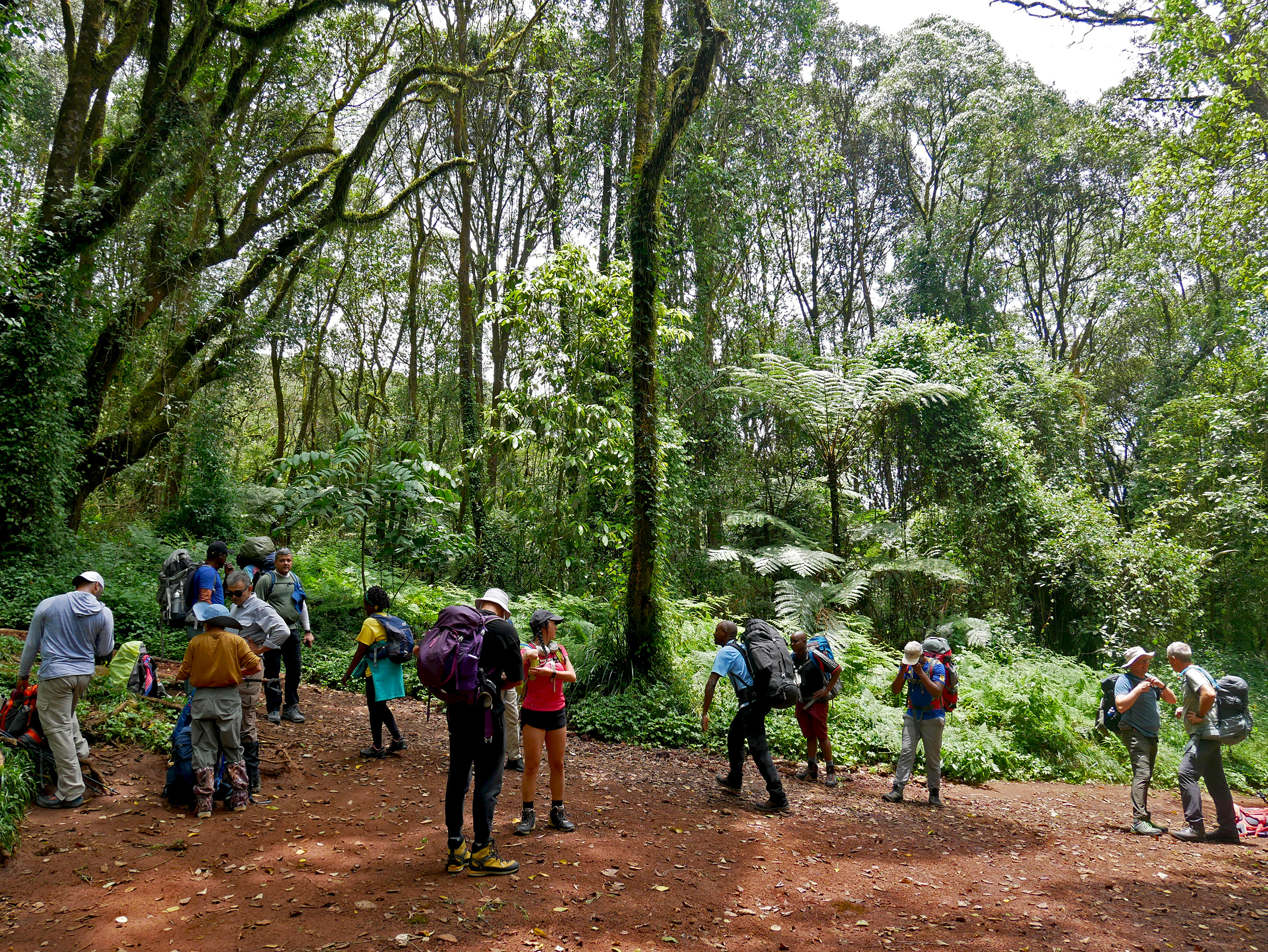
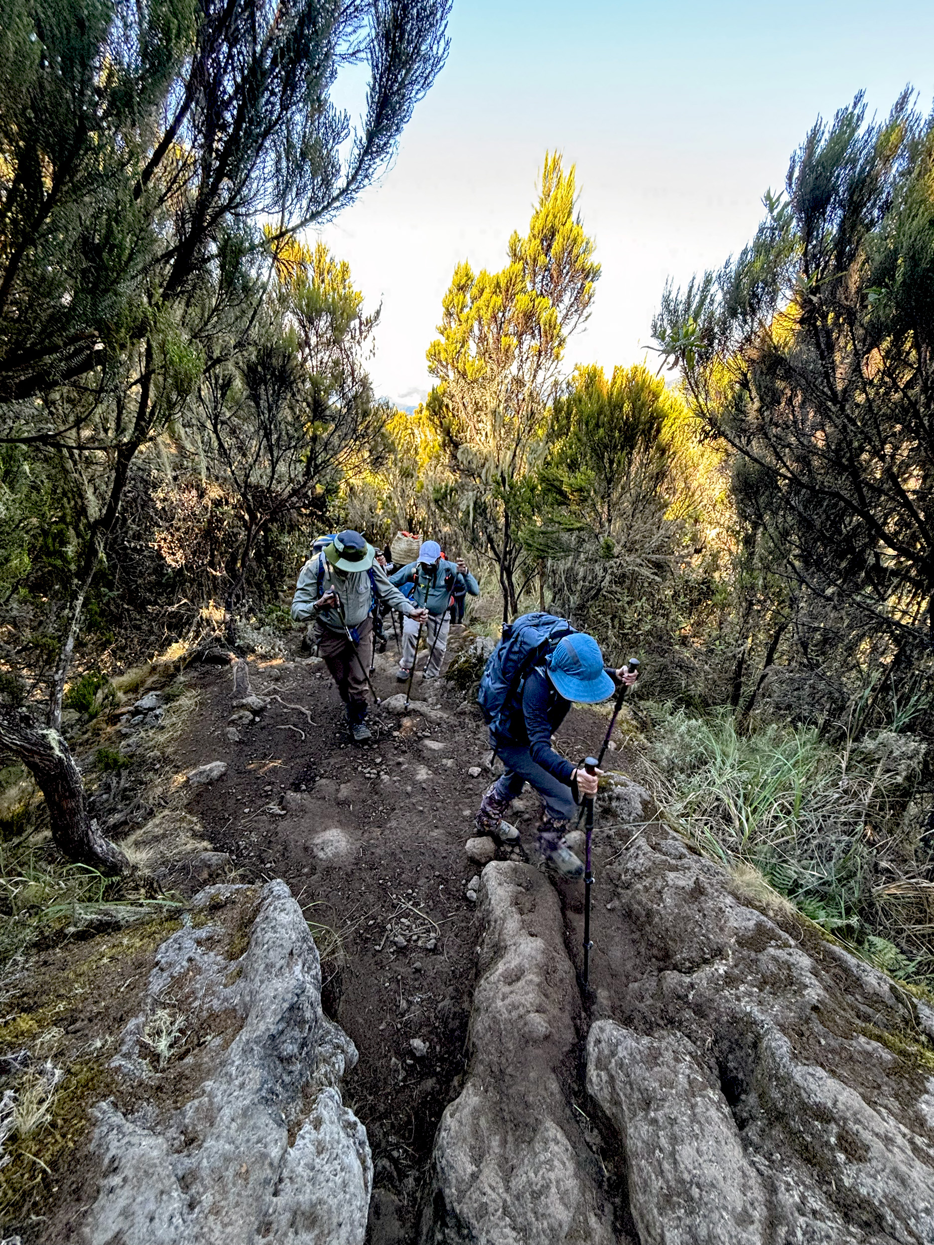
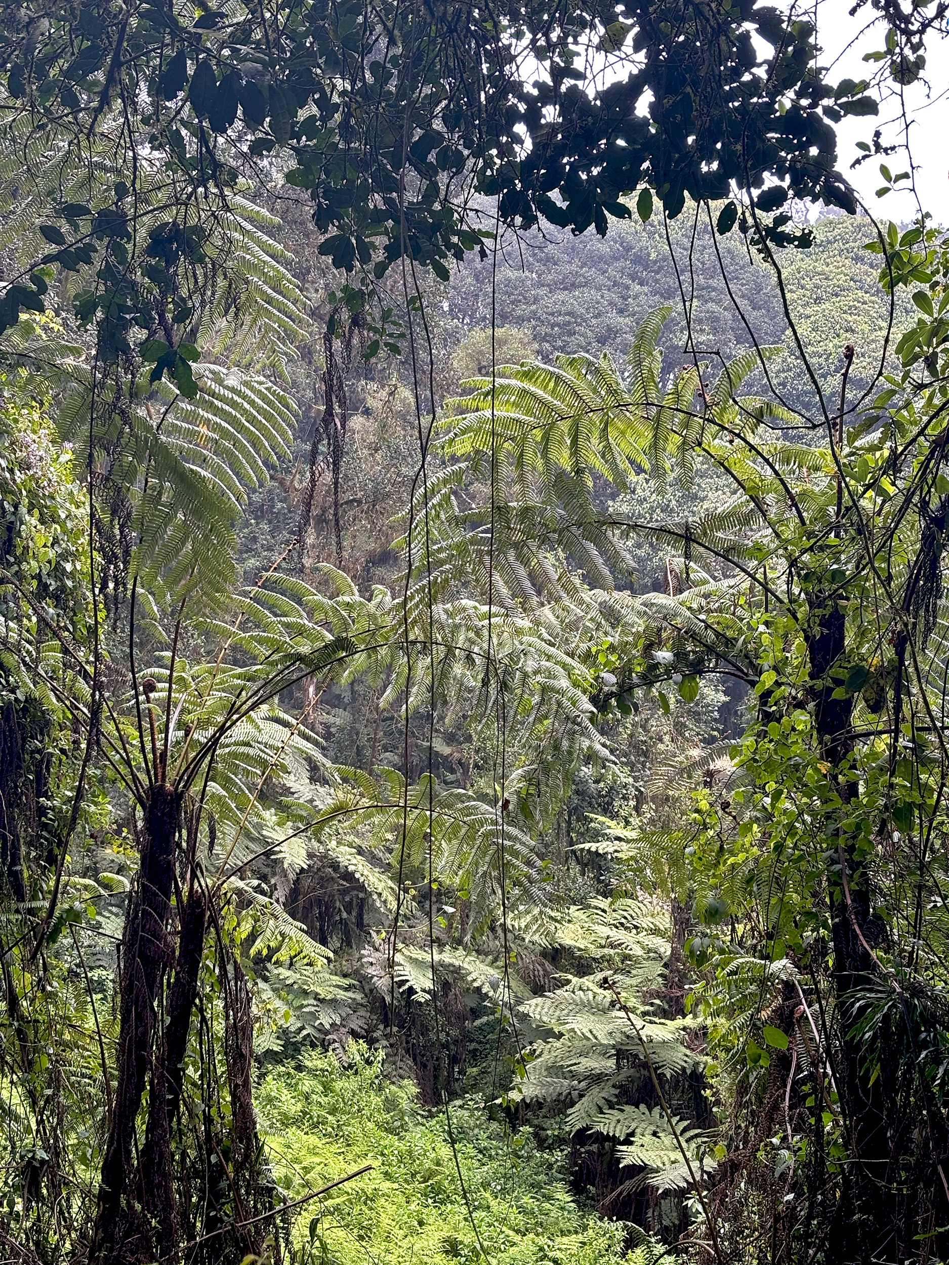
Twende Twende, Michael exclaims. We’ll pick up more than a smattering of Swahili by the end of our trek, but for now this is an important one. It’s our guide’s way of urging us to get a move on. It’s 1130 am local time and as we begin our hike, we leave the relative comforts of Machame Gate (5900 ft / 1800 m) behind. Ahead of us lies a magical canopy of ferns, lichens and clinging mosses; giant Camphorwood trees, and the occasional sighting of a Colobus Monkey. Through it all, seven grueling miles of a relentless uphill ascent. The Rainforest is the first of four distinct ecosystems we will experience over the course of our climb, and as beautiful as it is, we can hardly do it any justice; focussing instead on the drudgery of the first day’s incline, and the hours of walking that lie ahead. A break for lunch couldn’t be more welcome.
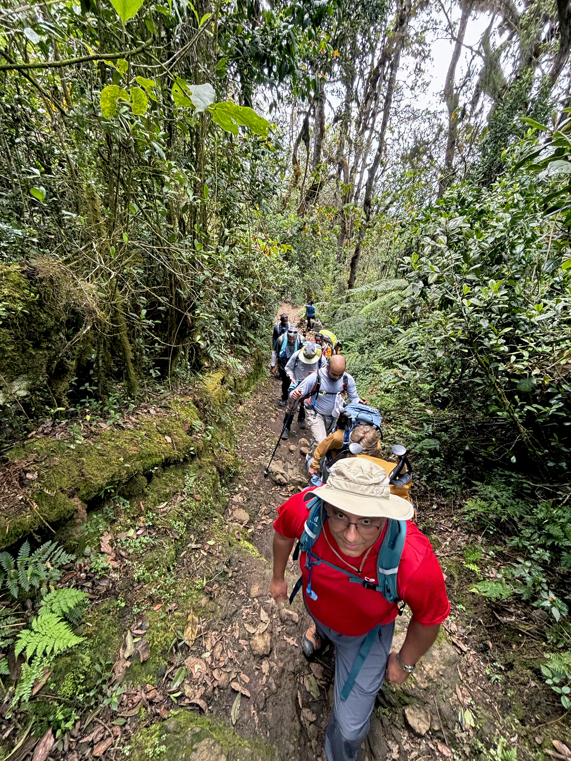
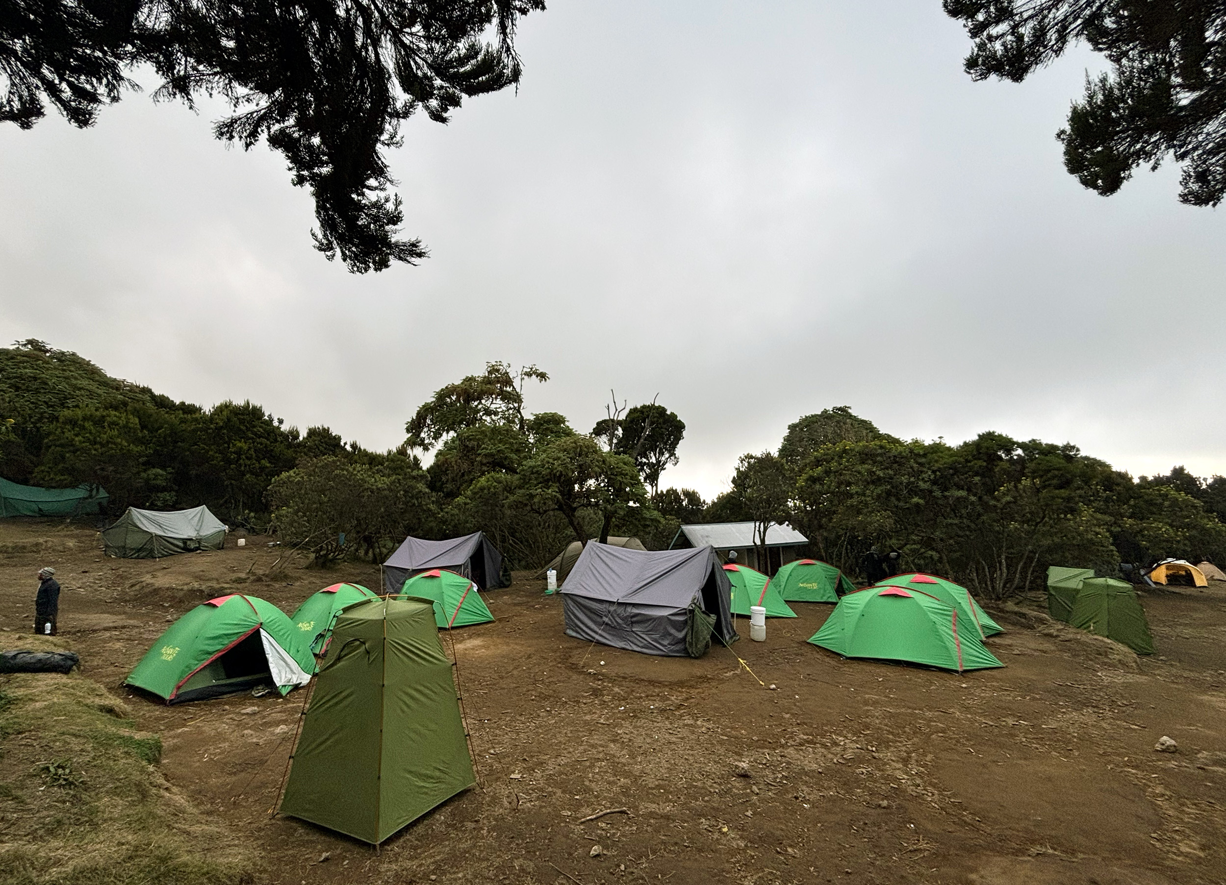
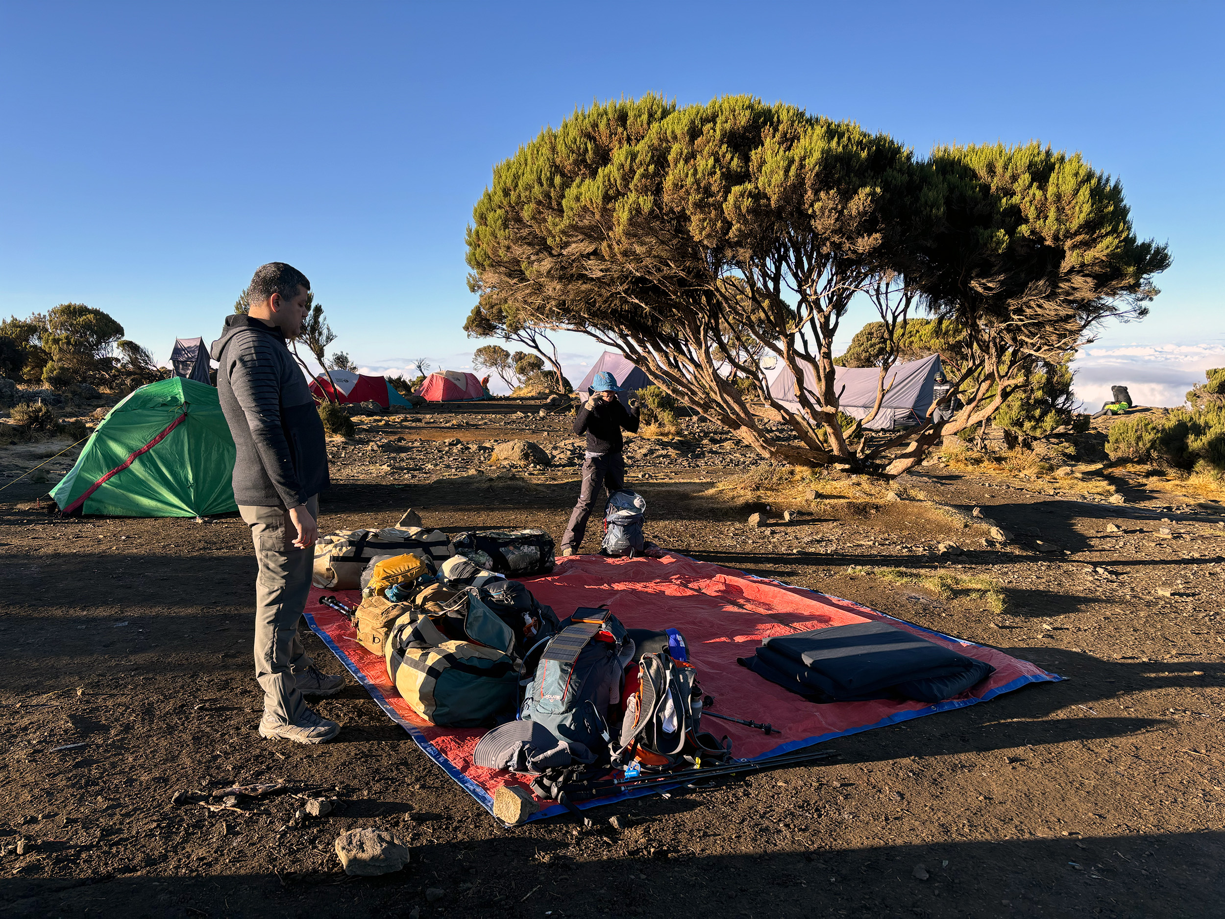
Today’s lunch is a packed one that we carried with us, but every other meal on the trek will be freshly prepared. A real luxury that. Five and a half hours after leaving Machame Gate, and with almost 3500-feet gained in elevation, we arrive rather beat at Machame Camp (9300 ft / 2835 m). Our campsite is already set up, and the six of us are perplexed as to when our porters might have overtaken us. Were we that slow? This would be a recurring theme every day, no doubt.
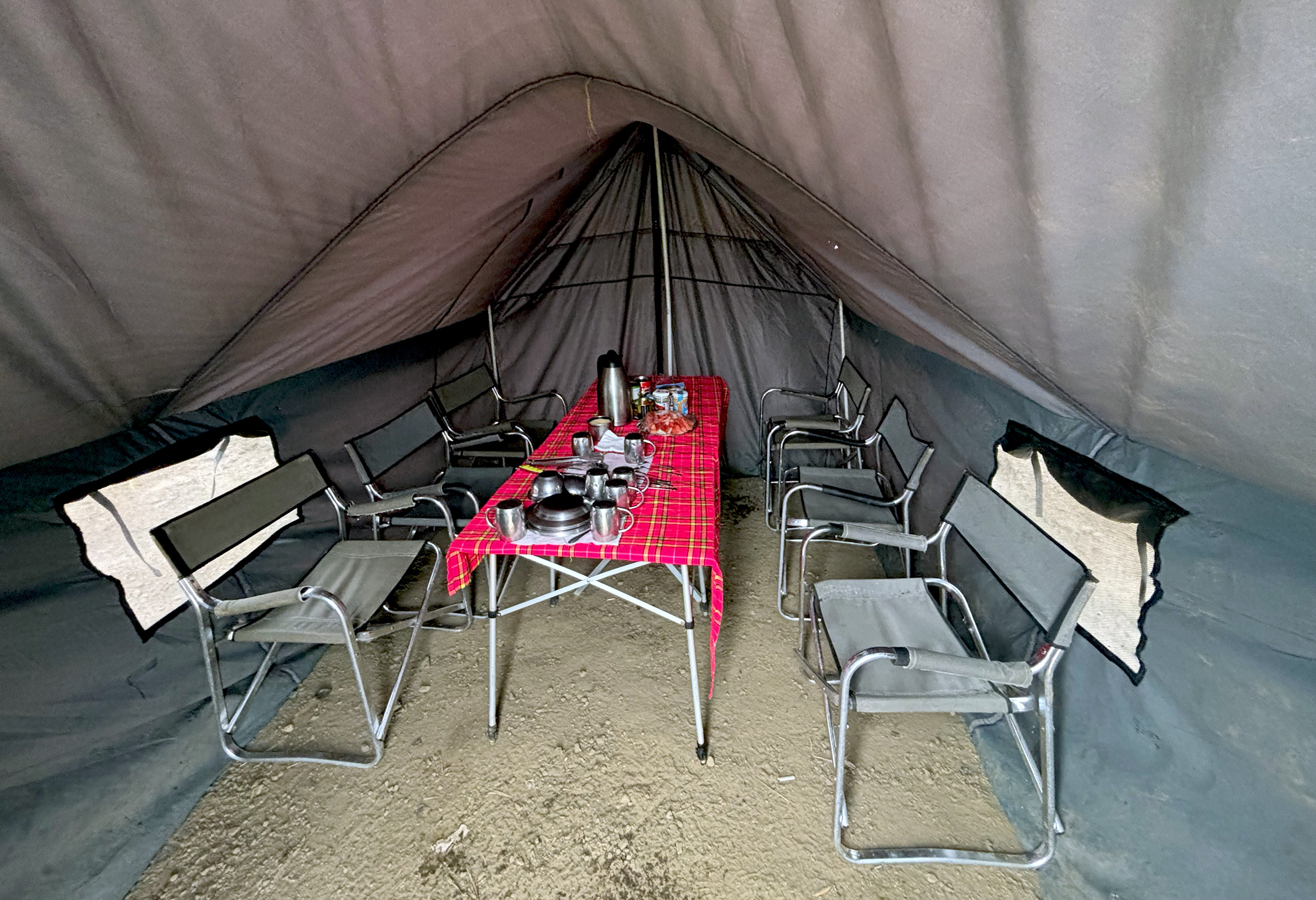
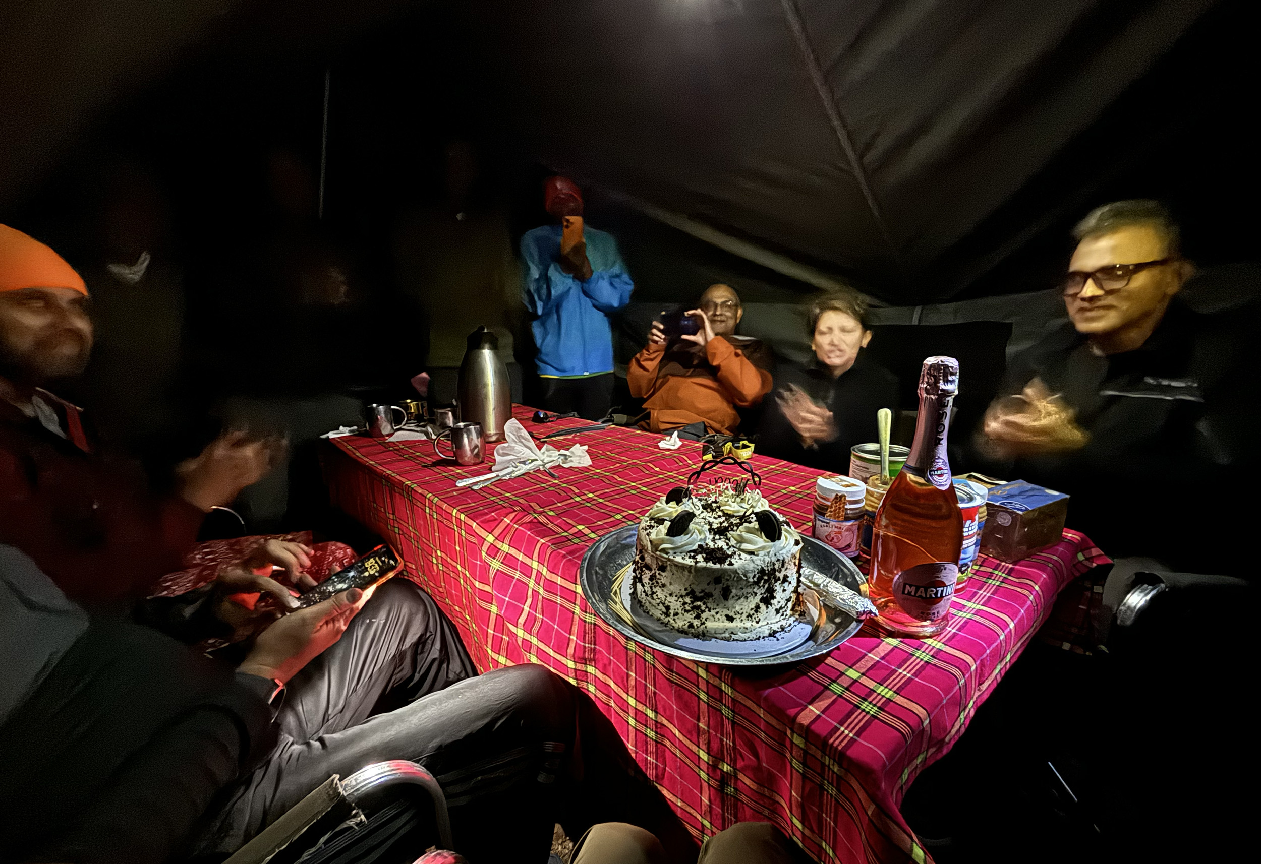
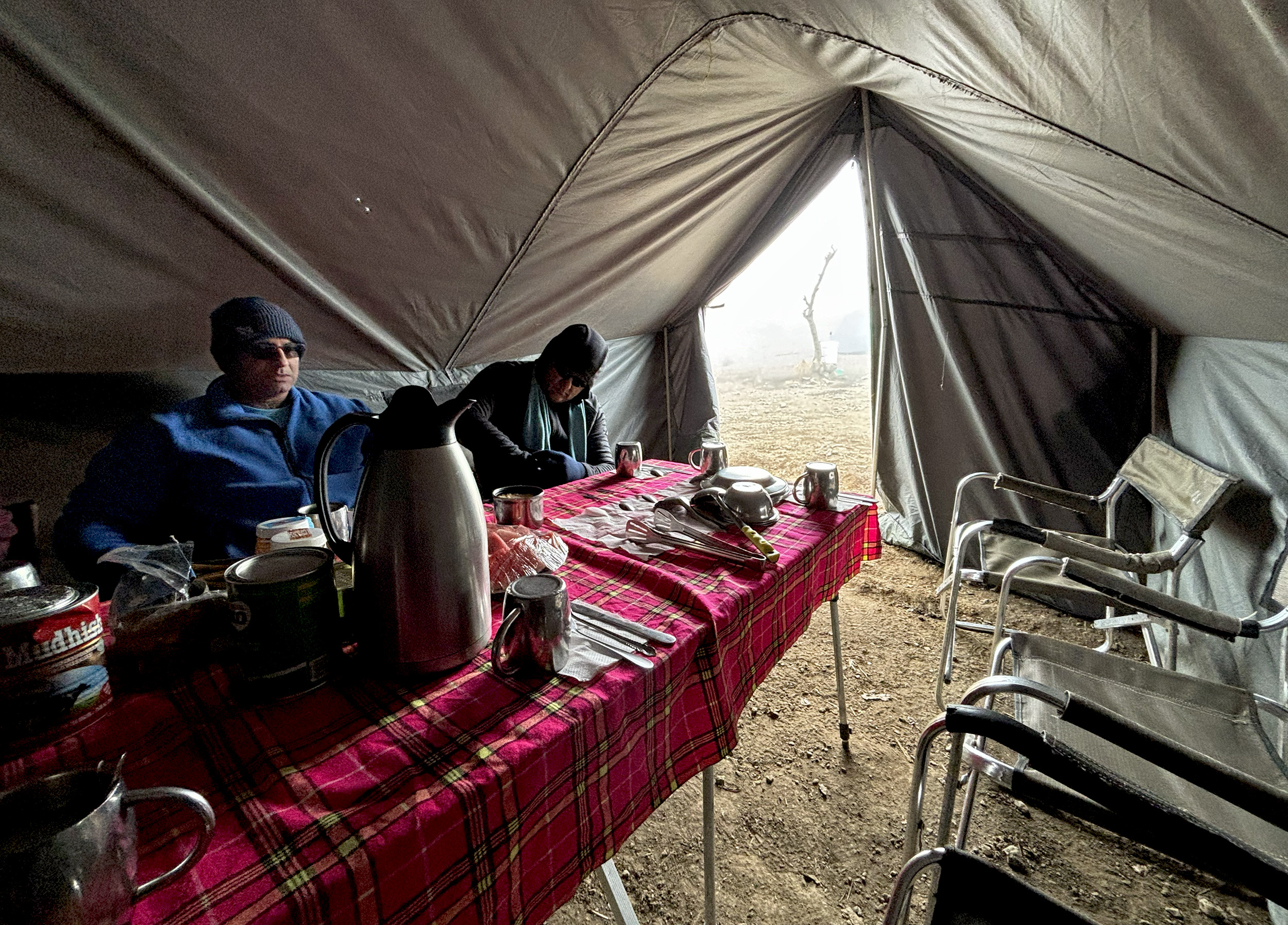
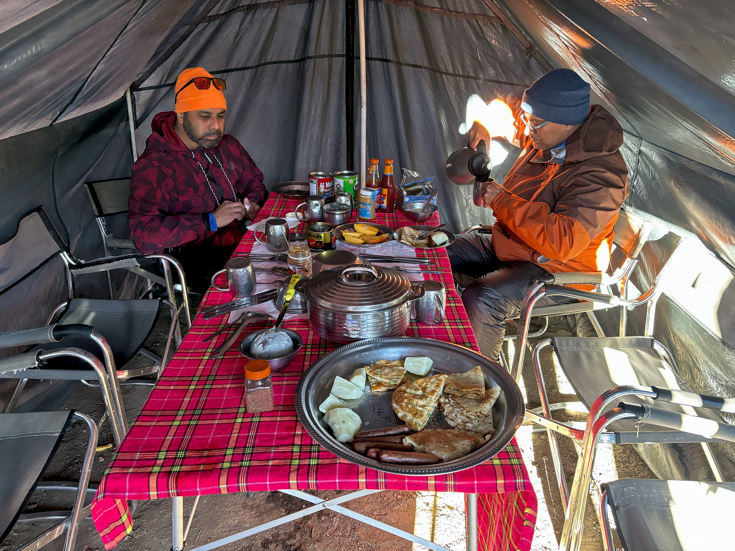
Evening tea is accompanied by biscuits and popcorn, and not long after, Musa, our server, announces dinner. Pumpkin soup to begin with, followed by grilled beef and pasta, and some aloo pakoras for good measure. What a treat! And then, just when I’d entirely forgotten about completing another turn around the sun, our mess tent is ambushed from both sides. A giant cake appears, as does some bubbly, all accompanied by plenty of raucous singing, in Swahili first, followed by English. A high-altitude birthday surprise! Surely one for the record books. Hopefully no one caught me blushing…
Day 2: Machame Camp to Shira Cave Camp
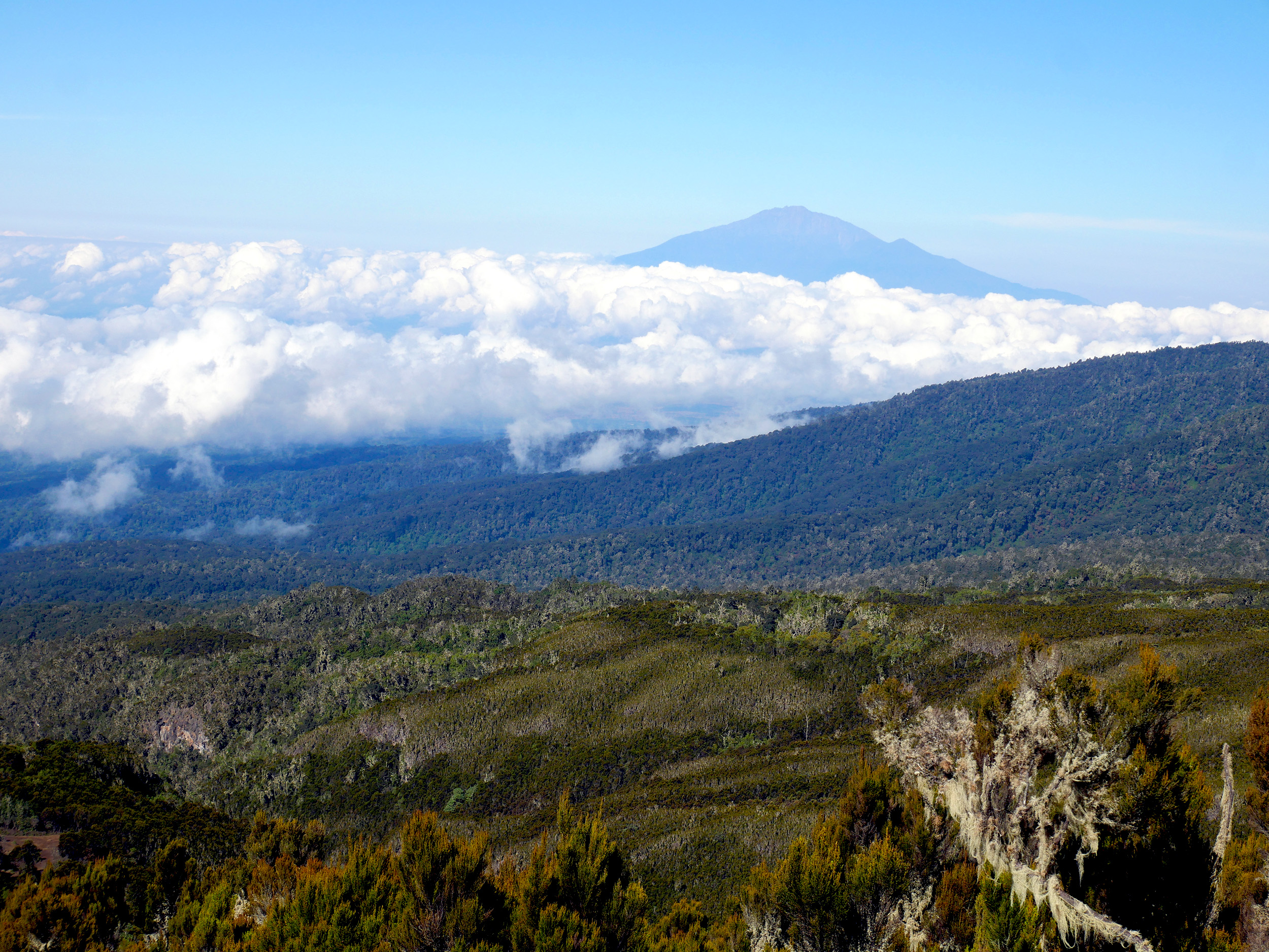
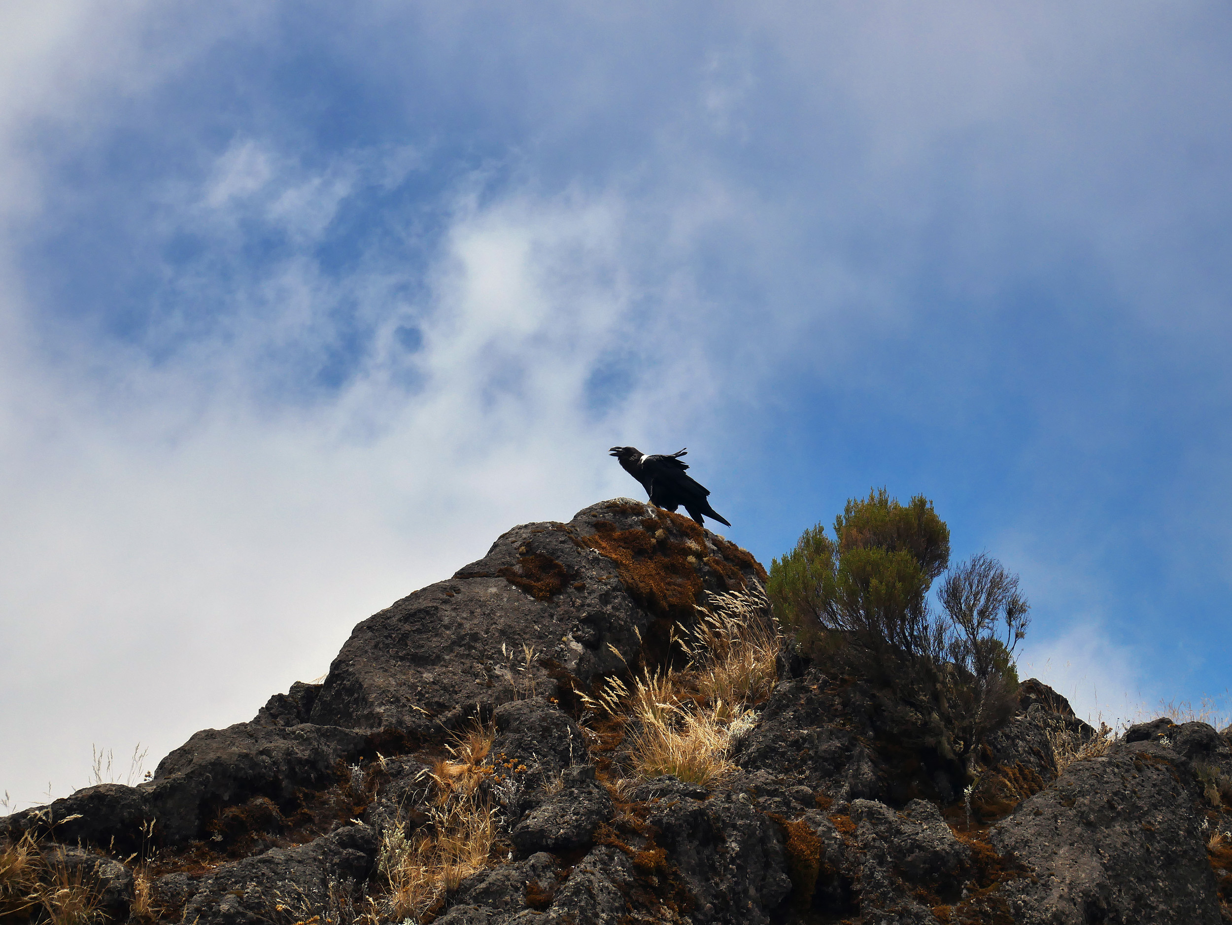
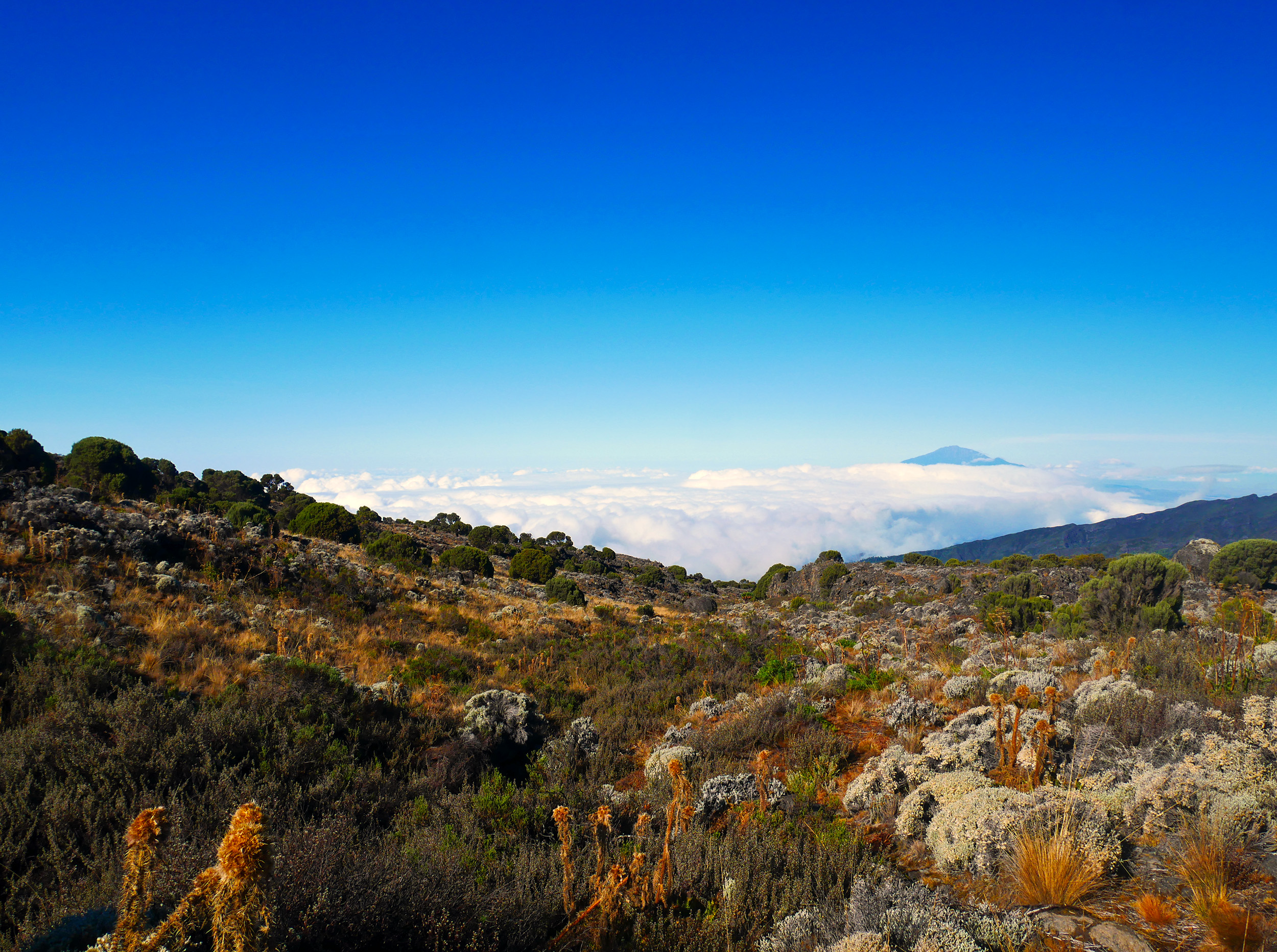
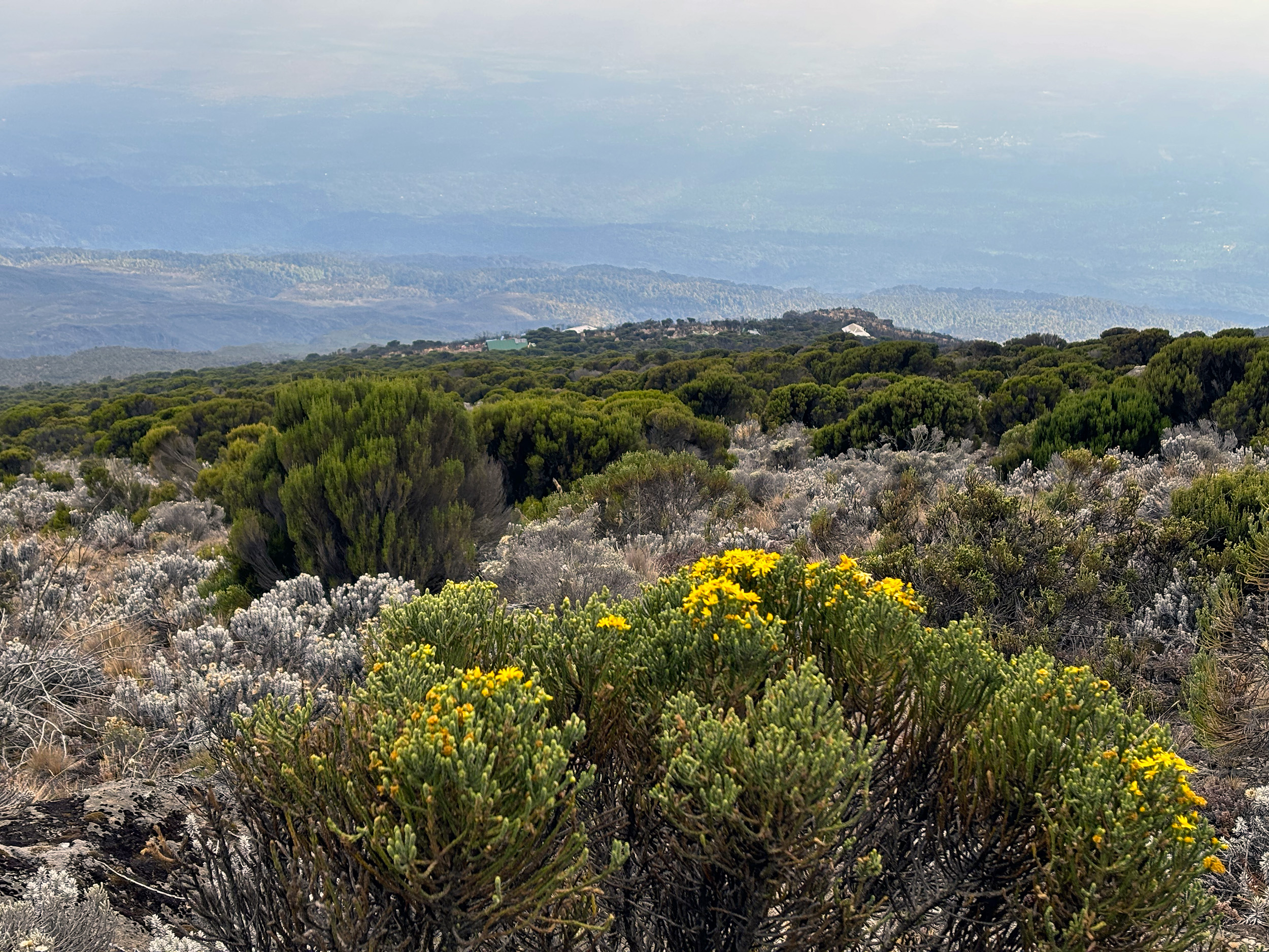
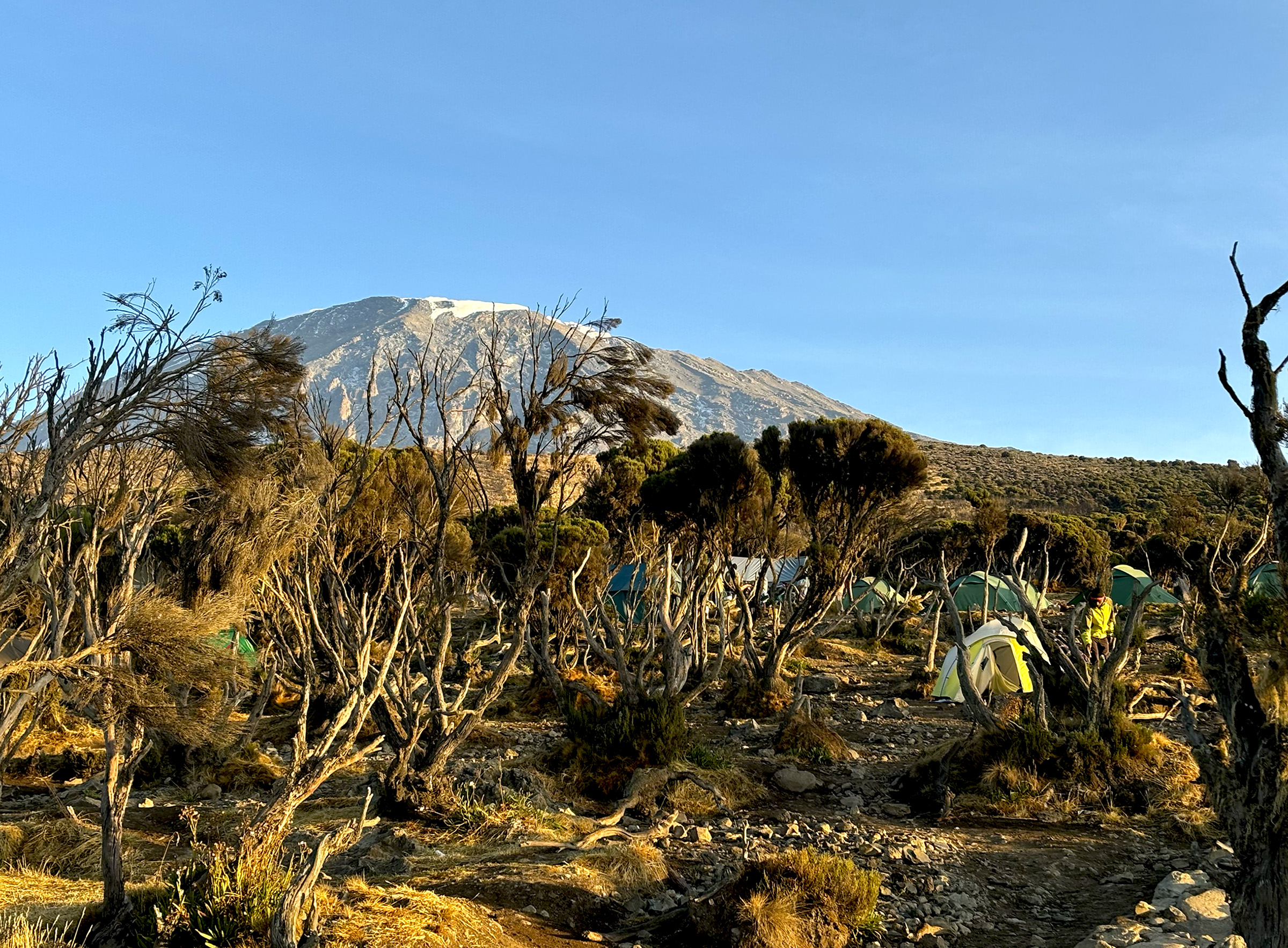
The tree line on Mt. Kilimanjaro extends to over 10,000 feet, so it takes about an hour of hiking from Machame Camp before we’ve gotten above it. Emerging from the depths of the Rainforest, we get our first glimpse of Mount Meru, the continent’s fifth tallest (14,980 ft / 4565 m), and over to our west, the imposing Shira Plateau, from which our next campsite gets its name. We’re now in the Moorland or Heath ecosystem of Kilimanjaro, and the vegetation here is decidedly different. Mosses and lichens cover exposed rock surfaces, succulents of all varieties thrive here, and we get our first introduction to the Plumeless Thistle and the aptly named, Everlasting Flower. At our first break, Vincent, one of our assistant guides, points towards a four-striped mouse, a unique breed that has adapted itself well to these high elevations. Soaring high above us and in striking contrast to the diminutive dimensions of the rodent, are a pair of White-Necked Ravens. Scavengers extraordinaire, they dominate the birdscape in the Moorland and will be a permanent fixture as we climb higher.

By mileage, today’s hike is a relatively short one, but with almost 3000 feet to climb, the ascent is a lot steeper than our first day, and involves some scrambling too. My glutes definitely feel sore, and the weight of my backpack, which I’m still getting accustomed to, is beginning to take a toll on my shoulders. Did someone say today was supposed to be a light one?

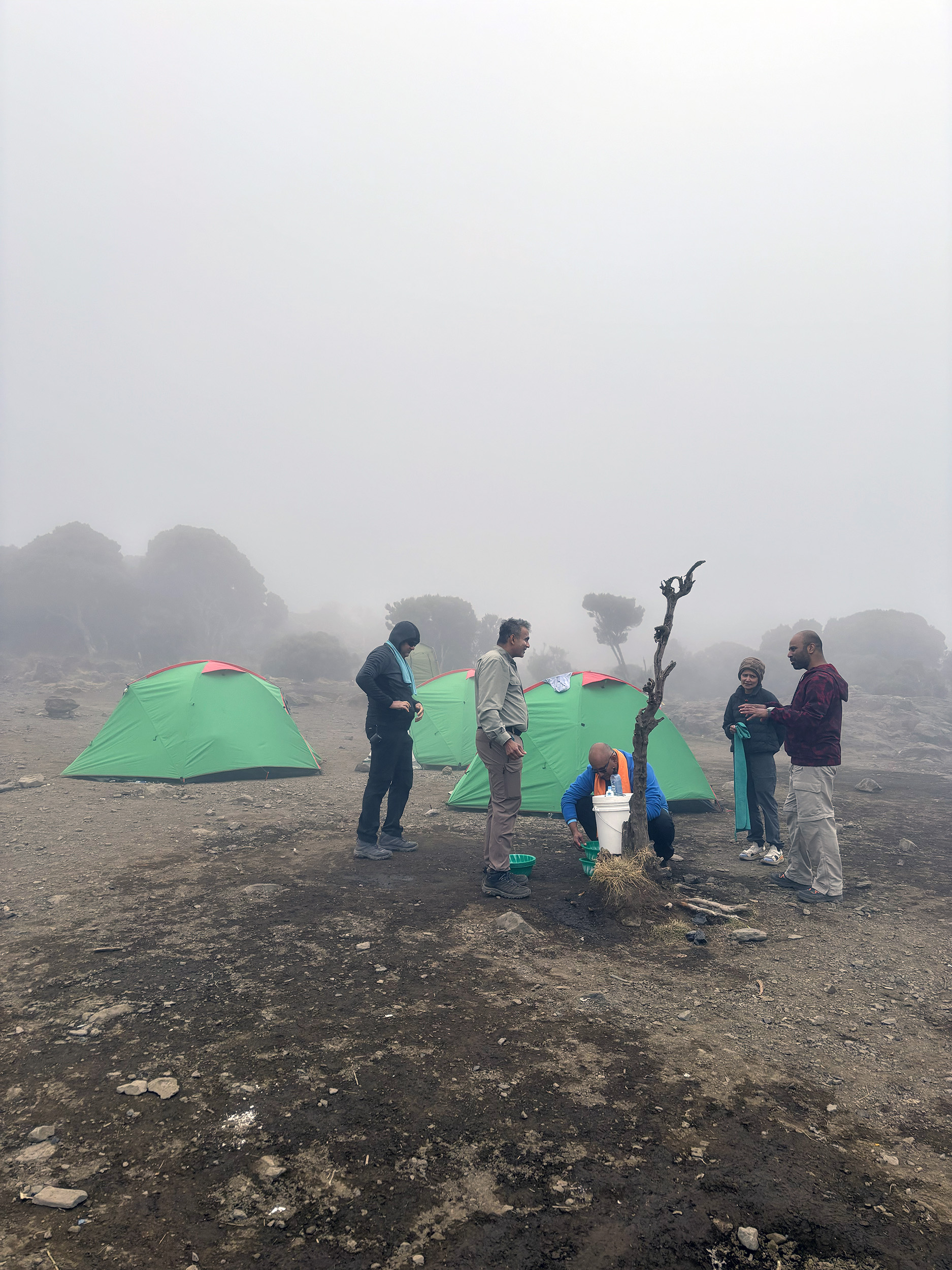
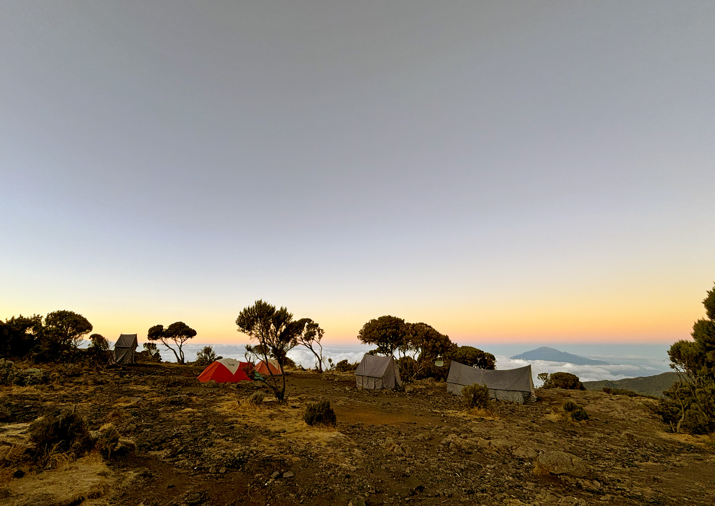
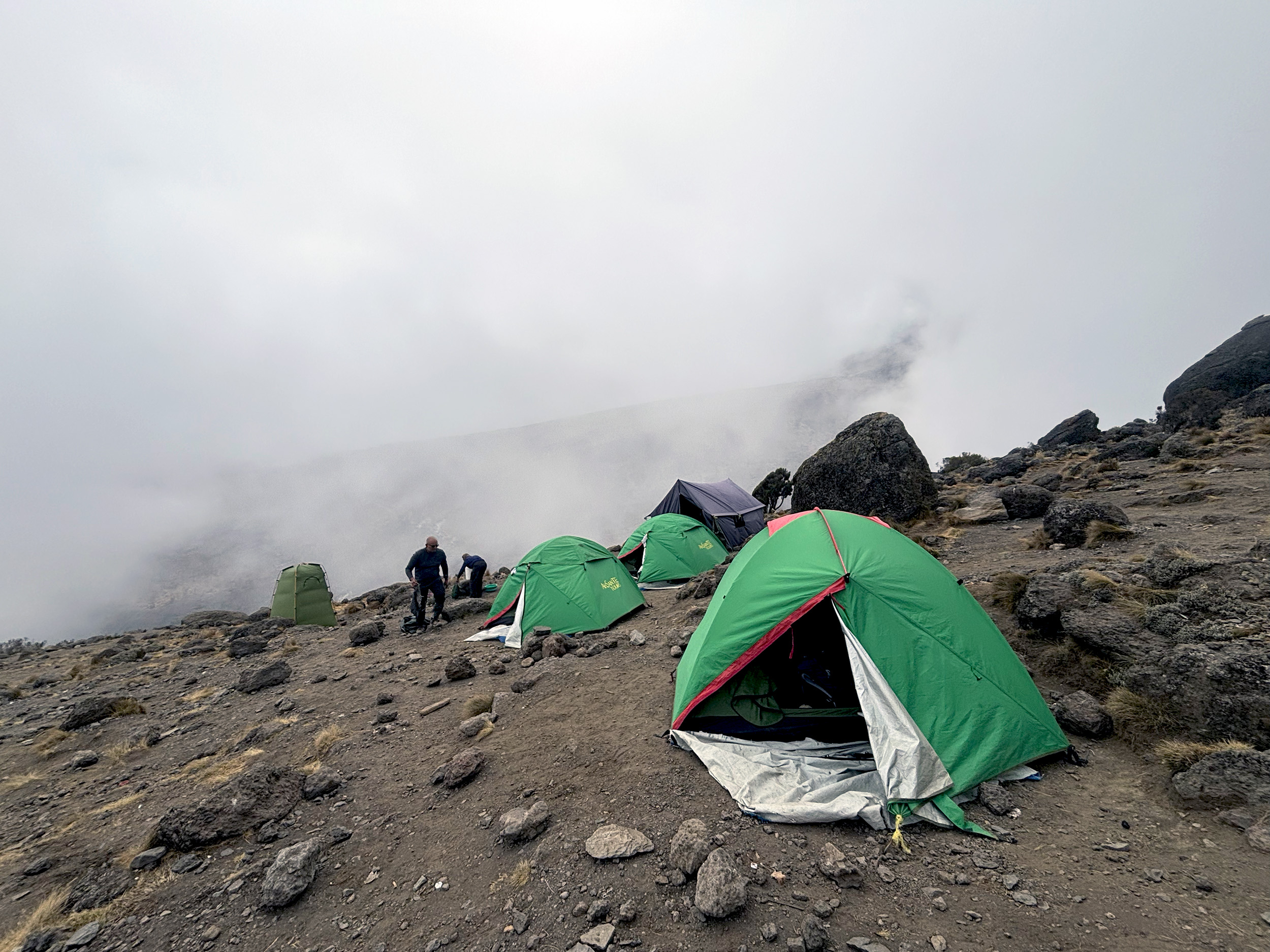
The clouds move in as we get closer to camp, and a definitive chill sets in. Layers that were removed not long after we began climbing, are hurriedly put back on. Conditions are fairly miserable as we approach Shira Cave Camp (12,300 ft / 3750 m), with a thick fog, stiff wind and persistent rain, making for some very damp cold. But there’s also ginger tea awaiting us in the mess tent, which US and SC have got a head start on. SC, in fact, is already done with this whole cold thing, reminding us time and again that he’s from the desert. At dinner, zucchini soup is accompanied by heated debates on bowel movement, but the discussion thankfully abates as the main course arrives. Grilled pork and pilau, along with our perennial favorite, kachumbari. The inclusion of pork courtesy of SC having tinkered with the menu previously. A fact we chided him for, but our secretly grateful about.

Day 3: Shira Cave Camp – Lava Tower – Baranco Camp
Being an incredibly light sleeper, I’ve lucked out so far with SM being by tent mate. Now the only event that can possibly break my sleep is the urge to pee. It’s laborious enough just getting in and out of our tents, but waking up in the middle of the night to answer nature’s call is excruciating. I seem to have struck on 0230 as that ideal time. There are some payoffs, to be sure. For one, a magical night sky above, with the milky way somewhat obscured by a waxing moon, and then earlier this morning, the chance sighting of a wild dog. 0600 is our wake up call each morning, and we’re expected to be on the move by 0800, with our morning rituals, breakfast and packing all out of the way. That relatively short two-hour window is also what accounts for some of the most memorable moments at camp. The sight of dawn on the eastern horizon, and then the rising sun slowly but surely warming up our campsite, and our souls.
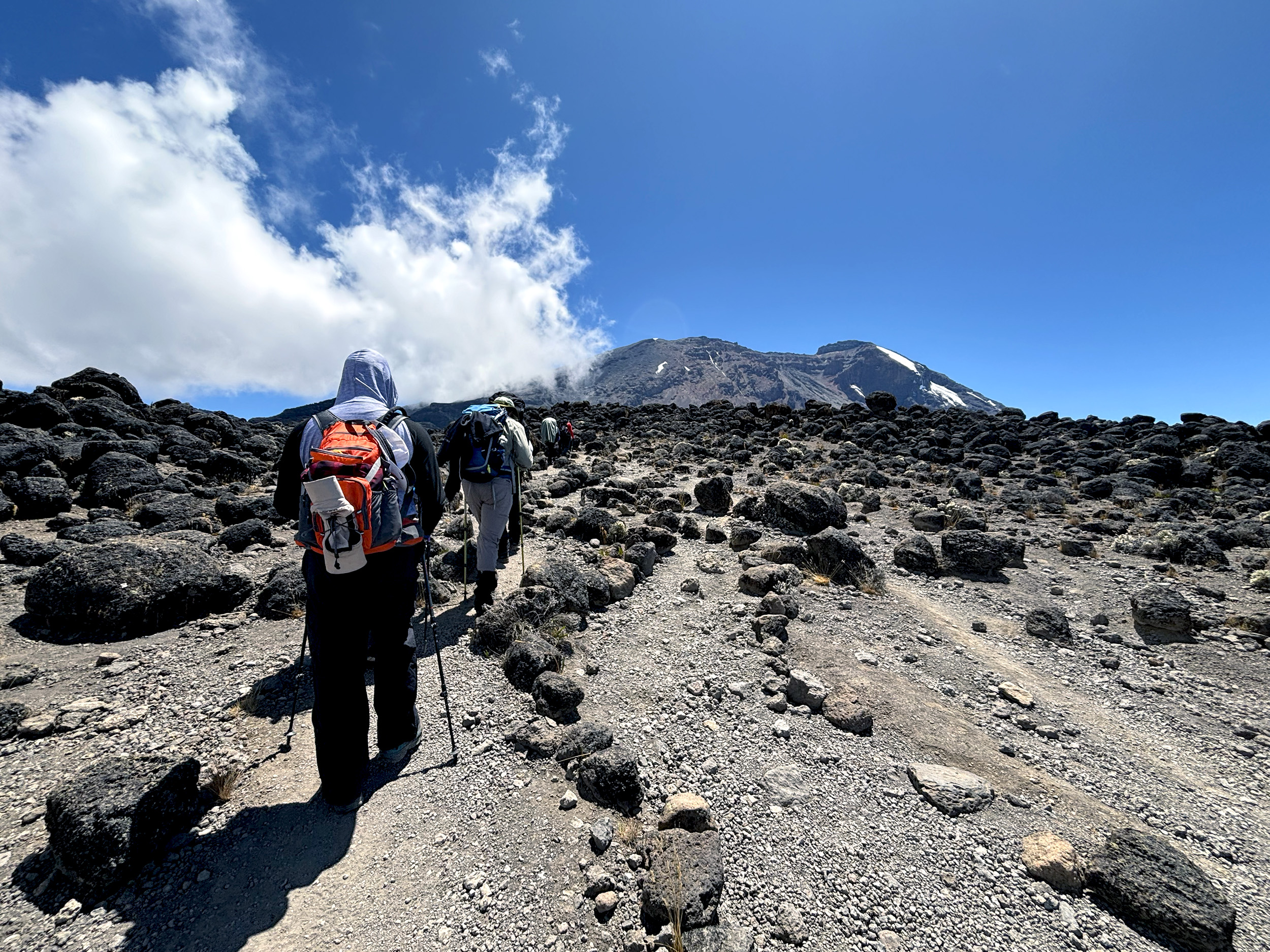
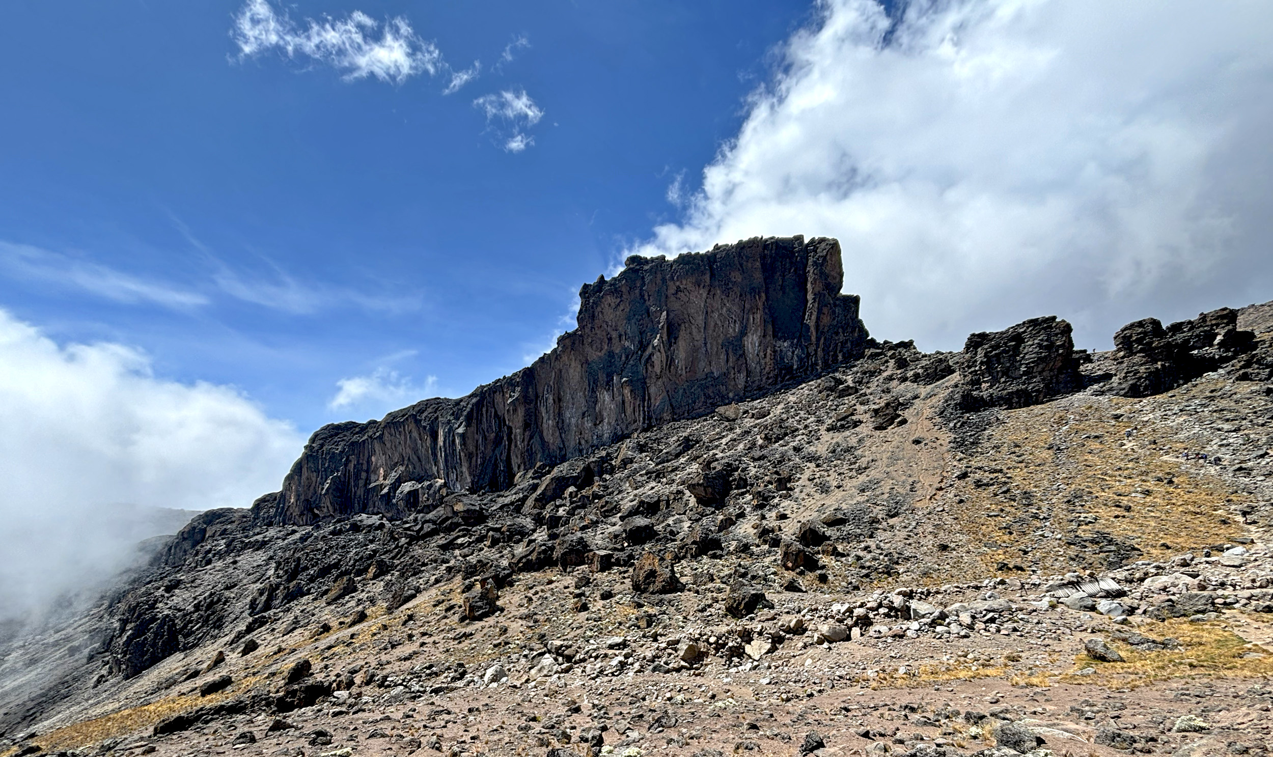
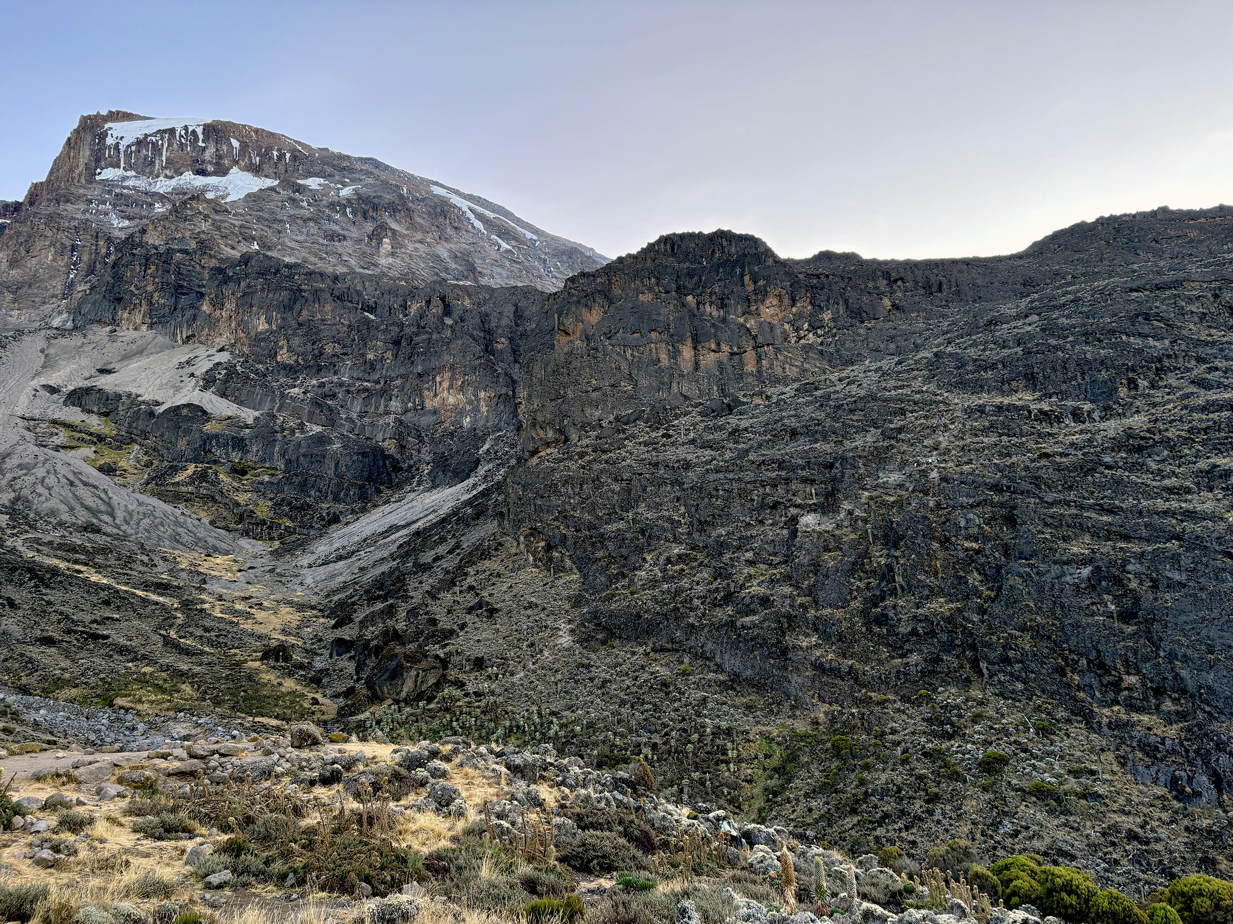
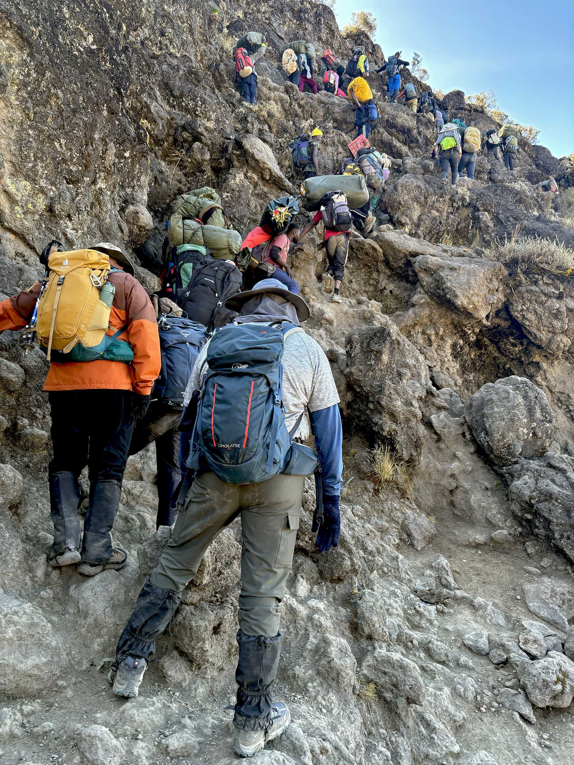
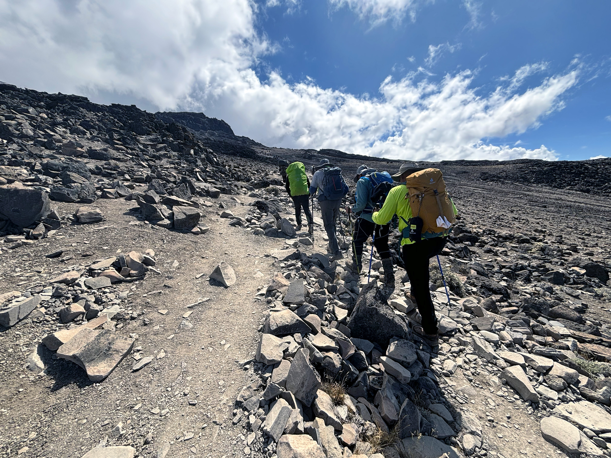
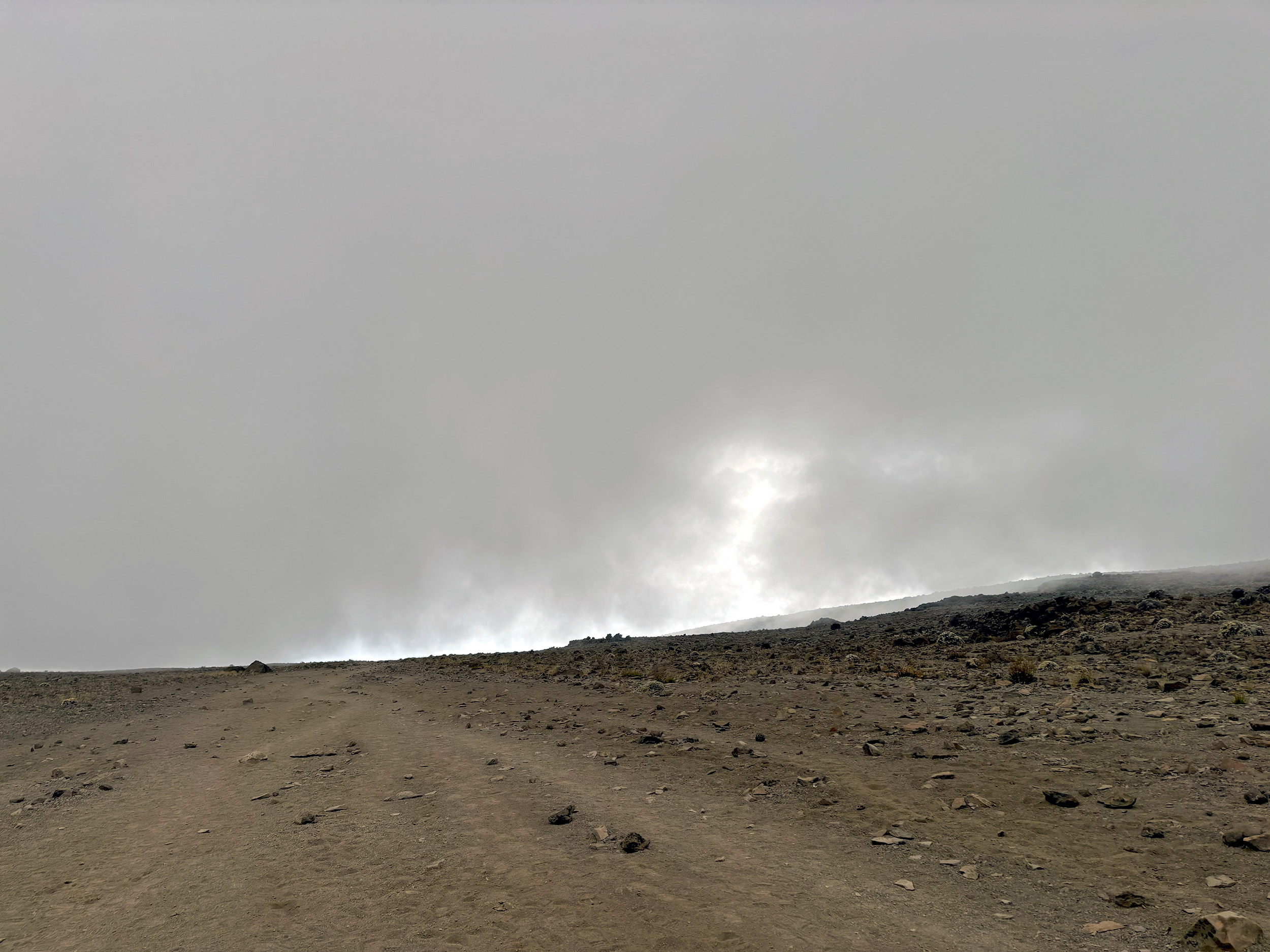
We have our gaiters on today, and have also been advised the use of our trekking poles. The last two days, we’ve had Pascal, our other assistant guide, and Vincent, alternating in the lead, but today, Michael, our head guide, is in charge. Day 3 is a crucial one, a dry run of sorts for summit night, with us climbing higher but sleeping lower. We’re also going to transition into the third of Kilimanjaro’s ecosystems, the Alpine Desert, a harsher environment than anything we’ve experienced so far. Where little shrubs account for the only vegetation, and volcanic rocks of every conceivable shape and size dominate the topography in surreal fashion.
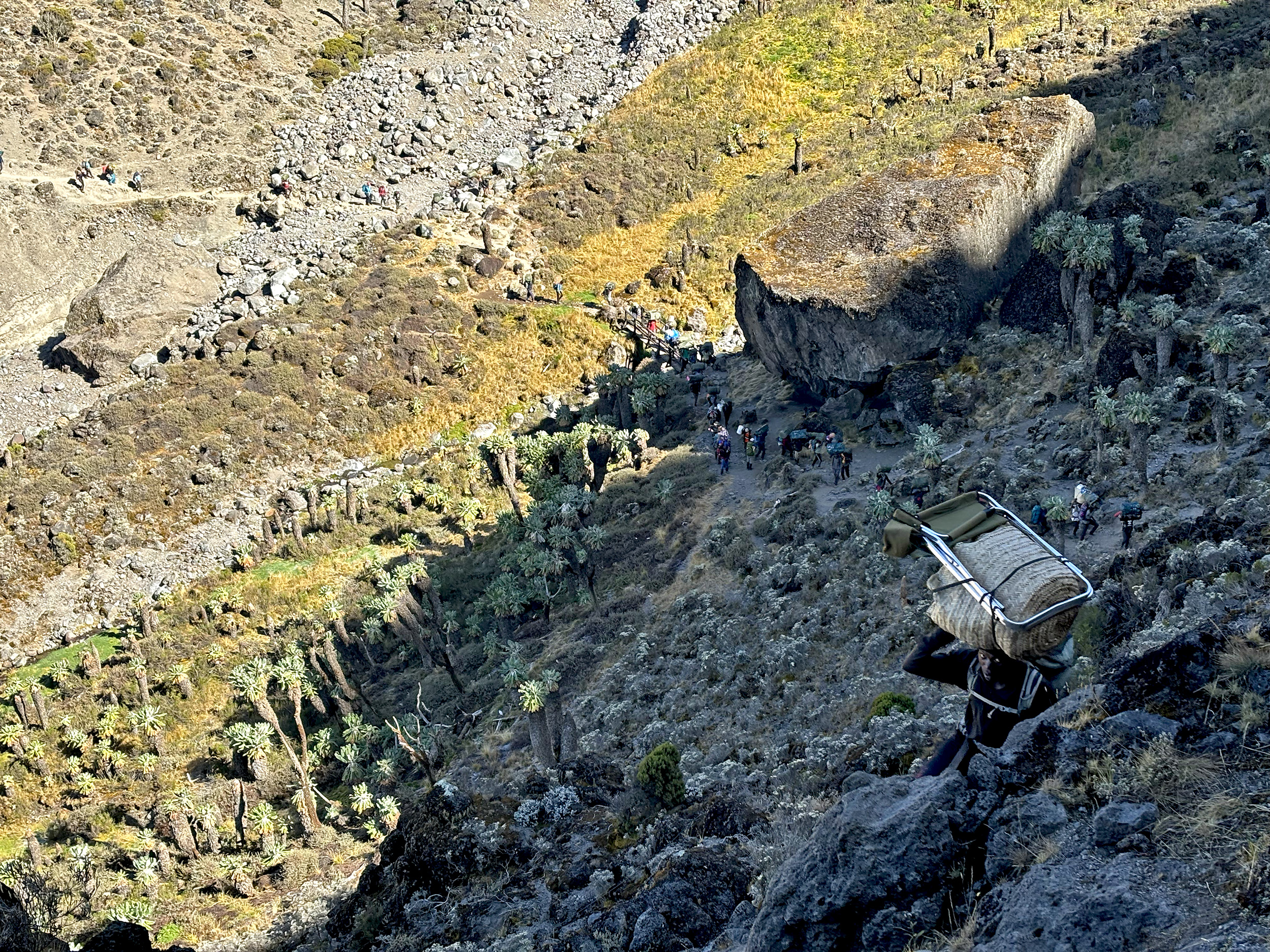
Approaching it from the west, we get our first clear look at the Kilimanjaro massif, its crater rim easily discernible. Two rest stops down and we can see the Lemosho route in the distance about to merge with ours. The trail is now a lot more crowded. Ahead lies Lava Tower, a hard to miss geological formation, and a major landmark on Kilimanjaro. While no one actually camps there, it’s where climbers on the Machame, Lemosho and Northern Circuit routes typically break for lunch, and expectedly, the campsite is teeming with kitchen and mess tents. At 15,200 feet, we can most certainly feel the altitude here, and the 90-minute break for lunch is well appreciated.

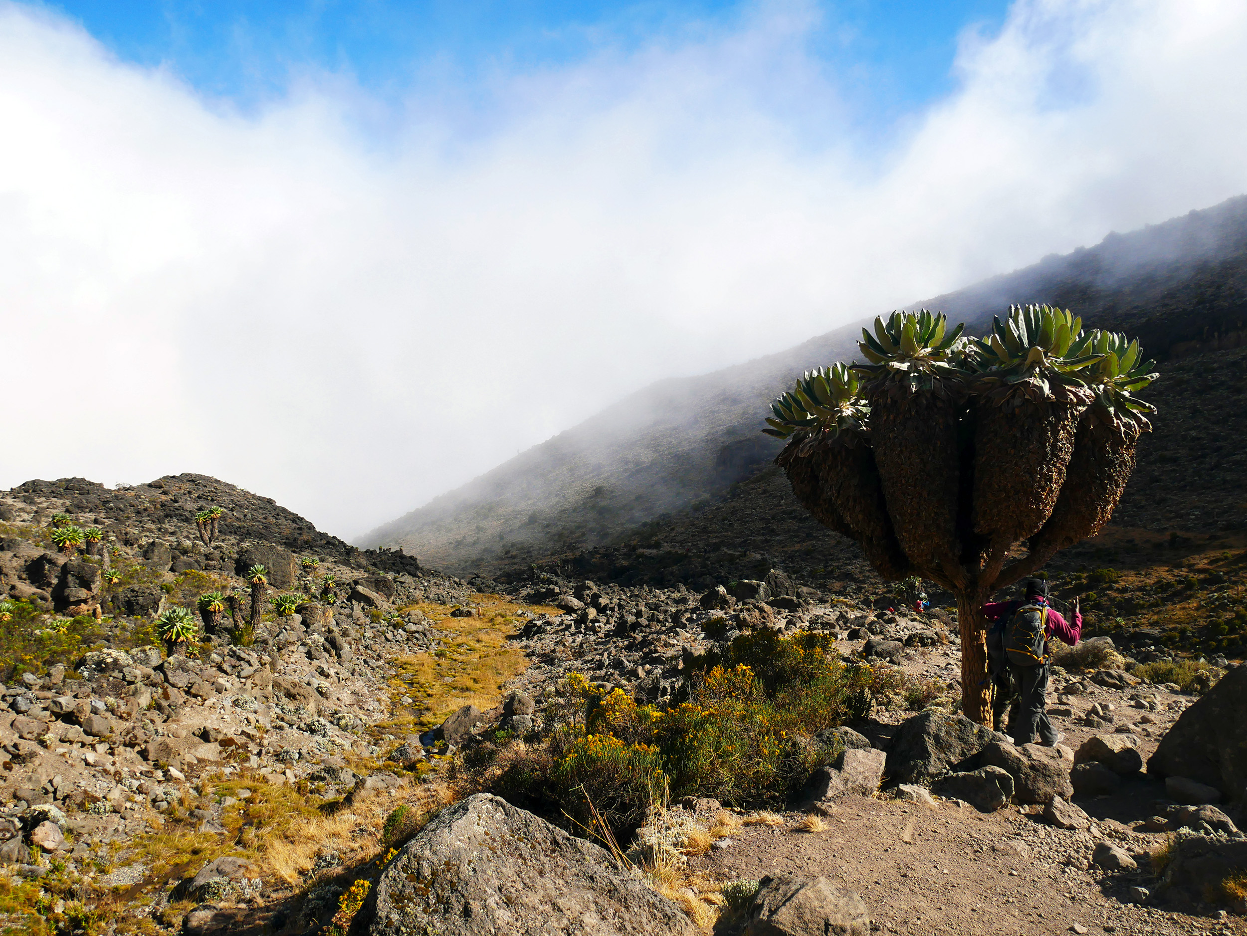
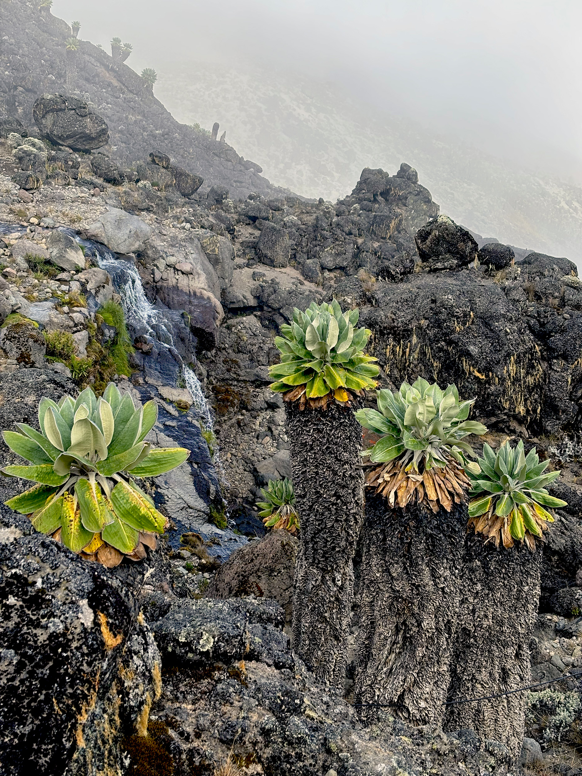
The trail drops precipitously upon leaving the campsite, using an extremely rocky, narrow pass to descend into the valley east of the imposing volcanic plug that is Lava Tower. Part desert palm, part larger-than-life pineapple, but mostly otherworldly, the Dendrosenecio Kilimanjari or Giant Groundsel is one of the most unique plants found on the mountain, and we stumble upon several groves of this handsome species as we hike further through the valley floor. In the distance, a waterfall punctuates the stillness, plunging toward a hidden mountain stream. Nature’s incredible landscaping act, in this seemingly barren expanse of the Alpine Desert.
We’ve spent over seven hours on the trail today, and my glutes, calves and shoulders are all acting up. But more pressing than that is a headache I’ve been nursing since late morning. One I’d hoped would subside as we descended down to Baranco Camp (12,800 ft / 3900 m). Everyone seems to have suffered from a headache today, even SM, who’s been leaving us in the dust when it comes to O2 levels. Michael’s readings post dinner would surely confirm that fact. A strong painkiller, and a hearty dinner should do the trick, hopefully.
Day 4: Baranco Camp – Karanga Camp
The headache has subsided, thankfully, and this morning’s readings by Michael confirm a slight uptick on my O2 levels. SM continues to crush it, no surprises there. As US and I soak up views of the plains below, the morning calm is shattered by the sound of a helicopter. It’s the first air evacuation we’re witnessing, and a sobering moment for everyone at camp.
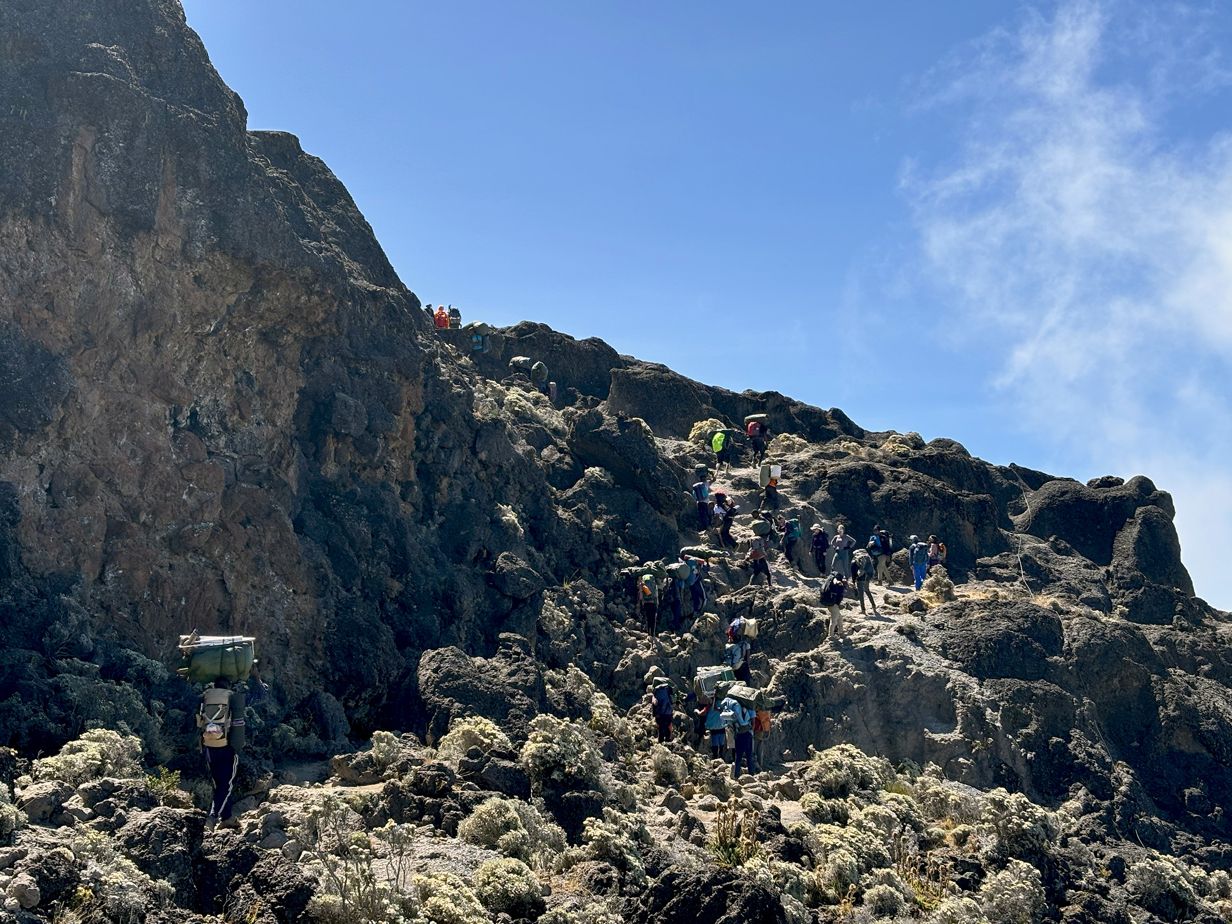
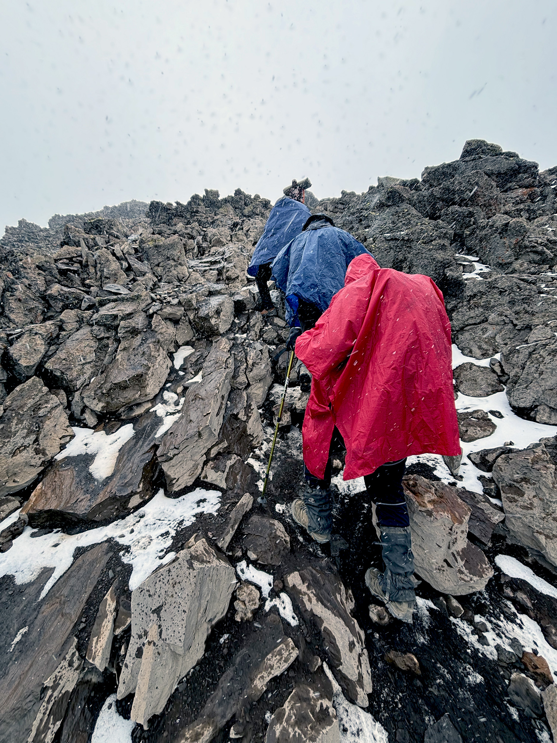
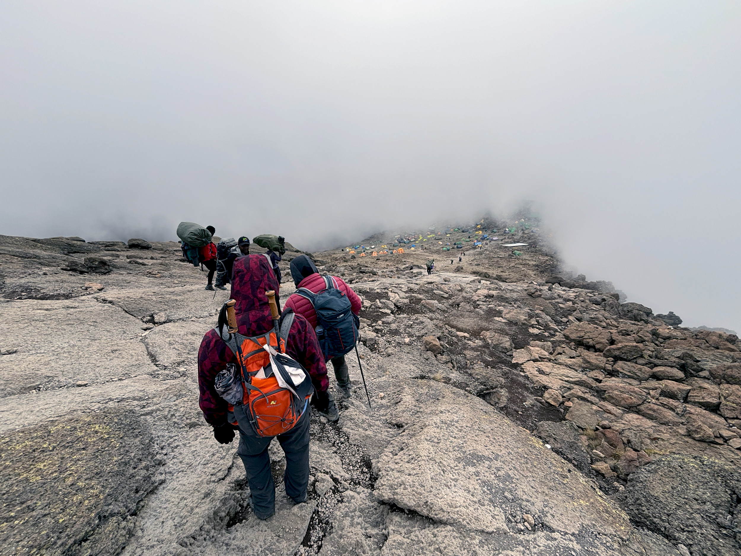
As the chopper eventually flies away, we turn our attention to the wall ahead of us. The very intimidating Baranco Wall, to be precise, from which the camp gets its name, and one that we’d have to surmount. Within the Yosemite decimal system, the Baranco Wall is considered a Class 4 scramble, which is to say you don’t need specialized gear but you will need all four limbs. Here, rocks seem like the obvious enemy, but they can also be your best friend. As for upper body strength, that’s crucial. Call it bouldering, scrambling or rock climbing, the Barranco Wall has it all!

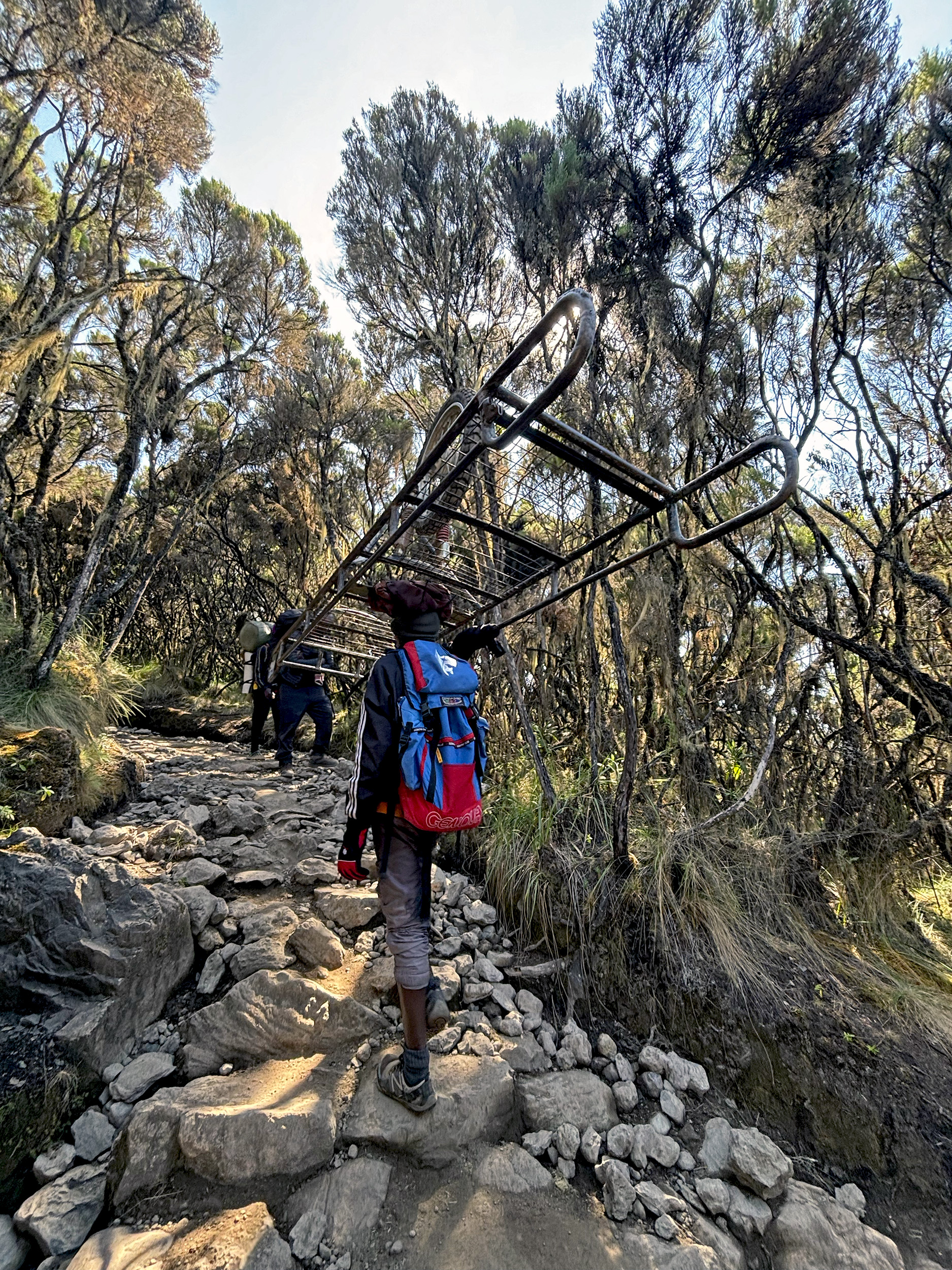
Half way up the wall, during a brief pause, we get a chance to look back at all we’ve gained. Baranco Camp, cleared of its coterie by now, wears a deserted look. As we ponder the remainder of the near vertical ascent, porters laden with supplies four times the weight of our backpacks whizz right past. A solid two-hour effort finally gets us through, and with that comes a longer break, with the added benefit of being above the clouds.
We have another two hours worth of hiking before Karanga (13,100 ft / 3995 m) is reached. The camp, barely discernible over the ridge line, lies at the very end of an undulating, dusty trail that’s made up entirely of moraine and scree. Slipping and sliding guaranteed. The route involves a steep drop into Karanga Valley, from which the camp gets its name, and an equally severe grade up from the valley floor. Michael promises SC a zip line for the next time he visits. The valley carries a perennial stream, the last source of water at Karanga, and campsites east of Baranco. A group of porters, barrels full of water in tow, congregate on the valley floor, before commencing their back-breaking journey uphill. We pity ourselves just a tad bit less for that final push ahead.

SM and I arrive at camp to find our tent on hopelessly uneven ground, but given that there’s literally no room to negotiate, we improvise somehow. Evening tea is accompanied by an ethereal light show, with the clouds parting just in time for magic hour, and the silhouette of Mt. Meru helping frame a perfect sunset.
Four days in and we’ve learned how to unpack and pack within the tight confines of our tents, angle of slope not withstanding. How to dress in layers. How best to stay hydrated. How to minimize the weight of our backpacks. And so on. We’ve gotten to know our guides better, and some of our support crew too. And vice versa. Musa, for instance, knows the ratio of carbs to protein for each of us. SP and AS, camp favorites by now, have even been assigned Swahili names, going by Manka and Masave respectively. Courtesy of a shorter supply route, Pasat and his team have had their rations restocked at Karanga, and Musa cheerfully announces that pork is back on the menu. Just when we’re ready to call it a night, SC’s quest for a warmer bed ends in disaster. Water is spilled. The troops are summoned. Paulo, the camp manager, delivers a fresh sleeping bag. Order is restored to the Karanga Valley.
Day 5: Karanga Camp – Kosovo Camp
It’s another gorgeous morning at camp, with Mt. Meru appearing further away than it has on previous days. Breakfast this morning is made up of omelettes, pancakes and sausages, and some mango, that’s not quite as tart as before. The sun is already beating down on us as we’re about to set off, so one set of outer layers is hurriedly discarded. Twende Twende!

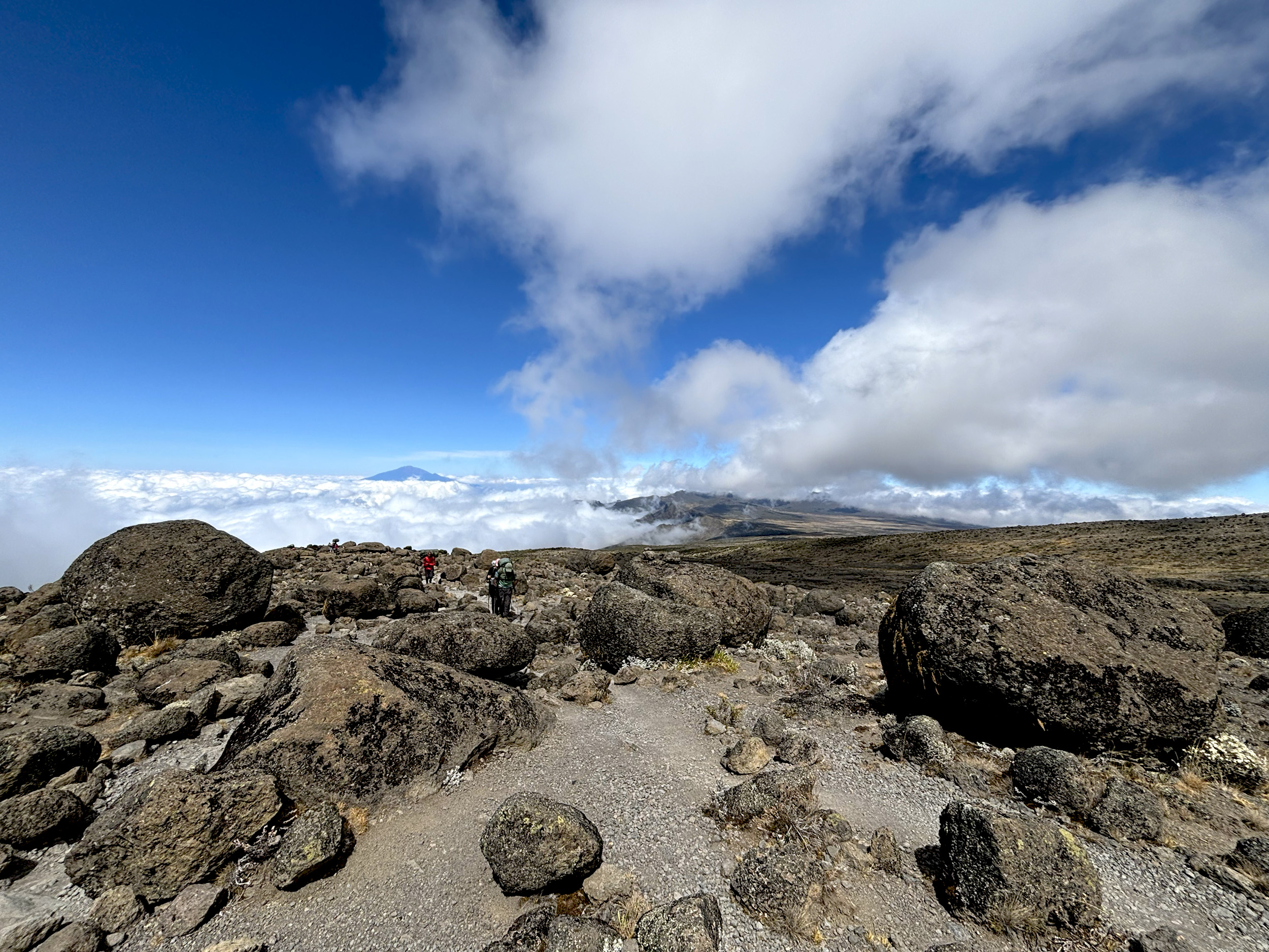
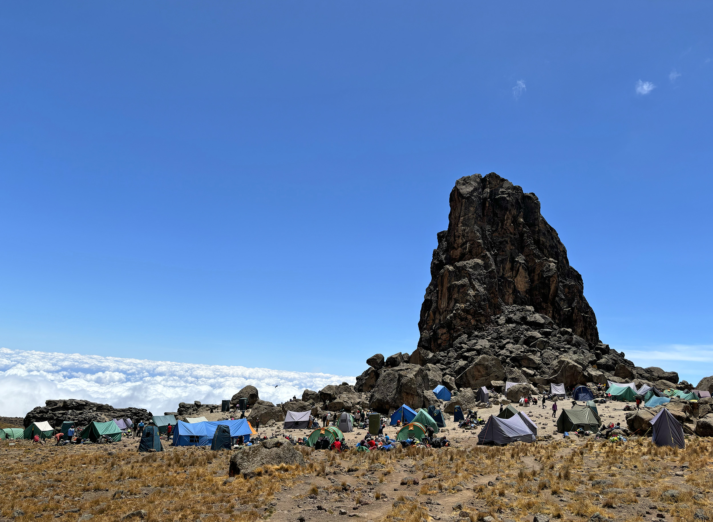
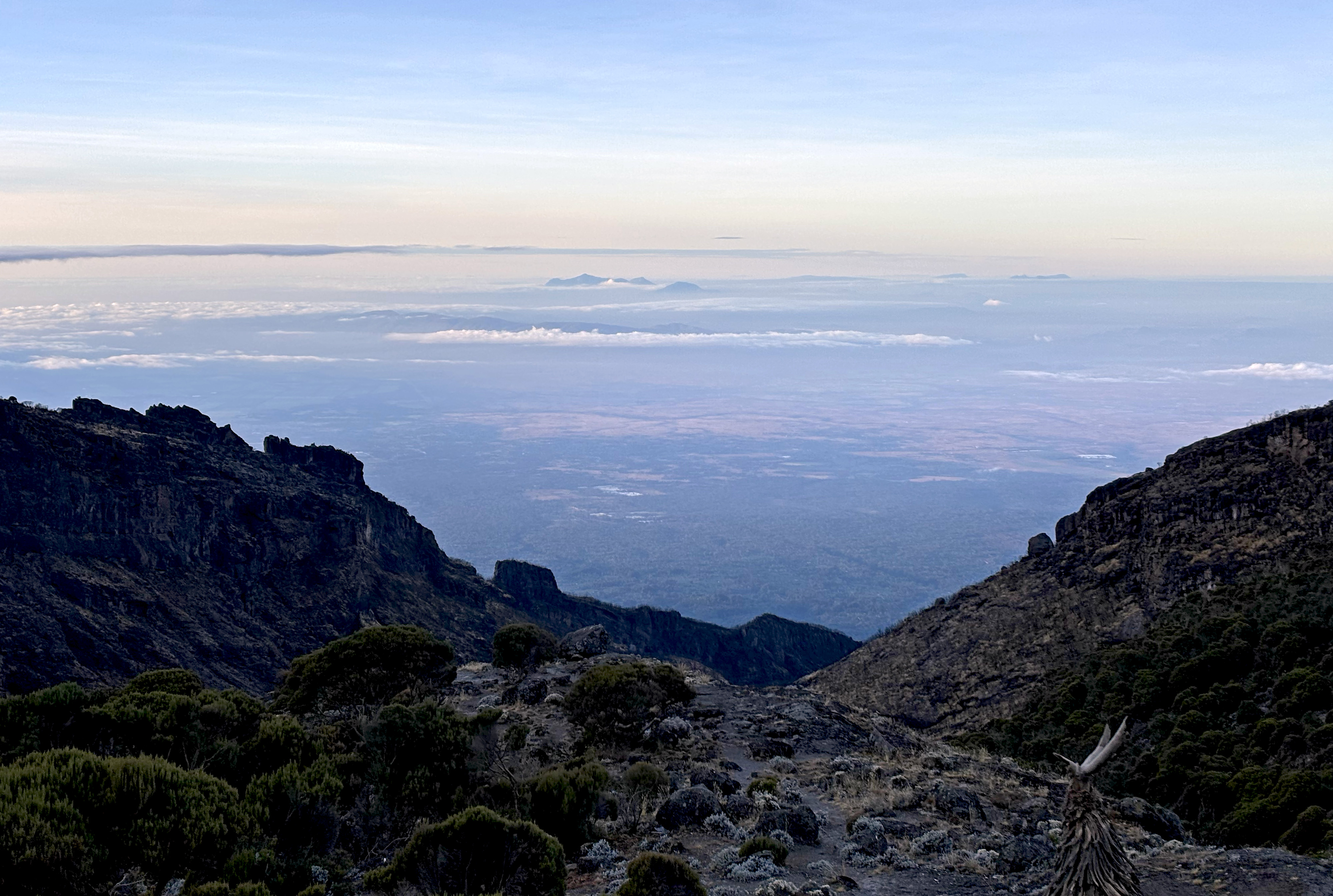
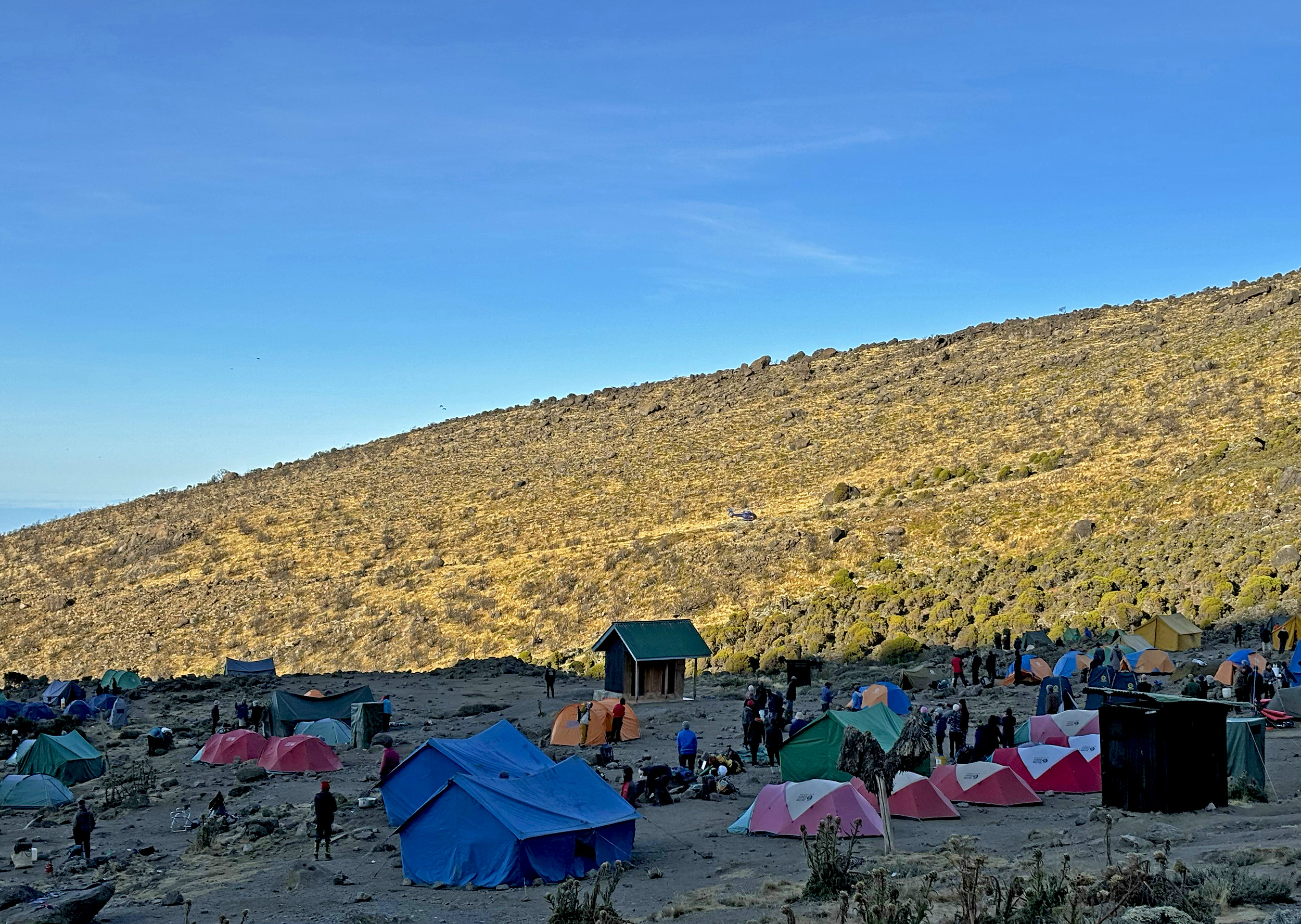
Frost-shattered rock makes up much of the terrain this morning, and walking over it is akin to treading on a field of broken glass. The incredibly arid environment of the Alpine Desert is in full effect today, with even the color of the soil appearing dull and gray. With only four miles to cover, today is considered another “light” one, but it is a constant climb nevertheless, and the trail is fairly crowded too. Barafu Camp (15,330 ft / 4673 m) is where most hikers are headed to, and it lies on a ridge in the distance, one that’s defined by a fortress-like rock formation. About half way there and some two hours into our ascent, the strong sun gives way to thick cloud cover, and the layers come right back on.

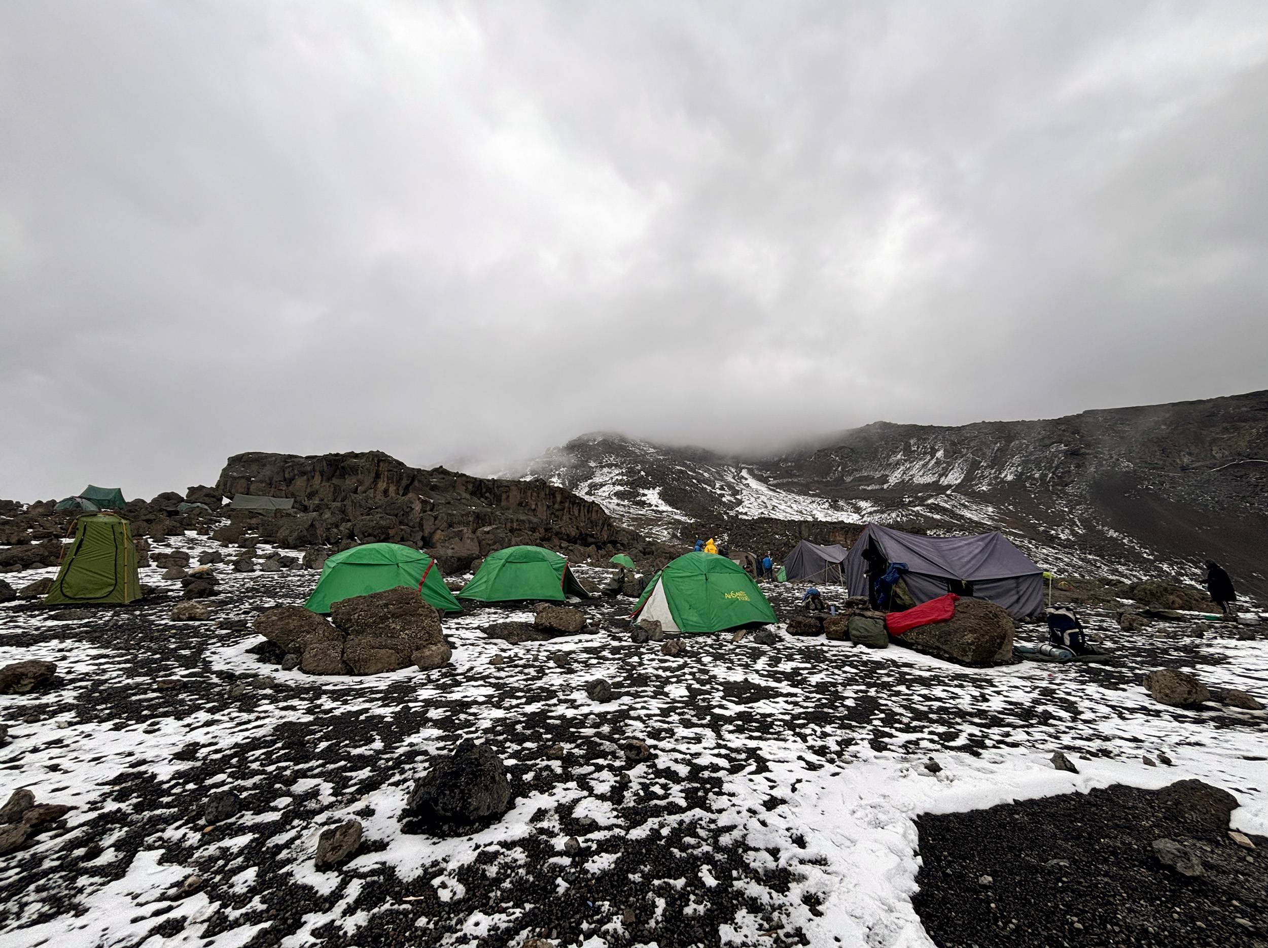
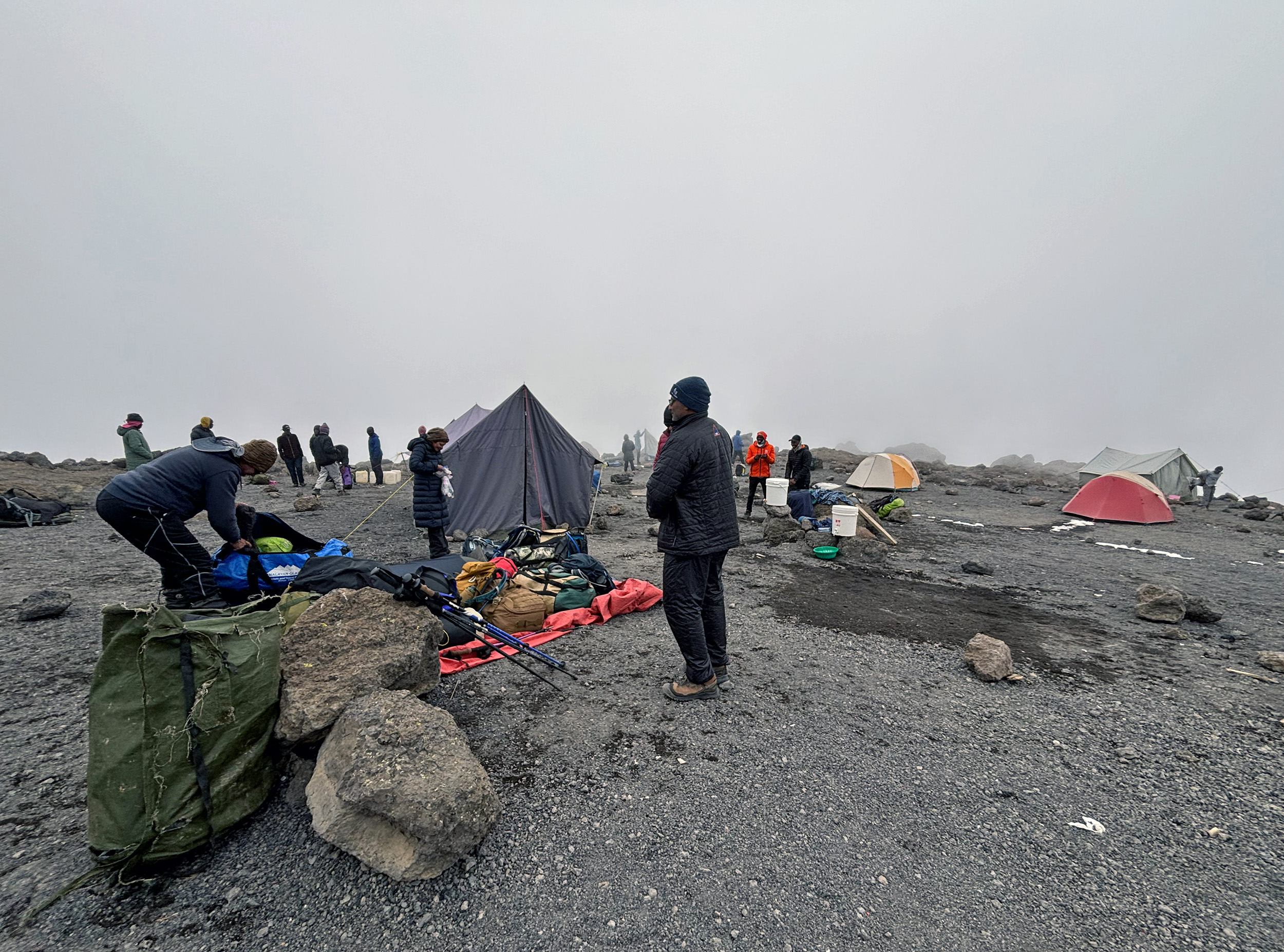
Coming up on Barafu Camp, the weather takes a turn for the worse with hail and high winds. If you lived here, you’d be home by now, AS reminds us, as we file past the sprawling campsite. Unlike everyone else finishing the day at Barafu, our group is climbing an additional 700-feet, along a dauntingly steep path to Kosovo, a higher basecamp that requires advance permits and an additional fee. The mountainsides are already covered with the white stuff as we inch further, and soon enough the hail turns into full blown snow; the precipitation accompanying us till our campsite is reached. Conditions at Kosovo, sitting just shy of 16,000 feet, can only be described as hostile.

A light lunch of chicken stew and cheese toasties is washed down with ginger tea, and that is followed by a compulsory nap, but sleep at this altitude is fleeting. Pottering around the campsite just prior to dinner, I’m rewarded with a truly mesmerizing cloud show, and a brief reveal of majestic Mawenzi, Kilimanjaro’s second highest peak. Dinner at 6 pm is on the early side today, and is a simple affair of pasta and red sauce. Over another flask of ginger tea, Michael briefs us on the summit ascent and introduces us to our summit porters. Readings our taken. O2 levels have dropped across the board. We’re also unanimously miserable in the cold. Wake up call is in three hours so it’s lights out by 8 pm.
Day 6: Kosovo Camp – Uhuru Peak – Kosovo Camp – Millennium Camp
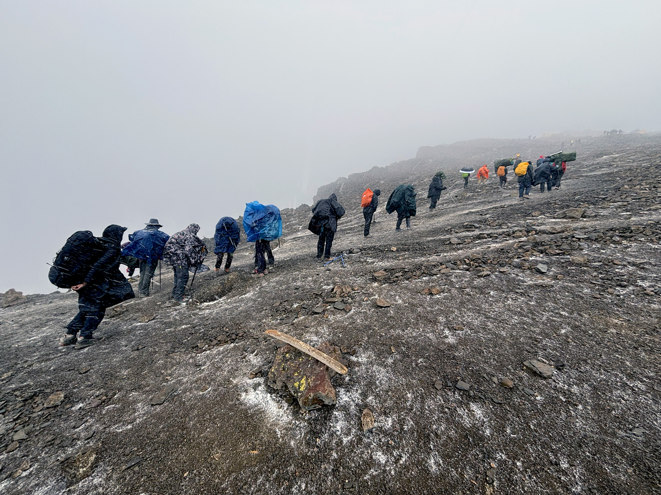
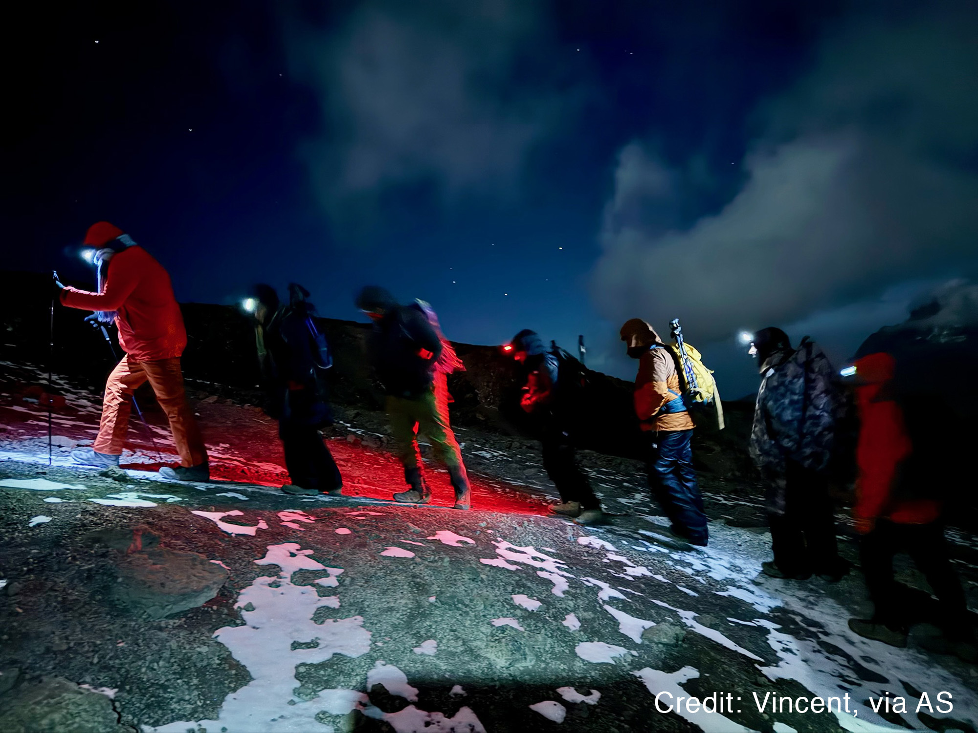
It’s twenty past midnight and we’ve begun our trudge out of Kosovo Camp. We have countless switchbacks to negotiate, and 3500-feet to ascend, but not long after leaving we reach our first milestone, crossing into Kilimanjaro’s Arctic zone. True to its name, it is absolutely frigid here, with the temperature dropping by a degree celsius every hundred or so meters gained. I have five layers on – probably the most I’ve ever worn – and the cold is still managing to seep through. My hands, especially, are bearing the brunt of it. Below us is a winding caravan of headlamps – hikers slowly making their way up, but all the while gaining on us.
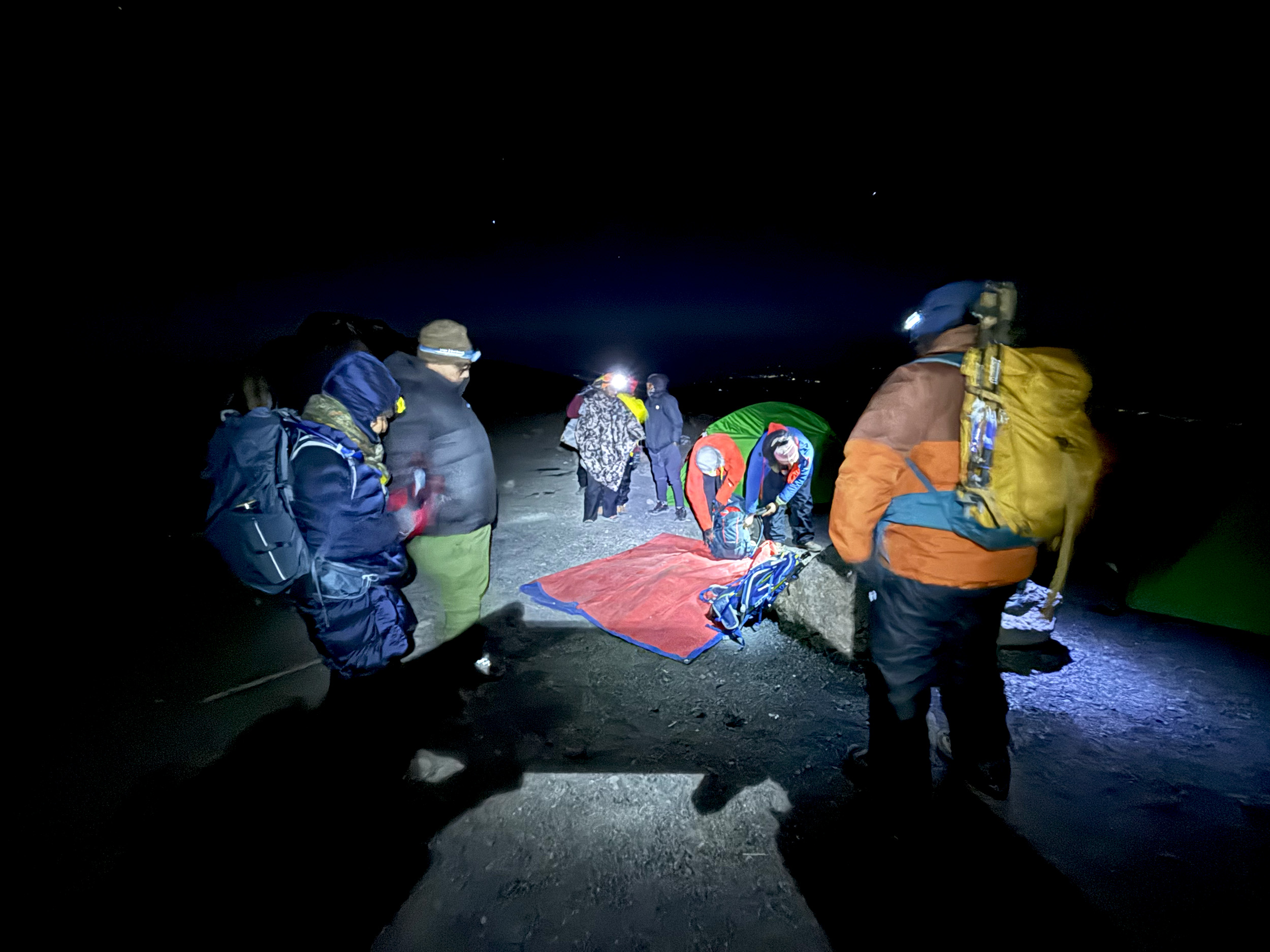
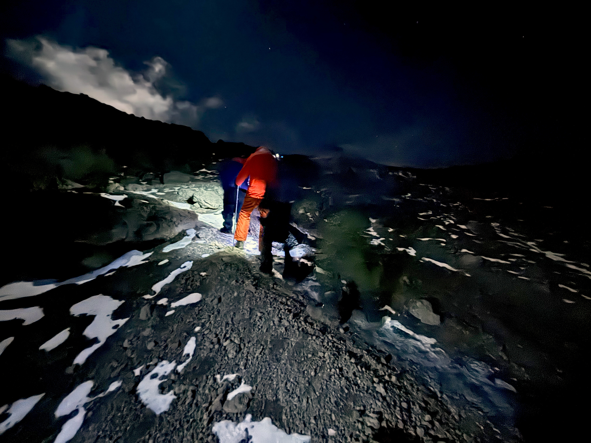
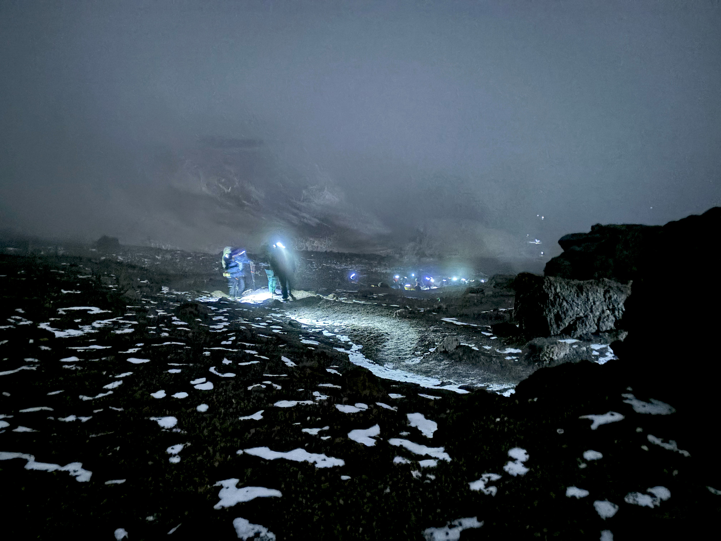
The night was clear when we started off, with a moon so bright we could get by without the use of our headlamps. But the clouds have begun to roll in now, accompanied by a punishing wind. To add to our misery, the pipes on our hydration packs have all frozen. Even though we’ve carried an additional bottle each as back up, hydrating sufficiently will prove to be a challenge. The push to the summit is turning out to be a lot more challenging, and much slower than we anticipated. Our steps are laborious, wobbly even. I feel like I’m drunk, declares US, who’s right behind me. He’s accurately summed up that inexplicable feeling of fatigue, a combination of exhaustion and exertion at this altitude, and in these temperatures. Especially struggling in our rank and file is SC, necessitating a stop for our group every five or so minutes. Michael urges us to keep moving, pole pole. The more we stop, the more body heat we lose, he reminds us.
It’s 0245, two and half hours since we left basecamp, and SC makes the difficult decision to turn back. It’s a laudable one. Not only has he shown grit, but in doing so he’s saved us the awkwardness of deciding for his sake. Vincent is entrusted with the task of getting SC safely back down to Kosovo. Our morale is severely depleted, but with no more time to lose, we must soldier on. In less than two hours, there will be light on the horizon. The very thought of that, and a changeover to mittens, warms me up somewhat.
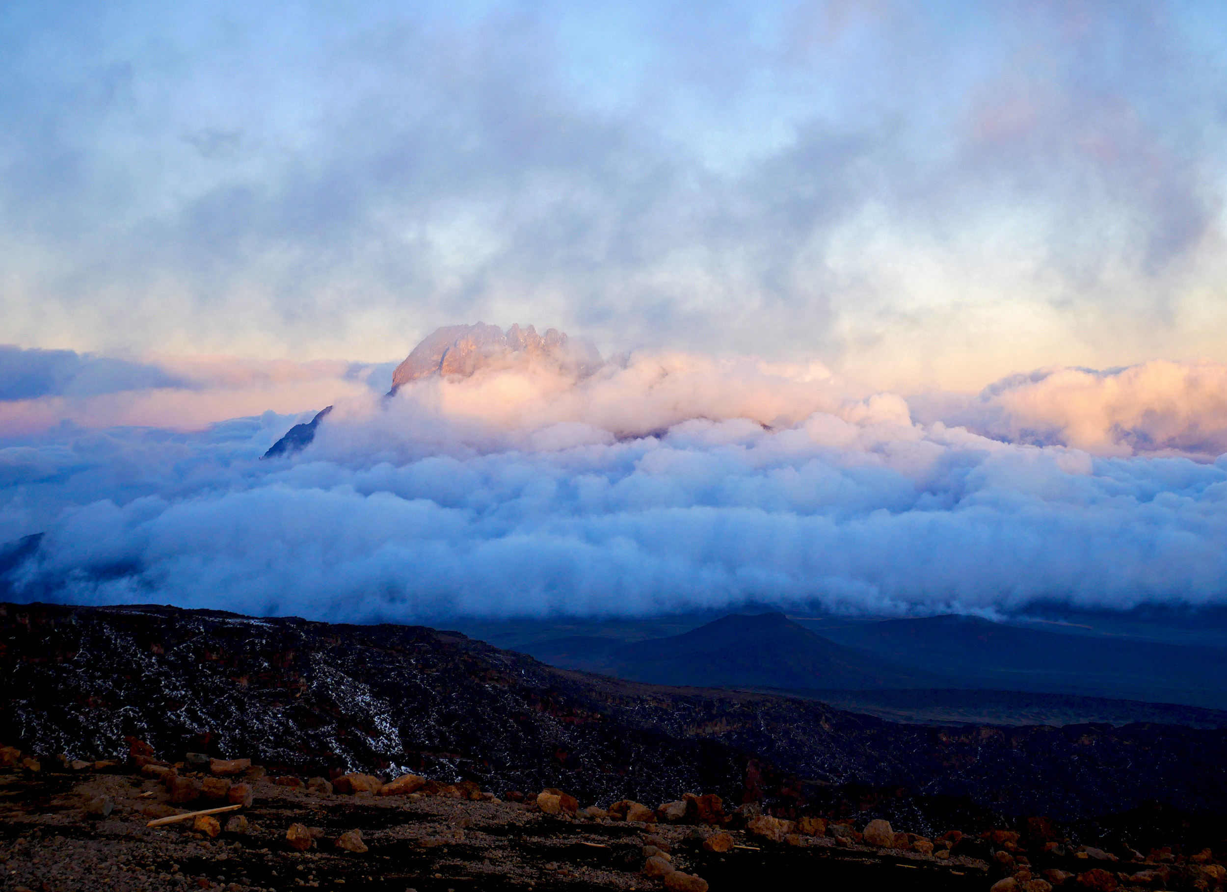
Michael calls for a brief halt at 4 am. One of our summit porters hands out mugs, and before we know it we’re sipping on steaming ginger tea. It’s hard to describe just how comforting that is. Not long after, the very faint silhouette of Mawenzi’s craggy peak becomes visible to us, becoming a lot more distinct as we climb higher. Things are finally looking up. Dawn is around the corner, and the early morning light is beginning to paint the landscape in striking hues. Located at the edge of Kilimanjaro’s crater rim, Stella Point (18,885 ft / 5756 m) is reached at 0604, just as that fiery ball emerges for the first time above Mawenzi Peak. We’re still an hour away from the summit, but the moment is nevertheless euphoric.

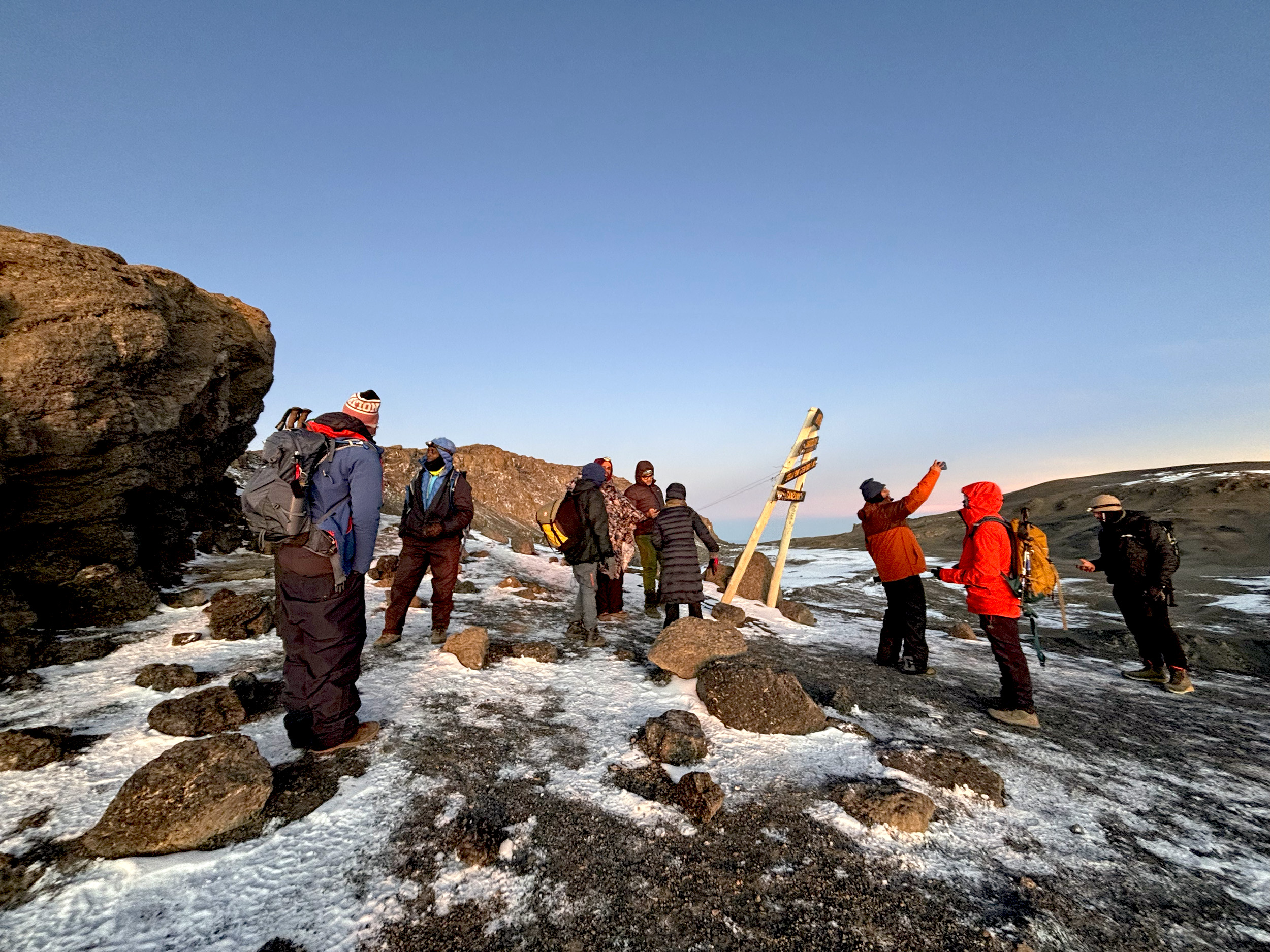

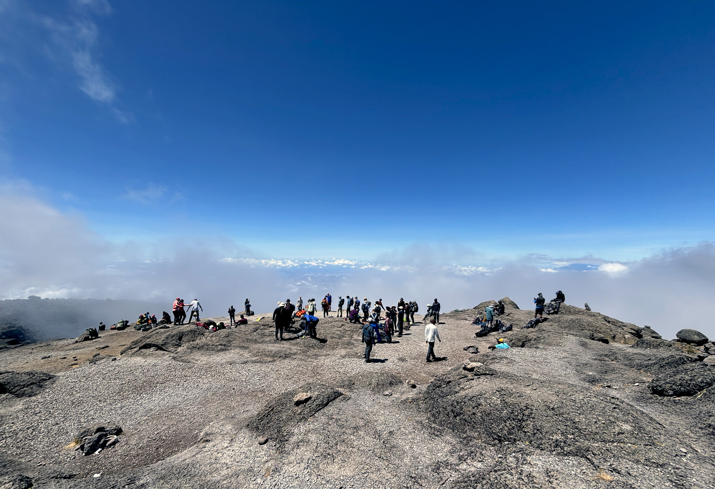
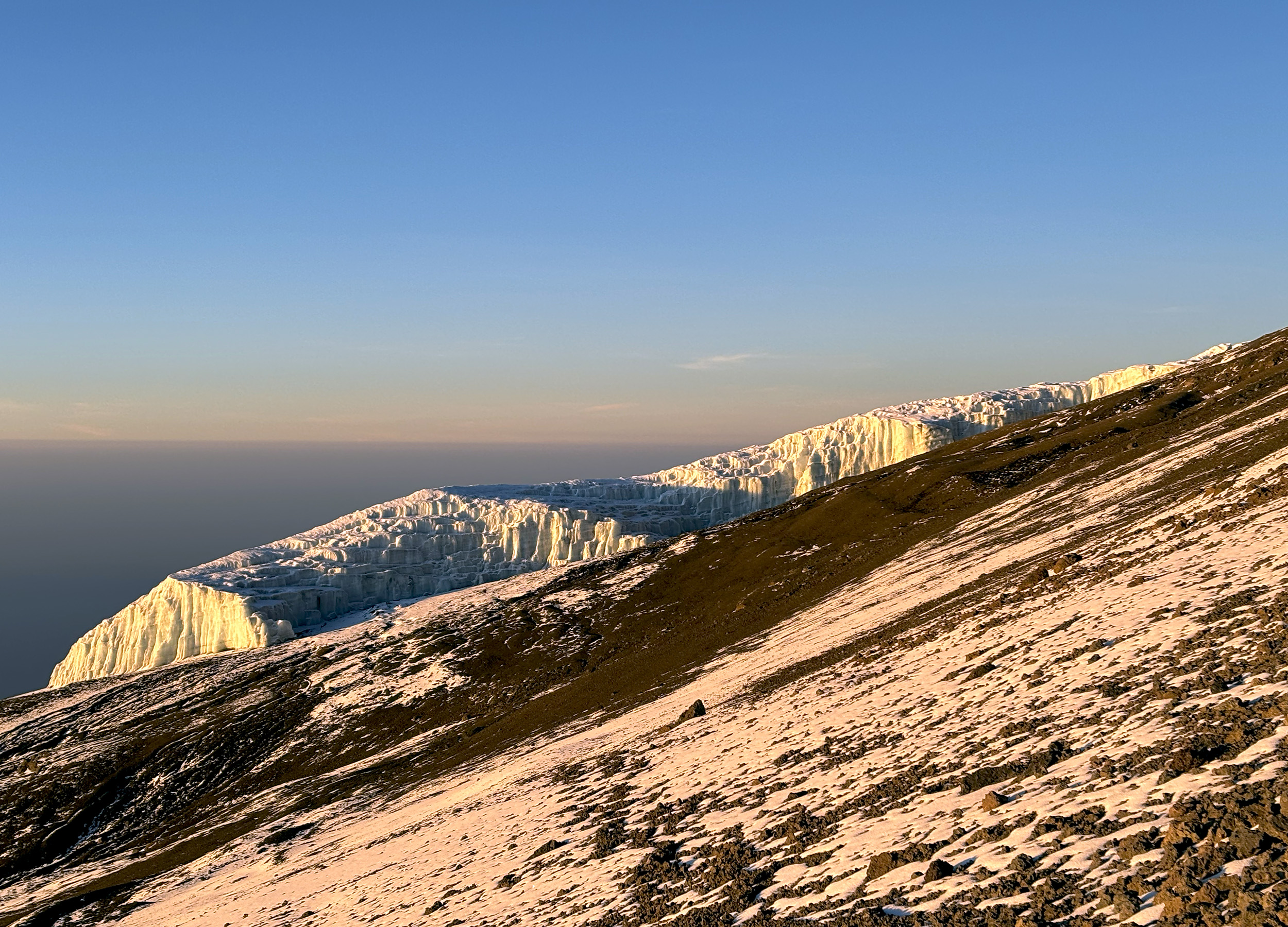
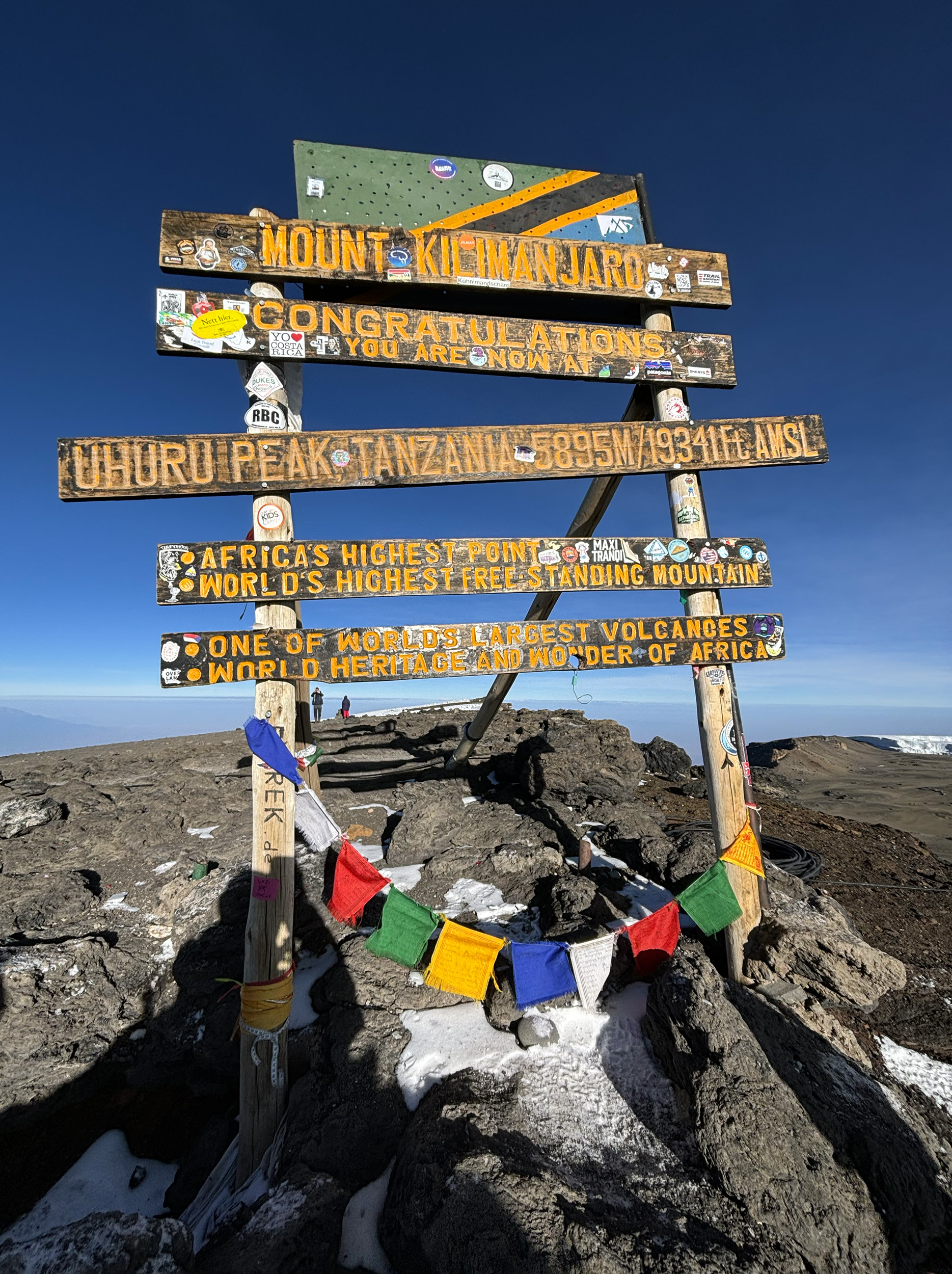
Uhuru Peak, now discernible in the distance, is the highest point on Mount Kilimanjaro, and is also located on the rim of Kibo Crater, making the last mile or so from Stella Point relatively flat. The most impressive sight on this stretch is the imposing southern icefield, overshadowing Mawenzi, and even Mount Meru in the distance. I was certainly not expecting to see so much snow or ice here. But the glaciers on Kilimanjaro are in rapid retreat, the mountain having lost over 80% of its ice mass in the last century alone, and it’s anyone’s guess how long this stunning view would remain. Before we know it, we’re standing in a long queue, waiting for our group photo to be taken against the official sign for Uhuru Peak. It’s 0710 East African Time. We’ve made it to the summit.

Apart from bitter cold, the Arctic zone is also known for its scorching sunshine, and we feel the effects of that as we linger around the summit. It’s 0740 and Michael suggests we get a move on it – we still have a long way to go, and staying at this altitude much longer isn’t advisable in any case. We’ve already seen a few climbers look sickly, and several are now being assisted down the mountain by porters. Past Stella Point, we descend to Kosovo using a different route, one that’s far more treacherous, with only scree, loose dirt, and gravel for terrain. It’s a slippery slope, anyway you slice it. The knees, expectedly, take a real beating, but my toes are faring no better and are literally on the verge of bleeding. There’s only one upside to this torture – this route will get us back to camp in a fraction of the time. As a thick cloud cover moves in gradually, we spot our campsite in the distance. SC is there, arms wide open, welcoming us warmly, and congratulating us individually, as we walk in. After a 3-hour break of sustenance and rest, the camp at Kosovo is struck down. It’s time to move again.
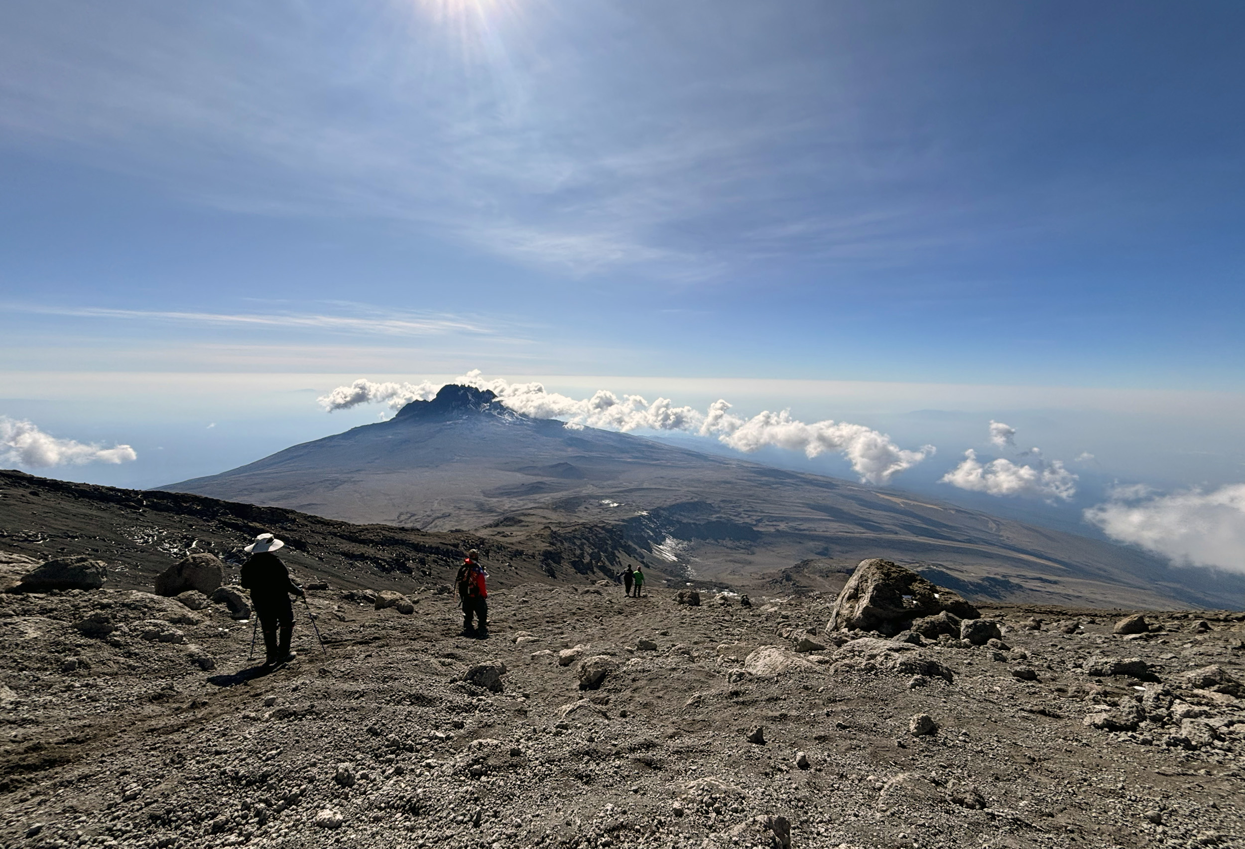

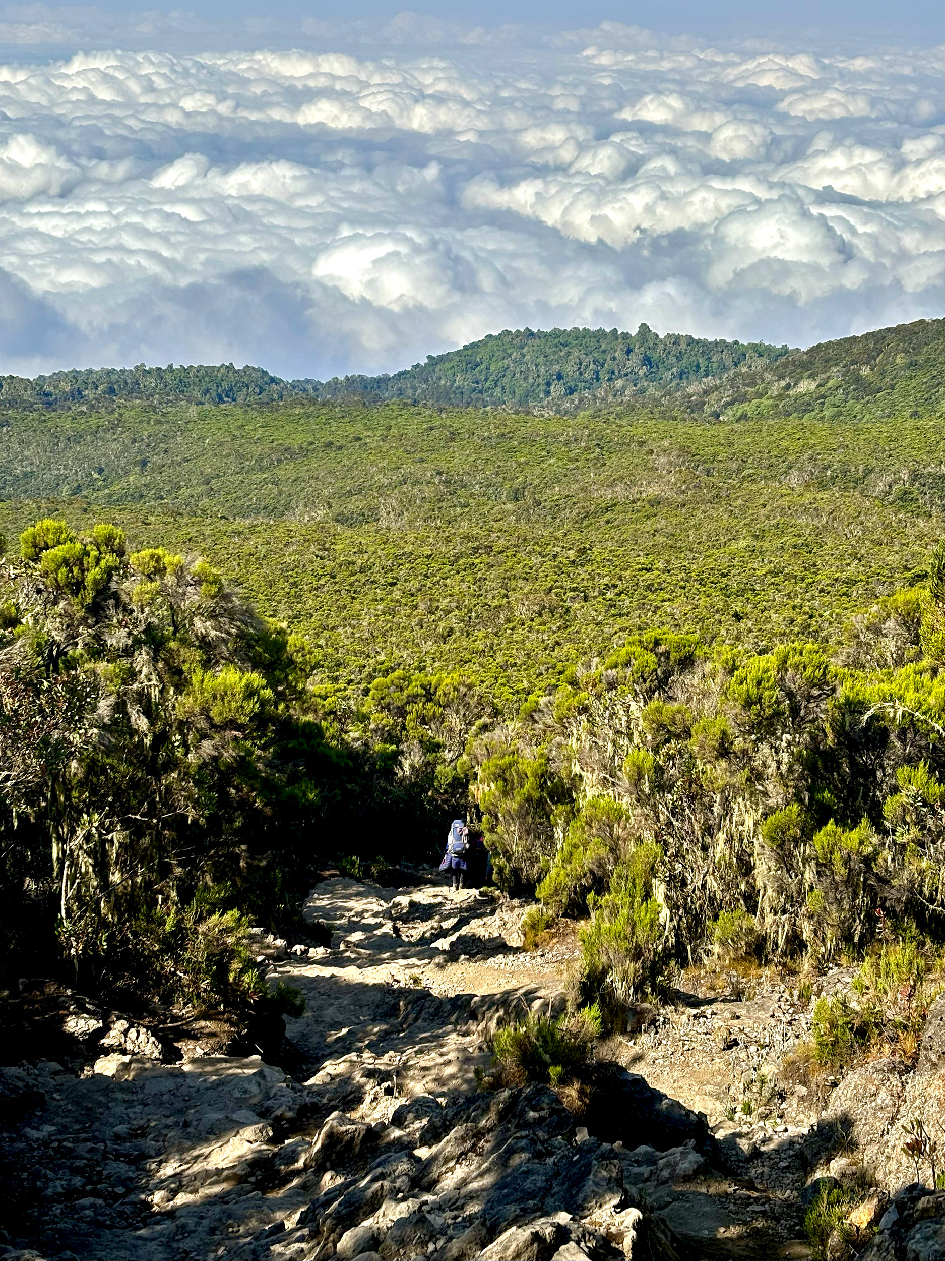
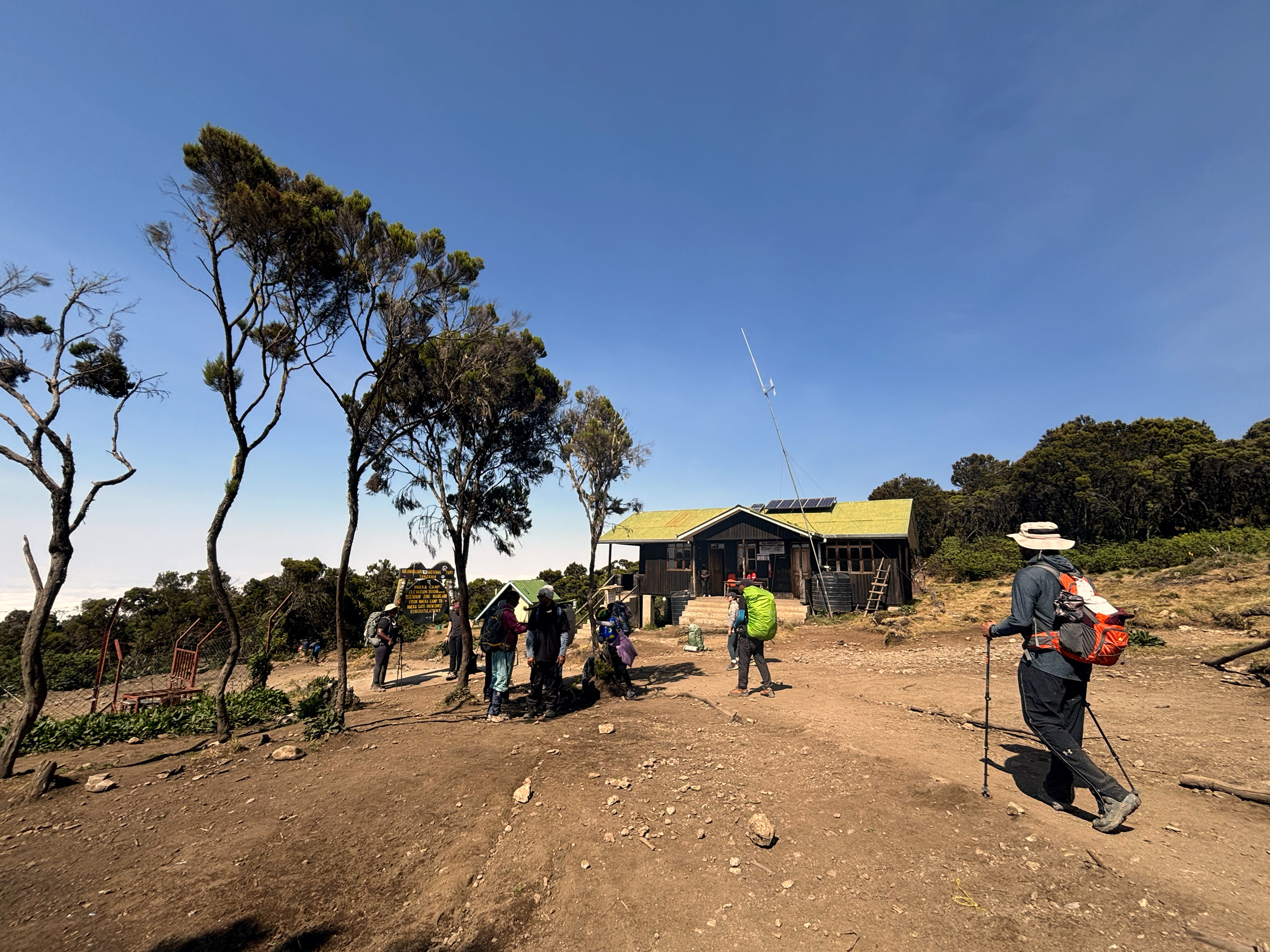
It’s taken us only 30-minutes to get down to Barafu, but an equal amount of time getting through that vast camp; our decision to camp at Kosovo validated even more. South of the campsite, we diverge from our original route, and join the route to Mweka Gate, passing a helipad along the way, and the first of many gurneys we’ll see on our descent. The expansive downhill tract we’re now on is a bleak, foggy and dusty one, with only the occasional volcanic boulder to break the monotony. About half way down and a break in, low shrubs finally appear, adding some color to our surroundings, and gradually getting taller as we hastily transition from Alpine Desert to Moorland. Thirteen hours, eleven miles, and a combined total of ten thousand feet later, we’ve made it to Millennium Camp (12,950 ft / 3960 m). To cap what could only be described as an extraordinary day of hiking, or “next level” as AS would put it, our campsite is gloriously lit by a waxing gibbous, one night shy of full moon. We’ll sleep well tonight.

Day 7: Millennium Camp – Mweka Gate
Our final morning at camp is one to savor. It’s also the last time we’ll lay eyes on the Kilimanjaro massif, while still on the mountain. Lots to take in over a cuppa, while soaking up some sunshine. Breaking the quiet of the morning are the sounds of singing and celebratory dancing at an adjacent campsite. For everyone at Millennium Camp, the last downhill leg beckons, and the festivities have already begun. The twende twende call is made with much fervor, and it’s our most punctual departure to date.
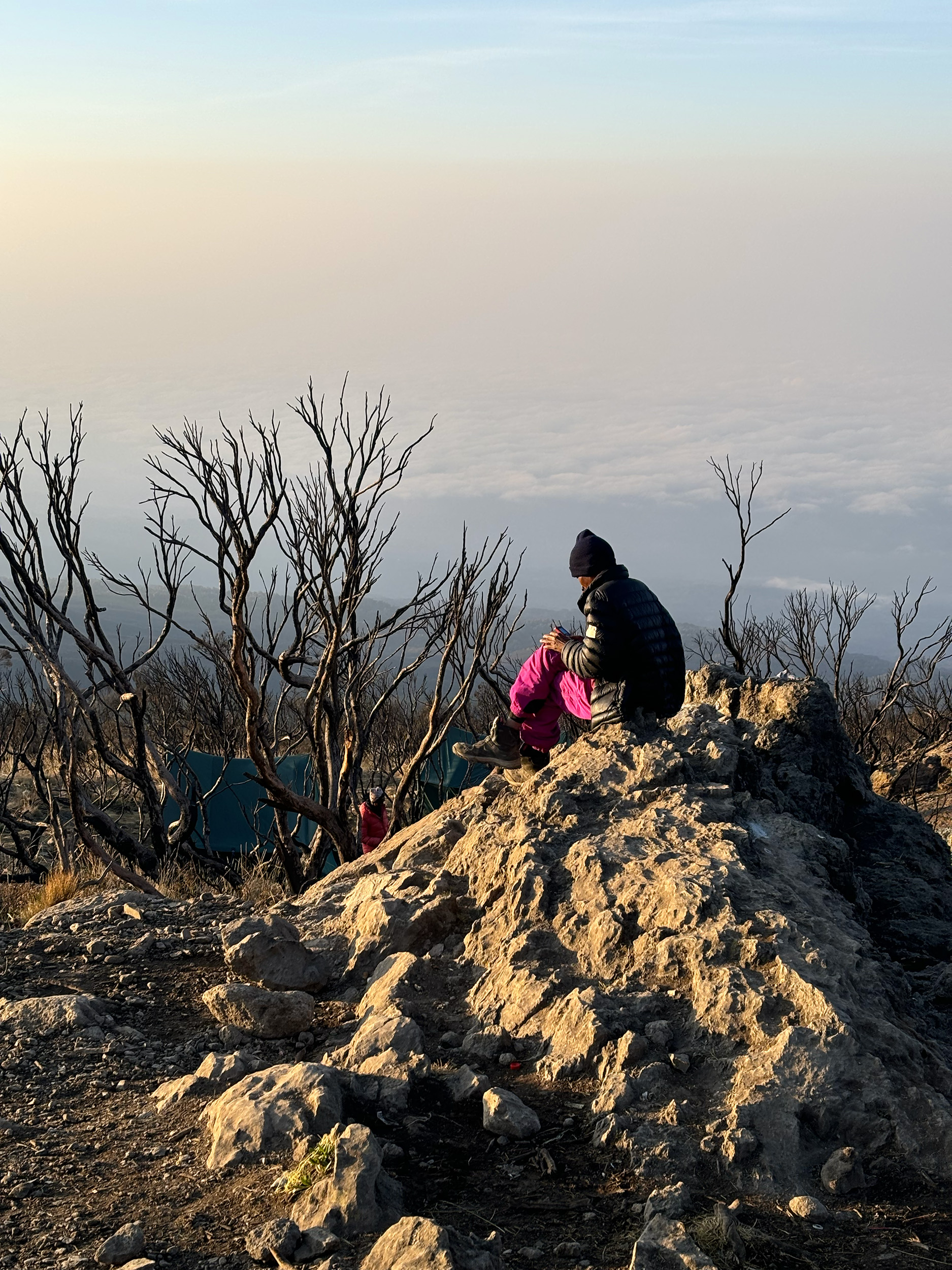
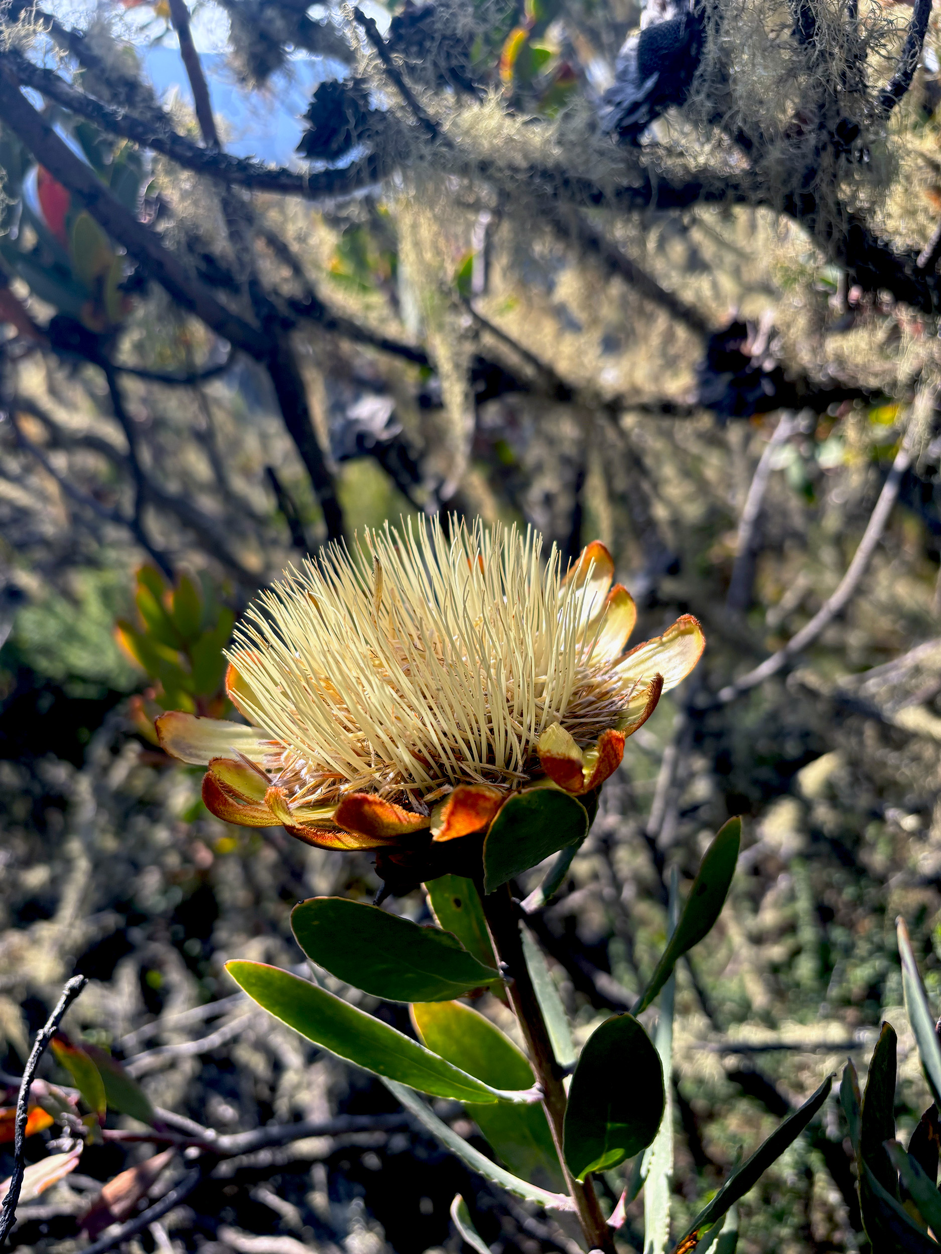
We have five hours of walking ahead of us this morning, and an elevation drop of almost seven thousand feet. Of that, the first two hours or so are expected to be rocky, but Michael promises it won’t be as bad as yesterday. My knees will surely be the judge of that. As we descend slowly through the Moorland, we’re treated to some fabulous views of the thick carpet of green that lies ahead. While vegetation at this altitude is sparse, there’s still plenty to keep an eye out for, as Vincent proves, pointing our attention towards the exquisite Protea Kilimandscharica. Unique to the Moorland of Kilimanjaro, it’s one of the oldest species of flowering plants, and one that we had missed entirely on our ascent.

We sail past Mweka Camp (10,170 ft / 3100 m), having made it there in less time than expected. It’s one of the last clearings on the trail before we are fully enveloped by Kilimanjaro’s Rainforest. Pascal, bringing up the rear, alerts us to make way. We’re expecting a couple of porters to speed past us, but in fact it’s a loaded gurney, with at least six porters assisting in getting a sick man down the mountain as quickly as possible. A gentle reminder that we’re still on a very formidable mountain.
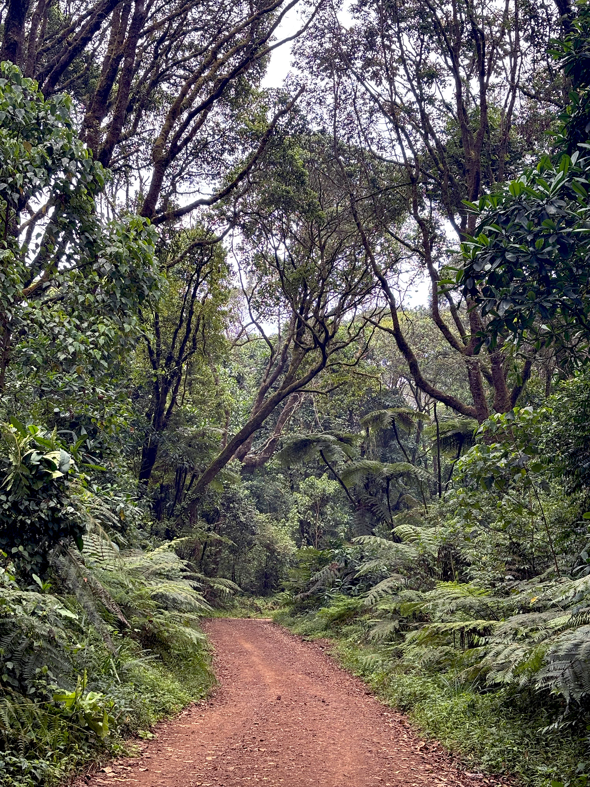
Two thirds of our route still remains below Mweka Camp, but with red-clay soil for terrain, and a generous green cover above, the last few hours are going to be easy on the knees, as well as the eyes. Making good time now, we stop occasionally to marvel at the hollowed out trunks of East African Camphorwood trees, or the aptly-named “old man’s beard”, a shrub-like lichen that hangs off them. Clouds roll through the Rainforest making for a truly sublime experience, with an earthy dampness that’s a joy to the senses.

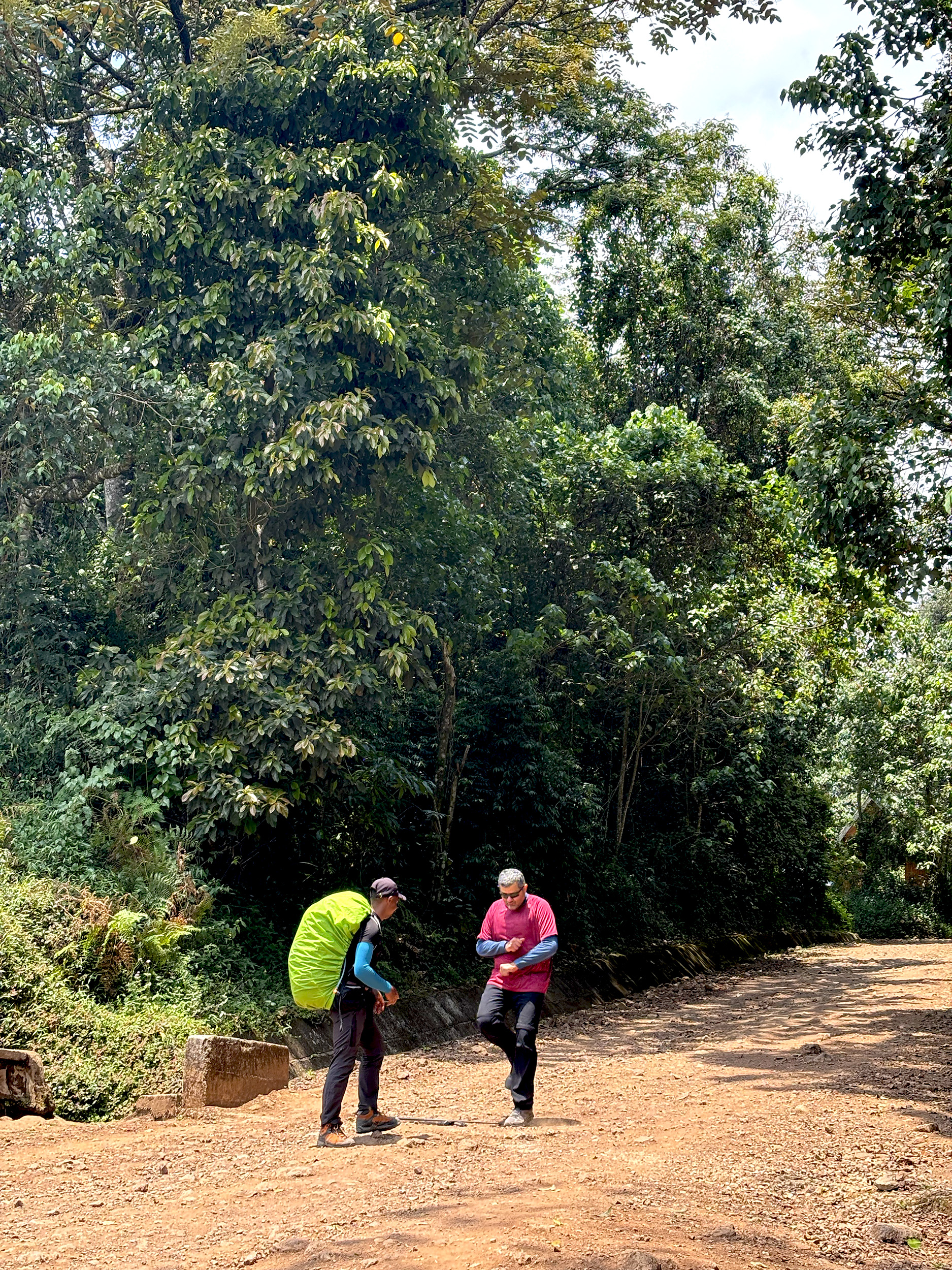
It’s 1220 and the “relief road” is sighted. It’s where a journey on the gurney would end for the few that are forced to make it, and a transfer can be made to an ambulance. For the majority of hikers, fortunate enough to walk that dirt road on their own two feet, it means they have less than two miles to go to Mweka Gate (5380 ft / 1640 m). The finish line is crossed with much gusto, with SC clocking in at precisely 1305, and officially calling it a wrap with some “next level” dance moves. The only steps left for us to climb now are that of our waiting bus.
A full set of photos from our trek to Kilimanjaro can be seen on my Flickr.
